-
Hello, please take a minute to check out our awesome content, contributed by the wonderful members of our community. We hope you'll add your own thoughts and opinions by making a free account!
You are using an out of date browser. It may not display this or other websites correctly.
You should upgrade or use an alternative browser.
You should upgrade or use an alternative browser.
Wintry January 29th-30th ARCC Slam Dunk Winter Weather Threat
- Thread starter ForsythSnow
- Start date


RollTide18
Member
I thought we wanted it faster? What does slowing it down do?
LovingGulfLows
Member
- Joined
- Jan 5, 2017
- Messages
- 1,499
- Reaction score
- 4,100
I thought we wanted it faster? What does slowing it down do?
Don't want the moisture to move out the area too fast. More time for the colder air to catch up to the band.
I don’t think we as in Alabama want it fasterI thought we wanted it faster? What does slowing it down do?
Stormlover
Member
no one wants it faster. by the time it changes over and starts sticking, it's over..smhI thought we wanted it faster? What does slowing it down do?
ForsythSnow
Moderator
Make everything too warm. We want faster. Some want slower since S. AL would benefit better. It's all about where you live.I thought we wanted it faster? What does slowing it down do?
Stormlover
Member
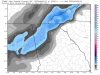
RPM showing 1-3 with a few 4-5 in spots. The brigher white is 3 and the blue is 4 or 5

whizrtr
Member
I expect if things slow down a bit it will allow higher totals south of I-20. Perhaps BMX will add WSW for next row of counties south if they see this trend in short range models.
Storm5
Member

Sent from my iPhone using Tapatalk
Nomanslandva
Member
Nah, you need both faster and slower. Cold faster and precip slower . Seriously. Interesting battle between globals and hires stuff. Especially up here and east of the mountains. Hires models are really light to non existent. I'll hug the fv3 for now and hope for an inch.
. Seriously. Interesting battle between globals and hires stuff. Especially up here and east of the mountains. Hires models are really light to non existent. I'll hug the fv3 for now and hope for an inch.Stormlover
Member
betting nw most counties in ala go to an advisory later today...don't see how they can stay in a warning
Sent from my iPhone using Tapatalk
Storm5
Member
12z gefs FWIW

Sent from my iPhone using Tapatalk

Sent from my iPhone using Tapatalk
Last time I heard, the Arctic front has moved past St. Louis.Anyway to see how the arctic air is moving upstream? Is it what the models have predicted so far? Is it Colder or warmer, moving faster or slower than modeled? Is it still in Canada?
ChattaVOL
Member
Just kinda of a question. There looks to be more moisture on radar than the models are showing.. does this mean anything or am I just looking at it wrong ?
Anyway to see how the arctic air is moving upstream? Is it what the models have predicted so far? Is it Colder or warmer, moving faster or slower than modeled? Is it still in Canada?
I like to use this for big fronts and tropical winds...
Wind Map
Darklordsuperstorm
Member
As we typically say around here it's getting close to that time where we need to stop looking at the models and see what is happening upstream.
addicted2boost
Member
NBAcentel
Member
Current analysis vs what the hrrr modeled 

RollTide18
Member
Current analysis vs what the hrrr modeled View attachment 14076View attachment 14077
Location is pretty much spot on, looks like more moisture but how much is reaching the ground?
Storm5
Member
FV3 looks like the gfs

Sent from my iPhone using Tapatalk

Sent from my iPhone using Tapatalk
If you sort out SPC page in all the options you can pick out the temp profilesJust kinda of a question. There looks to be more moisture on radar than the models are showing.. does this mean anything or am I just looking at it wrong ?
https://www.spc.noaa.gov/exper/meso...r.php?sector=20&parm=ttd&underlay=1&source=1#
RosewoodWX
Member
http://hint.fm/wind/?fbclid=IwAR3Abggj-L_4zz4bhkigjP3xDSehH8f1c_Xd6nbOFOjrtde4Th4Zw3qKMTIAnyway to see how the arctic air is moving upstream? Is it what the models have predicted so far? Is it Colder or warmer, moving faster or slower than modeled? Is it still in Canada?
Looking at visible satellite, there are low level cumulus developing and lifting northward over eastern TX and LA. Maybe a sign that this system is trying to tap some gulf moisture. Also, SPC precipitable water shows and increase over the last couple of hours in this area.


The 16z HRRR at the end of its run looks really good. Pops a low and appears to have a bit of a NW action to it. I would think if something like that happens, it may prolong the precip a little bit. I am being hopeful

Webberweather53
Meteorologist
Not to rain on anyone's parade wrt the GFS & GEFS but...
Storm5
Member
Euro is a hit

The nam is dead to me
Sent from my iPhone using Tapatalk

The nam is dead to me
Sent from my iPhone using Tapatalk
Is that 3 inches for Jackson MS?Euro is a hit
The nam is dead to me
Sent from my iPhone using Tapatalk
Sent from my SM-G950U using Tapatalk
Snowflowxxl
Member
GFS/Euro/FV3 still look fine. Hopefully NAM and RGEM are drunk. Model madness
Showmeyourtds
Member
12k NAM wasn't terrible pretty close to others.... 3K NAM and RGEM were not good at all but RGEM did make a motion to the right direction but it had a long way to go it was so bad to begin withGFS/Euro/FV3 still look fine. Hopefully NAM and RGEM are drunk. Model madness
Isnt it kind of late in the game to be looking at the Euro and GFS ? Wouldnt short range models be more accurate at this point ?
ForsythSnow
Moderator
Hmm not bad. I'll take and run. Maybe the NAM is going to be wrong. The globals vs the NAM.Euro looks a little beefed up
Stormlover
Member
look how screwed up the euro is..that isn't rain on the back side...can't believe a thing it shows

We all are basically sitting around a burn barrel taking ever run and looking at it and deciding to hug it or chunk it at this point more power to us I suppose that's why we sit in this darn forum for days on end tracking weatherIsnt it kind of late in the game to be looking at the Euro and GFS ? Wouldnt short range models be more accurate at this point ?