ForsythSnow
Moderator
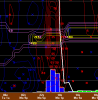
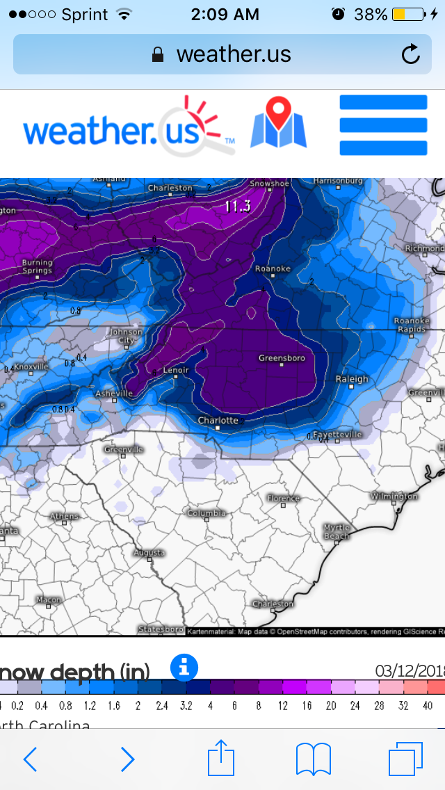
Oh well. I was hoping for some chance. Maybe I'll get lucky and there will be more moisture, but I may be too far SE and SW for flakes.Energy. You can tell with the dew point and temp lines are far apart, there's no relative humidity or moisture in the atmosphere there. In Webb's image you can see these lines on top of one another, from the ground all thew way up to 500mb, showing full saturation of the column with moisture. From there, you can see Omega maxed out in the DGZ, very heavy snowfall per the sounding.