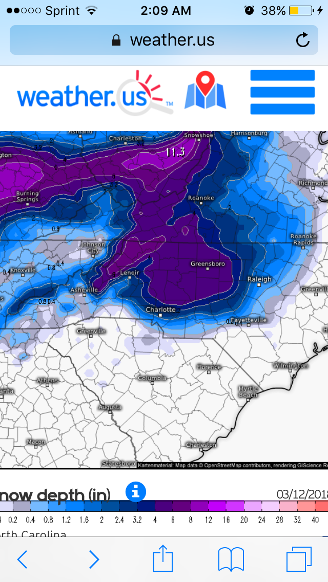
I think there will be snow that falls....probably even heavy snow for a period, but I was one of those bitter, yet curious persons that decided to follow the last Nor'easter and NYC was struggling to get snow to accumulate even with rates of 1-2" per hour so I'd be careful especially since this is falling during the day for much of NC(at least the western half). Those who have sundown on their side will probably find it easier to get some snow to stick. The ratios are going to be crap...like 6:1 ratios if even that.