Oh and the EPS too!Where do I sign
View attachment 35681
-
Hello, please take a minute to check out our awesome content, contributed by the wonderful members of our community. We hope you'll add your own thoughts and opinions by making a free account!
You are using an out of date browser. It may not display this or other websites correctly.
You should upgrade or use an alternative browser.
You should upgrade or use an alternative browser.
Misc Winter Whamby 2020, a New Decade
- Thread starter ForsythSnow
- Start date
- Status
- Not open for further replies.
If so why wouldn't they have done it when they issued the others. This is going to be a non event for the upstate.They will be
Is it really going to sneet or slow? Jus wondering..............................Man wish you hadn't done that, my wife hasn't made it to the grocery store yet. Now all the milk and bread going to be gone... LOl
Had to man, safety first! ???
I’m sure they are waiting on the 00z..? Rarely, if ever, do you see York/Cherokee without Greenville/Spartanburg/Pickens...it’s a head scratcherIf so why wouldn't they have done it when they issued the others. This is going to be a non event for the upstate.
Crown town is battle line(Charlotte) but some of the best storms,IMO, have been a "base" of sleet then 2-3...or more... inches of powder on top....
SnowNiner
Member
Crown town is battle line(Charlotte) but some of the best storms,IMO, have been a "base" of sleet then 2-3...or more... inches of powder on top....
Always is. Like always, every time. Sleet is almost a given. Powder no, but wet saturated flakes on top yes! lol.
GSP is 0-2 so far on snow events this month for mby so I remain optomistic..bet the streak
ATLwxfan
Member
I may have heard this wrong but the WRF-ARW2 is well respected by FFC because it tends to handle CAD better and more accurately reflects the modeled atmospheric soundings.
Sent from my iPhone using Tapatalk
Sent from my iPhone using Tapatalk
I’m just waiting for my inevitable WWAGSP is 0-2 so far on snow events this month for mby so I remain optomistic..bet the streak
You may be waiting awhile then. I really don't know why they wouldn't have issued them along with the others if they were going to.I’m just waiting for my inevitable WWA
Maybe waiting for more meso models. They are forecasting over .5 in of snow so it wouldn’t surprise me if they did issue one.You may be waiting awhile then. I really don't know why they wouldn't have issued them along with the others if they were going to.
Crown town is battle line(Charlotte) but some of the best storms,IMO, have been a "base" of sleet then 2-3...or more... inches of powder on top....
It amazes me how many different solutions each local TV station is forecasting. You could literally go to every station across the Carolina's and have completely different accumulation maps. But yes, Charlotte is always on the battleground, which makes me nervous being south of 85. My hope is that the NAM is too amped and somehow we can overcome the warm nose with some impressive rates. Sometimes being on the line can be good, and depending on how this unfolds it could greatly increase totals throughout the Charlotte Metro. It's a long shot, but i have my fingers crossed! ?
I don't know. If their forecast is a dusting to half an inch that would probably only require a special weather statement.Maybe waiting for more meso models. They are forecasting over .5 in of snow so it wouldn’t surprise me if they did issue one.
MBY getting raked under a heavy band on the Happy Hour GFS. modernweenie

Shaggy
Member
I hate the NAM, it's going to crush NC north of Hwy 64.... this only makes the crash & burn later even more horrific.
I'm about 5 miles wsw of greenville and had been sitting pretty on quite a few runs. I need the nam to drop back south about 30 miles with that warm nose.
I always love those horrible maps from weathernerds website. And to think, that site may be created by a NWS guy.
Guess we will enjoy our huge snow band all the way to the atlantic ocean here in SC... ... .......................................... ..........
Guess we will enjoy our huge snow band all the way to the atlantic ocean here in SC... ... .......................................... ..........
when's my graupal gonna arrive!? lolI always love those horrible maps from weathernerds website. And to think, that site may be created by a NWS guy.
Guess we will enjoy our huge snow band all the way to the atlantic ocean here in SC... ... .......................................... ..........
Shaggy
Member
Clearing skies to my north possibly. I'd love to get a couple of hours of radiational cooling in tonight
SnowNiner
Member
I may have heard this wrong but the WRF-ARW2 is well respected by FFC because it tends to handle CAD better and more accurately reflects the modeled atmospheric soundings.
Sent from my iPhone using Tapatalk
I'm not sure this is actually a CAD situation. Not classic anyway. I wish it were. We're waiting for the cold to come over the mountains from the mid-west. Usually CAD has the high in the NE filtering down the east side of the apps.
Nerman
Member
I may have heard this wrong but the WRF-ARW2 is well respected by FFC because it tends to handle CAD better and more accurately reflects the modeled atmospheric soundings.
Sent from my iPhone using Tapatalk
I just went back and checked the last GA storm and it did really well 36-48 hours out. I'll definitely be interested to see what it says at 0Z. It's the only thing we've got to look at...

ATLwxfan
Member
I'm not sure this is actually a CAD situation. Not classic anyway. I wish it were. We're waiting for the cold to come over the mountains from the mid-west. Usually CAD has the high in the NE filtering down the east side of the apps.
Agree. I was just stating that it’s ability to forecast CAD was one of the reasons it was relied upon.
Sent from my iPhone using Tapatalk
Nerman
Member
I'm not sure this is actually a CAD situation. Not classic anyway. I wish it were. We're waiting for the cold to come over the mountains from the mid-west. Usually CAD has the high in the NE filtering down the east side of the apps.
huh?


That would be nice. I don't really see itEveryone in upstate sc from Anderson up will have 2+ inches. The rain/snow line will be down in abbeville/greenwood area. The temps will drop much faster than the models are saying.
Not that this setup is anywhere close to the Carolina Crusher in 2000. But what was the actual set up for that day? How much was predicted? I was young and didn't live in NC at that time. But I am somewhat curious. TIA!
Last edited:
Reading a lot of famous last words in the storm thread ? dis gone b good ?
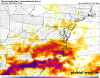
Oh man the 18z HRRR is U G L Y for upstate and central NC
HRRRRRRRRR on TT is down. Throw me a rain map..?Oh man the 18z HRRR is U G L Y for upstate and central NC
B
Brick Tamland
Guest
Haven't you heard? The Euro is the only model that matters. You know, the long range model that was the last one to jump on board with this.
For some of us in the sleet zone tomorrow the rates will overcome statement will be put to the test. Thin warm nose with plenty of lift and some cape indicating convective elements in the precip. Do rates beat the warm nose?Reading a lot of famous last words in the storm thread ? dis gone b good ?
For some of us in the sleet zone tomorrow the rates will overcome statement will be put to the test. Thin warm nose with plenty of lift and some cape indicating convective elements in the precip. Do rates beat the warm nose?
Lol come on man.

As a central Wake county person my only hope is to have a winter storm that actually performs up to expectations from the weather models. When did we last over perform, 2010 maybe?Yup. Maybe we should move to wake forest
HRRRRRRRRR on TT is down. Throw me a rain map..?

Its been a long time since we've had a system where imby I said wow we went over. Right off hand I'm drawing a blankAs a central Wake county person my only hope is to have a winter storm that actually performs up to expectations from the weather models. When did we last over perform, 2010 maybe?
What's going on here? Lots of rain? IIRC, that model is awful at thermals.
The NAM says the whole stateAny model spotting out good UVVs? Or no need to look for this until the heavy bands set up?
Attachments
Yeah essentially all rainWhat's going on here? Lots of rain? IIRC, that model is awful at thermals.
Rather see that than suppressed OTS tbh.Yeah essentially all rain
BHS1975
Member
Its been a long time since we've had a system where imby I said wow we went over. Right off hand I'm drawing a blank
Jan 2000
Sent from my iPhone using Tapatalk
That HRRR looks like what the Euro tried to do yesterday.
- Status
- Not open for further replies.