Yeh I have my moments also. But personally have a came a long way hahaha. The Winter of 2017/2018 still gets me sometimes where every location in the South & Southeast got measurable Winter weather except Columbia. But I am going to stay positive. Weather is going to do what it do.I am trying to take your advice from yesterday and think positive. However, it is becoming more and more difficult when everything trends downhill as we approach verification time.
-
Hello, please take a minute to check out our awesome content, contributed by the wonderful members of our community. We hope you'll add your own thoughts and opinions by making a free account!
You are using an out of date browser. It may not display this or other websites correctly.
You should upgrade or use an alternative browser.
You should upgrade or use an alternative browser.
Misc Winter Weather Support Group
- Thread starter RBR71
- Start date
A trip down memory lane:
Georgia Weather History for January 10th
In 2011, one of the most significant winter storms to affect north and central Georgia in years began on the evening of the 9th and continued through much of the 10th. Four to eight inches of snow was common across most of north Georgia north of I-20. South of I-20 and into central Georgia, there was a mix of snow, sleet and freezing rain. Major interstates and roads were impassable across north Georgia for 2 to 3 days and many schools were closed for the entire week.NBAcentel
Member
+PNA/Aleutian low is coming. There’s no other way around it. AK block retrograding to Siberia is gonna add a bunch of momentum to the pacific jet and bring back the pac trough/Aleutian low. Maybe we delay it because overextension, but it’s gonna happen. I think the biggest challenge is lining something up during the SE during that pattern lolWe need a reassurance post from @Myfrotho704_ & @Webberweather53 & @griteater regarding Fab February again. We are going to need one at least every other day.
Warm regards,
Drizzle Snizzle
Member
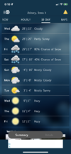
Your snow is going to be around for a very long time.Then this! Who’s coming to visit? Average high is 29 degrees!View attachment 141096
Atleast February, for sureYour snow is going to be around for a very long time.
I keep telling myself we don’t need a fantasy 200hr snowstorm but I’m getting nervous I’m just coping and reality is going to hit soon ?
+PNA/Aleutian low is coming. There’s no other way around it. AK block retrograding to Siberia is gonna add a bunch of momentum to the pacific jet and bring back the pac trough/Aleutian low. Maybe we delay it because overextension, but it’s gonna happen. I think the biggest challenge is lining something up during the SE during that pattern lol
And then the track will be over southern Georgia and CAE remains sleet and fr rain. Lolz
For real though, for us down here around I 20 dealing with warmer advection, we need a system traveling across North central Florida with an arctic type front already in place along with some supportive cad. It takes so much here, and it's always been that way for pure sn. ?
SnowNiner
Member
It's going to snow east of the mountains with this pattern...it just is...it has to...I think
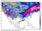
View attachment 141102
If it actually turns out to look like that, and it doesn't snow on us, or at least give us a trackable threat, I give up. I don't know what else we need and I'm wasting my time and energy honestly. Hoping the snow means on the ensembles start to at least creep up modestly.
W
WSW
Guest
This is going to be your February 2010.
rburrel2
Member
Really annoying that we're going to finish way above normal on precip for January and well below normal on temps... and not get a single flake.
Iceagewhereartthou
Member
Burrel, when you despair we're in real trouble...?Really annoying that we're going to finish way above normal on precip for January and well below normal on temps... and not get a single flake.
597DM
Member
Grandma's cooking
597DM
Member
What else happens in the future?Really annoying that we're going to finish way above normal on precip for January and well below normal on temps... and not get a single flake.
Grandma's cooking
Attachments
rburrel2
Member
I'm just looking at the writing on the wall... We have little to no chance with the day 6 threat east of the apps... then if you look for a day 9-10 threat on ensembles (b/c no operationals have shown anything all week), other than a couple freezing rain events 95% of them don't show any wintry for us. (I guess there's a tiny bit of snow noise on the Canadian ensembles, but bleh).
Then you have fairly good consensus the pattern is going to re-schuffle post day 12 in to something not conducive for us, (all the ensembles have us moderating to above normal temps then).
That gets us in to January 23/24th or so, Not good.
Other than a really lucky break in our favor with modeling the next few days, we're now looking in to the February Webb window for something.
rburrel2
Member
But there's no doubt we're finishing above normal precip/below normal temps for January across the board. So there's that
Agreed...it doesn't necessarily have to snow in Raleigh but snow somewhere from in GA/SC/NC get a small 1-2" to get one on the scoreboard. Pattern is going to relax and we are looking at end of January before we could see a more favorable pattern develop again.If it actually turns out to look like that, and it doesn't snow on us, or at least give us a trackable threat, I give up. I don't know what else we need and I'm wasting my time and energy honestly. Hoping the snow means on the ensembles start to at least creep up modestly.
rburrel2
Member
rburrel2
Member
Hot take... this pattern/block has never looked good for us, It's developing too far north towards the pole. It's in a great spot to deliver cold and snow to Canada and New England.
Usually you'd assume it's still a great look as modeled b/c it is going to eventually retrograde west as it breaks down, which is typically money for us, but it seems like we're going to have a solid week+ where it's stationary,(too far north), then when it finally retrogrades west and the vortex kicks east, that's going to happen at rocket ship speed and leave us with a very short window for something good.(and no modeling is showing anything capitalizing on that short window so far other that a little noise on CMCE and a few GEFS members showing some nuisance level freezing rain events).
Usually you'd assume it's still a great look as modeled b/c it is going to eventually retrograde west as it breaks down, which is typically money for us, but it seems like we're going to have a solid week+ where it's stationary,(too far north), then when it finally retrogrades west and the vortex kicks east, that's going to happen at rocket ship speed and leave us with a very short window for something good.(and no modeling is showing anything capitalizing on that short window so far other that a little noise on CMCE and a few GEFS members showing some nuisance level freezing rain events).
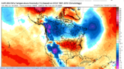
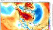
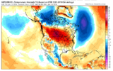
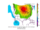
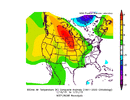
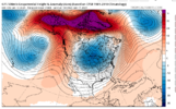
Here's proof our goose is cooked around the January 23rd timeframe and the few days beyond... look at that consensus!
View attachment 141109View attachment 141110View attachment 141111
Not sure why but it seems like mid January give us something like this in nino's. Saw it in 2010 and 2015.
if it were too fart north we wouldn't be shearing everything to pieces after day 7Hot take... this pattern/block has never looked good for us, It's developing too far north towards the pole. It's in a great spot to deliver cold and snow to Canada and New England.
Usually you'd assume it's still a great look as modeled b/c it is going to eventually retrograde west as it breaks down, which is typically money for us, but it seems like we're going to have a solid week+ where it's stationary,(too far north), then when it finally retrogrades west and the vortex kicks east, that's going to happen at rocket ship speed and leave us with a very short window for something good.(and no modeling is showing anything capitalizing on that short window so far).
rburrel2
Member
Meh, that's more a product of TPV stalling too far west over Canada. Shift the block south and it can't hang out there for a week anymore.if it were too fart north we wouldn't be shearing everything to pieces after day 7
This is a horrible location for the TPV to be for us to score. Just looking at that map you'd think we would evolve in to a solid window with a banging pattern. But for whatever reason we drew the short straw and somehow it gets hung up just like that for a long time and then rapidly breaks down, (shrinking our window to a very short period).
But hey, maybe something will change on the modeling today and things will look better. It just looks really bleak right now, imo.
rburrel2
Member
That is wild how well it matches up with what's being advertised.Not sure why but it seems like mid January give us something like this in nino's. Saw it in 2010 and 2015.
View attachment 141114View attachment 141115
GoDuke
Member
I had Grandmas French toast breakfast this morning at Cracker Barrel. It was Awesome.Grandma's cooking
you know what they say. good winters snow. great winters cover the spreadBut there's no doubt we're finishing above normal precip/below normal temps for January across the board. So there's that
Oh no, I hope this doesn't put us back to square one in the snowpack2023™ department.Here's proof our goose is cooked around the January 23rd timeframe and the few days beyond... look at that consensus!
View attachment 141109View attachment 141110View attachment 141111
NBAcentel
Member
Typical for overextension later on in ninos in late jan before the early Feb +PNA. Get a compilation of Feb strong ninos and that’s what you end up withThat is wild how well it matches up with what's being advertised.
Last edited:
Well we better hope something pops up in Jan. I've done some digging and if we don't get on the board in Jan history says there will be no Fab Feb. Fab Febs are reserved for winters already on the board by then.Hot take... this pattern/block has never looked good for us, It's developing too far north towards the pole. It's in a great spot to deliver cold and snow to Canada and New England.
Usually you'd assume it's still a great look as modeled b/c it is going to eventually retrograde west as it breaks down, which is typically money for us, but it seems like we're going to have a solid week+ where it's stationary,(too far north), then when it finally retrogrades west and the vortex kicks east, that's going to happen at rocket ship speed and leave us with a very short window for something good.(and no modeling is showing anything capitalizing on that short window so far other that a little noise on CMCE and a few GEFS members showing some nuisance level freezing rain events).
There have been 33 years where GSP has only recorded at TR or less through Feb 1st. Only 4 have finished above the current 30 year average of 4.7 inches.
1893-94 7.0"
1894-95 14.5"
1926-27 9.7"
1928-29 5.6"
Only 2 have finished close to average. Above 4 inches but less that the 4.7"
1898-99 4.3"
2008-09 4.4"
17 finished with less than 1 inch total. So the remaining 10 finished between 1-4 inches. Not exactly encouraging looking at the long range. If we reach Jan 25th and have no snow and no hope through Feb 1st I'm hanging it up for a good winter because the data days it's an unrealistic expectation at that point. Sure it may snow but it'll likely only be a novelty event and nothing major. This is for GSP only maybe RDU and other have better stats. But I think CLT is similar.
I just hope to see 1300m
I don't think it matters even if we have a "good pattern," or if it's Nina or Nino. It's just timing and luck to get snow here. I have seen people talk about how good the pattern looks over the years and we still ended up with nothing.Agreed...it doesn't necessarily have to snow in Raleigh but snow somewhere from in GA/SC/NC get a small 1-2" to get one on the scoreboard. Pattern is going to relax and we are looking at end of January before we could see a more favorable pattern develop again.
I’ll be honest I’m starting to think all that fab Feb talk is gonna end up being a huge disappointment. We will see.I'm just looking at the writing on the wall... We have little to no chance with the day 6 threat east of the apps... then if you look for a day 9-10 threat on ensembles (b/c no operationals have shown anything all week), other than a couple freezing rain events 95% of them don't show any wintry for us. (I guess there's a tiny bit of snow noise on the Canadian ensembles, but bleh).
Then you have fairly good consensus the pattern is going to re-schuffle post day 12 in to something not conducive for us, (all the ensembles have us moderating to above normal temps then).
That gets us in to January 23/24th or so, Not good.
Other than a really lucky break in our favor with modeling the next few days, we're now looking in to the February Webb window for something.
It is unless we get something this month. And that's looking less likely with each passing day. See my latest post in this thread to see why the odds are against usI’ll be honest I’m starting to think all that fab Feb talk is gonna end up being a huge disappointment. We will see.
I assume this data is all winters and not nino ones?Of course the nino ones may look worse. If nino winters where we do not score before Feb 1st follow by showing a poor feb snow performance then we might need to adjust our expectations.It is unless we get something this month. And that's looking less likely with each passing day. See my latest post in this thread to see why the odds are against us
Bro you got to change that profile pic. Tiger looks like he is staring into my soul. @Myfrotho704_
NBAcentel
Member
Nah that’s just me after we finish chasing this pattern and get nothing in result of itBro you got to change that profile pic. Tiger looks like he is staring into my soul. @Myfrotho704_

