-
Hello, please take a minute to check out our awesome content, contributed by the wonderful members of our community. We hope you'll add your own thoughts and opinions by making a free account!
You are using an out of date browser. It may not display this or other websites correctly.
You should upgrade or use an alternative browser.
You should upgrade or use an alternative browser.
Misc Winter Weather Support Group
- Thread starter RBR71
- Start date
Forecast for this weekend is rain and in the 50s. Awesome. Love the pattern we have been in since "winter" began.
Brent
Member
Someone posted about the last day of winter well that assumes we had one 
SnowNiner
Member
Maybe if people keep tweeting the cold is coming they will eventually be right
Brent
Member
Maybe if people keep tweeting the cold is coming they will eventually be right
There's always next winter
Next winter is going to be amazing!!!!! 


for golf weatherNext winter is going to be amazing!!!!!
That’s JB’s MO!Maybe if people keep tweeting the cold is coming they will eventually be right
Honestly I don’t think I’m gonna look at models and model runs next winter. After the rug pull this year I think I’ll go back to the old days where I’ll either wake up with snow, or my weather man will tell me.
GoDuke
Member
call the weather phone for updatesHonestly I don’t think I’m gonna look at models and model runs next winter. After the rug pull this year I think I’ll go back to the old days where I’ll either wake up with snow, or my weather man will tell me.
Well everything else is similar to 2020 this might as well be also lolIf the pattern is similar to 2020 with the El Niño transitioning to La Niña we could be very active east of the Apps with severe weather setting up on wedge boundaries.
See you next November! You’ll be back!Honestly I don’t think I’m gonna look at models and model runs next winter. After the rug pull this year I think I’ll go back to the old days where I’ll either wake up with snow, or my weather man will tell me.
Brent
Member
Honestly I don’t think I’m gonna look at models and model runs next winter. After the rug pull this year I think I’ll go back to the old days where I’ll either wake up with snow, or my weather man will tell me.
Just wait for all the hurricanes coming
Call movie phone for showtimes!call the weather phone for updates
Man, all this CAD and below normal temps. So many know it alls called this spring perfectly!
Cheers!
Cheers!
SnowNiner
Member
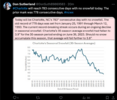
Sad. Lol. Confirms what we've all been seeing. It's snowing less and less each year. Honestly I have to just move on to something else and lower my expectations during the winter. If I want snow, I'll likely need to take a trip to the mountains.
Imagine if we blank next year too, smh.
Our snow climo has turned into that of Jacksonville FL.Sad. Lol. Confirms what we've all been seeing. It's snowing less and less each year. Honestly I have to just move on to something else and lower my expectations during the winter. If I want snow, I'll likely need to take a trip to the mountains.
Imagine if we blank next year too, smh.
BHS1975
Member
Our snow climo has turned into that of Jacksonville FL.
There's is effectively 0 so not yet.
Sent from my iPhone using Tapatalk
J1C1111
Member
Man, I wish I lived where you did. Enjoy it brother.
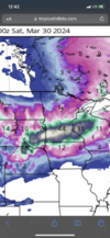
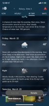
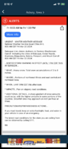
My friend in Montana said they are supposed to get 6 to 10 inches of snow Saturday through Sunday. Must be nice.
Brent
Member
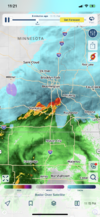
Nothing but high winds here apparently and maybe some severe on Sunday if we get lucky
Temps are running cooler than they have been though
Temps are running cooler than they have been though
RDUHeatIsland
Member
Drizzle Snizzle
Member
Someone start the April thread
We take a spring break trip to the Smokies every year. I bet half of the time in the past 10 years we've seen at least flurries falling so this would line up.View attachment 147191
Amazing April will save us
I've been away from home so much this winter was almost debating on not going to Snowshoe this weekend to close out the season, but I thought better of it. 25 days boarding this season will be a record for me. Anyone ever been to Whitefish, Montana? I think that is going on the calendar for next February.
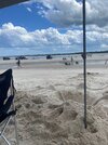
Verano Beach this past Saturday was gorgeous.

Verano Beach this past Saturday was gorgeous.
