I don't have Fake Book or Look At Me Gram, so I'm good
-
Hello, please take a minute to check out our awesome content, contributed by the wonderful members of our community. We hope you'll add your own thoughts and opinions by making a free account!
You are using an out of date browser. It may not display this or other websites correctly.
You should upgrade or use an alternative browser.
You should upgrade or use an alternative browser.
Misc Winter Weather Support Group
- Thread starter RBR71
- Start date
Been up since 2:30. 18 yr old driver in unknown condition. Hope and pray he’s doing well.
While speeding he lost control and flipped 5 times through my yard before ending upside down 4 houses down.
He took out 4 mailboxes and since it was garbage pickup “eve” 4 trash bins. Troopers wouldn’t let us out of our driveways until a team did all the measuring and painting until around 10 AM. Mailboxes and bins can be replaced… Prayers for the 18 yr old driver. My house has the American flag.
kennedybb6
Member
Praying for his recoveryBeen up since 2:30. 18 yr old driver in unknown condition. Hope and pray he’s doing well.
While speeding he lost control and flipped 5 times through my yard before ending upside down 4 houses down.
He took out 4 mailboxes and since it was garbage pickup “eve” 4 trash bins. Troopers wouldn’t let us out of our driveways until a team did all the measuring and painting until around 10 AM. Mailboxes and bins can be replaced… Prayers for the 18 yr old driver. My house has the American flag.
View attachment 147017
View attachment 147018
I survived. But the world will never be the same.Facebook/Instagram outages
Avalanche
Member
Prayers going out with you!!!Been up since 2:30. 18 yr old driver in unknown condition. Hope and pray he’s doing well.
While speeding he lost control and flipped 5 times through my yard before ending upside down 4 houses down.
He took out 4 mailboxes and since it was garbage pickup “eve” 4 trash bins. Troopers wouldn’t let us out of our driveways until a team did all the measuring and painting until around 10 AM. Mailboxes and bins can be replaced… Prayers for the 18 yr old driver. My house has the American flag.
View attachment 147017
View attachment 147018
It has been dumping snow out in Jackson Hole most of the day:
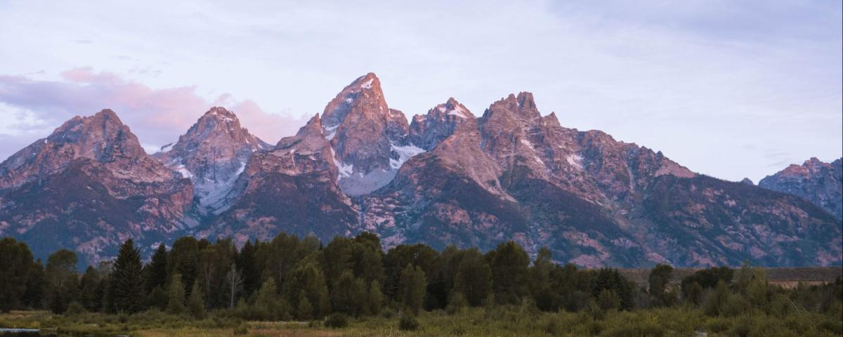
Jackson Hole Webcams
View live webcams from Jackson Hole, Wyoming, Grand Teton National Park, Yellowstone National Park, and Jackson Hole Mountain Resort.
www.jacksonholechamber.com
One more from Telluride.

man that’s just mean JC..
That looks money
Any body else had problems with their Tempest station crapping out? I’ve lost four of my sensors and can’t seem to get them to work. Ill be trying their customer service tomorrow.
They are usually pretty good after you get past the reboot it step. They dl should replace it or offer a new one at a good discountAny body else had problems with their Tempest station crapping out? I’ve lost four of my sensors and can’t seem to get them to work. Ill be trying their customer service tomorrow.
I’m sad for the Sierra Nevada region! 
They busted on the snow forecast! They were forecasting 10-12’ and the highest total I heard of was 8’
 losers!
They busted on the snow forecast! They were forecasting 10-12’ and the highest total I heard of was 8’
losers!Just horrible job by forecasters…. Missing on accumulations by 2-4’I’m sad for the Sierra Nevada region!
They busted on the snow forecast! They were forecasting 10-12’ and the highest total I heard of was 8’
Brent
Member
I’m sad for the Sierra Nevada region!
They busted on the snow forecast! They were forecasting 10-12’ and the highest total I heard of was 8’
Where is my sad violin
We need a spring support thread so we can gripe about how March is going to be cool and rainy all month.
I only have one, and the only time I have to reboot it is when the internet goes out, so maybe less then 5 times in a couple of years.Any body else had problems with their Tempest station crapping out? I’ve lost four of my sensors and can’t seem to get them to work. Ill be trying their customer service tomorrow.
John1122
Member
Sugar Bowl ended up with 126 inches, Soda Spring 116, and Kingvale 106.I’m sad for the Sierra Nevada region!
They busted on the snow forecast! They were forecasting 10-12’ and the highest total I heard of was 8’
I don’t share a whole lot about my personal life here but our family farm got a segment on FoxCarolina news yesterday with Mira Ruiz. This story was about the decline of family owned farms in the State of South Carolina. Here’s a shot of me and my oldest son being interviewed by Mira live on air. Now that I’ve hit the big time, please don’t ask for more donations from me. I already gave my $50! I share this because I know a lot of you guys are in the farming community and we have to stick together. 
Be sure to post the clip!I don’t share a whole lot about my personal life here but our family farm got a segment on FoxCarolina news yesterday with Mira Ruiz. This story was about the decline of family owned farms in the State of South Carolina. Here’s a shot of me and my oldest son being interviewed by Mira live on air. Now that I’ve hit the big time, please don’t ask for more donations from me. I already gave my $50! I share this because I know a lot of you guys are in the farming community and we have to stick together. View attachment 147025
gud teethI don’t share a whole lot about my personal life here but our family farm got a segment on FoxCarolina news yesterday with Mira Ruiz. This story was about the decline of family owned farms in the State of South Carolina. Here’s a shot of me and my oldest son being interviewed by Mira live on air. Now that I’ve hit the big time, please don’t ask for more donations from me. I already gave my $50! I share this because I know a lot of you guys are in the farming community and we have to stick together. View attachment 147025
Wait, you spend way too much time on here to be a farmer. Also, you look nothing like I imagined, trust me that's a compliment LolI don’t share a whole lot about my personal life here but our family farm got a segment on FoxCarolina news yesterday with Mira Ruiz. This story was about the decline of family owned farms in the State of South Carolina. Here’s a shot of me and my oldest son being interviewed by Mira live on air. Now that I’ve hit the big time, please don’t ask for more donations from me. I already gave my $50! I share this because I know a lot of you guys are in the farming community and we have to stick together. View attachment 147025
Lol! We’ve got a 6 generation family farm that dates back to the sharecropper days in the 1800’s. My brother heads the operation because I work a full time job but it takes an army. We’ve got pigs, chickens, turkey, rabbits and peacocks. I figured I’d finally let y’all put a face with my online snow nerd persona. We had a lot of fun doing this. I know my grandpa and everybody who came and went before us were looking down with a big grin on their face Tuesday morning.Wait, you spend way too much time on here to be a farmer. Also, you look nothing like I imagined, trust me that's a compliment Lol
It's like the Yellowstone of South Carolina. Better not cross the Hypocracy family and try to take their land!Lol! We’ve got a 6 generation family farm that dates back to the sharecropper days in the 1800’s. My brother heads the operation because I work a full time job but it takes an army. We’ve got pigs, chickens, turkey, rabbits and peacocks. I figured I’d finally let y’all put a face with my online snow nerd persona. We had a lot of fun doing this. I know my grandpa and everybody who came and went before us were looking down with a big grin on their face Tuesday morning.
Who's ready for all the rain?

GoDuke
Member
Thought that was Greg Olsen and his boy lolI don’t share a whole lot about my personal life here but our family farm got a segment on FoxCarolina news yesterday with Mira Ruiz. This story was about the decline of family owned farms in the State of South Carolina. Here’s a shot of me and my oldest son being interviewed by Mira live on air. Now that I’ve hit the big time, please don’t ask for more donations from me. I already gave my $50! I share this because I know a lot of you guys are in the farming community and we have to stick together. View attachment 147025
only reaction i got to this is "hell yeah"I don’t share a whole lot about my personal life here but our family farm got a segment on FoxCarolina news yesterday with Mira Ruiz. This story was about the decline of family owned farms in the State of South Carolina. Here’s a shot of me and my oldest son being interviewed by Mira live on air. Now that I’ve hit the big time, please don’t ask for more donations from me. I already gave my $50! I share this because I know a lot of you guys are in the farming community and we have to stick together. View attachment 147025
Richmond just had our *wettest winter ever* and then it preceded to rain friday, saturday, monday, wednesday and now tomorrow. dude i am so tired. give me some prolonged dryness
i never want a winter like this again everything is so soggy and damp every dead lawn has the same consistency as braised spinach
Lol in winter muddled up disaster in spring clean high amplitude wave .png")
It is very moist.i never want a winter like this again everything is so soggy and damp every dead lawn has the same consistency as braised spinach
This made me cackle pretty hard. 1 month cloud forecast lmao

You kinda look like Brick!?I don’t share a whole lot about my personal life here but our family farm got a segment on FoxCarolina news yesterday with Mira Ruiz. This story was about the decline of family owned farms in the State of South Carolina. Here’s a shot of me and my oldest son being interviewed by Mira live on air. Now that I’ve hit the big time, please don’t ask for more donations from me. I already gave my $50! I share this because I know a lot of you guys are in the farming community and we have to stick together. View attachment 147025


Now I know who to look for at La Fogata next time I’m in town!Lol! We’ve got a 6 generation family farm that dates back to the sharecropper days in the 1800’s. My brother heads the operation because I work a full time job but it takes an army. We’ve got pigs, chickens, turkey, rabbits and peacocks. I figured I’d finally let y’all put a face with my online snow nerd persona. We had a lot of fun doing this. I know my grandpa and everybody who came and went before us were looking down with a big grin on their face Tuesday morning.

Kind of a side note, but somewhat related. My sister moved here a year ago from California. She bought a cool, Frank Lloyd Wright inspired house on 1 1/2 acres. Going through some of the old paperwork ( house was built in the 60s)
The original owner had the house and 668 acres of land, and now only 1 1/2 acre left. It’s surrounded by acres of corn and soybeans and I hope he got good money when he sold! The original owner was the only owner and had to sell to go into a nursing home.
The original owner had the house and 668 acres of land, and now only 1 1/2 acre left. It’s surrounded by acres of corn and soybeans and I hope he got good money when he sold! The original owner was the only owner and had to sell to go into a nursing home.
LickWx
Member
aww! I’m glad you have a sister near you I was worried you were getting lonely up there, I was fixin to come keep you company big guy!Kind of a side note, but somewhat related. My sister moved here a year ago from California. She bought a cool, Frank Lloyd Wright inspired house on 1 1/2 acres. Going through some of the old paperwork ( house was built in the 60s)
The original owner had the house and 668 acres of land, and now only 1 1/2 acre left. It’s surrounded by acres of corn and soybeans and I hope he got good money when he sold! The original owner was the only owner and had to sell to go into a nursing home.
Brent
Member

I still need a roomate and cuddles! Come on upaww! I’m glad you have a sister near you I was worried you were getting lonely up there, I was fixin to come keep you company big guy!
I love it when people defend this model.


My tempest is toast but it is absolutely dumping so it may not be far off from this mornings runs. Even though it began to doubts itself. It is straight up summer thunderstorm extreme rain now.
We may never have a freeze again.
Drizzle Snizzle
Member
4 inches of rain last night. I’ve never seen such a wet start to the year. We’ve already exceeded our average March rainfall.
I am at just over 20 inches for the year, ridiculous. My area of Alabama is the mud hole of the south.