If it's now early March and Durham, NC, still hasn't seen any snow, several points can explain this scenario and what might happen next:
1. **End of Peak Snow Season**: By early March, the peak season for snowfall is winding down in many parts of the Southeast, including North Carolina. While it's not impossible for snow to occur in March, the chances typically diminish as the month progresses and temperatures start to rise [oai_citation:1,60-Day Extended Weather Forecast for Durham, NC | Almanac.com](https://www.almanac.com/weather/longrange/NC/Durham).
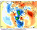
2. **Impact of Weather Patterns**: The presence of a strong El Niño pattern increases the likelihood of snow during the winter months. However, if snow hasn't materialized by early March, it might indicate that other climatic factors have overridden the typical impacts of El Niño, such as unexpected shifts in jet streams or warmer than anticipated temperatures [oai_citation:2,2023-24 NC snow outlook: A colder winter and good news for snow lovers](https://www.wral.com/story/how-much-snow-NC-2023-24/21128901/).
3. **Historical Variability**: Historical weather data shows variability in snowfall patterns, with some years seeing little to no snow. The absence of snow by early March would not be unprecedented, and it underscores the variability inherent in regional weather patterns.
4. **Shift Towards Spring**: As March progresses, the focus of weather patterns begins to shift towards spring. The likelihood of warming temperatures reduces the chances of new snowfall events, although late cold snaps can still occur.
5. **Looking Ahead**: Without snow by early March, it might be time to start looking ahead to spring weather patterns and preparing for the transition out of winter. This includes planning for spring gardening, outdoor activities, and home maintenance tasks that are best performed in warmer weather.
In summary, the lack of snowfall in Durham, NC, by early March suggests that this winter might conclude with less snow than anticipated, despite forecasts suggesting otherwise due to El Niño. While disappointing for snow enthusiasts, it's a reminder of the unpredictability of weather and the need to adapt to whatever conditions prevail.


