It's neither here nor there but the GFS was within a whisker of dropping a 30" storm from Winston to Durham. Three hours with a slightly warm layer.

It's neither here nor there but the GFS was within a whisker of dropping a 30" storm from Winston to Durham. Three hours with a slightly warm layer.
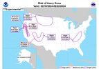
It’s gonna make its own coldIt’s supposed to be 72 with precipitation on Saturday. Can it snow at that temperature?
Reminds me of a a bachelor trip to south beach I took back in 2014. It definitely snowed at 95 degrees that weekWith enough ? power it can snow at 95 degrees
Plenty of bourbon will do the sameWith enough ? power it can snow at 95 degrees
I'm not even sure what that means but it sounds fun.Reminds me of a a bachelor trip to south beach I took back in 2014. It definitely snowed at 95 degrees that week
To be 25 againI'm not even sure what that means but it sounds fun.
If you were 25 ten years ago then you're still young.To be 25 again

Close by, yeah. It keeps improving on the more reliable suites.Is that for Columbia?

Maybe he’s trying some reverse psychology ?
Hes such a pompous douche
Don’t you think this is a little premature for them? Seems too earlyBrad is in shambles View attachment 145759
Yeah, now kind of just being a ****Hes such a pompous douche
For the mtns? NahDon’t you think this is a little premature for them? Seems too early
No; Because outside the models this website posts and living and dying by every model run, external tools and utilities (and experimental modeling) is showing there is a very strong chance at a big storm.Isn’t it way too early for something like this?

Great post.Went back and looked at some stuff from Feb 2014..... just to see if anything in the similar time periods were similar.....one thing that stands out that we had then that we do not have currently, a metric ton of snow cover to our North lol I think one big helper for us will be to pull hard for MA/NE to get smothered next week with a big event and maybe that helps us ever so slightly anyway. Very excited though especially for my fellow I-85 N/W people NC / SC / GA


I just remember him on Twitter year after year posting graphics showing February as our snowiest month of the year and March 2nd as the snowiest calendar day. I think he loves snow just like most of us, so it may be a little reverse psychology, or he could be getting back at some nagging comments. Heck, he even brags about making snow with his snow machine whenever we get a dry cold snap. He made a vlog early this past January talking about how great the pattern was looking for the mountains. I doubt he’s suddenly gone off the deep end and completely forgotten how to read long range models.Hes such a pompous douche
So you know exactly what’s gonna happen at day 9-11 nowAreas further west and north got their winter weather earlier in the winter and now it looks like CAD areas will get their winter weather while Atlanta is stuck in the middle with nothing.
Areas further west and north got their winter weather earlier in the winter and now it looks like CAD areas will get their winter weather while Atlanta is stuck in the middle with nothing.