• Hello, please take a minute to check out our awesome content, contributed by the wonderful members of our community. We hope you'll add your own thoughts and opinions by making a free account!

Wintry Winter Discussion 2023/24

Gotta love the Cinnabon pattern in the eastView attachment 138855
The Cinnabon even has a little Barney in it. But yeah, I think getting that thing to wind up and slow down is the first step to getting things behind it to slow down and sink south

f8a9nJN.gif
 
The Cinnabon even has a little Barney in it. But yeah, I think getting that thing to wind up and slow down is the first step to getting things behind it to slow down and sink south

f8a9nJN.gif
Agreed. It's not the most sexy way to get a winter storm but sometimes you get lucky and back into one. I love the Hudson block on the euro and the arctic tap it establishes and feeds the Cinnabons into the NE us gyre, it almost acts as a west based -nao. It's just so touchy though, you can see that on the cmc and how it's just a front.
 
it was mentioned before but for those of us in the CAD areas eastern Canada has been pretty cold also and getting the TPV to drop south further really helps as we establish CAD in the pattern for a potential winter storm. While I agree having snow pack to the NW is nice to have, those of us to the east of the mountains don’t need it to get our winter storms either. I personally am not punting to the end of January while we wait for snow pack to establish itself. I think January-February has just as much of a shot. We just need to inject more cold air on our side of the continent and getting a jet retraction is the first step in doing that.
 
We've become jaded. Upper 40s/upper 20s to low 30s is about average for central NC; maybe a degree or two below normal and we're trying to spin that into being a good look. I would call that seasonable, but certainly not cold. Not gonna score with that; but it seems most of us are pretty skeptical about much snow anymore. Need an old fashioned setup with a real score to remind us what it's like.
 
We've become jaded. Upper 40s/upper 20s to low 30s is about average for central NC; maybe a degree or two below normal and we're trying to spin that into being a good look. I would call that seasonable, but certainly not cold. Not gonna score with that; but it seems most of us are pretty skeptical about much snow anymore. Need an old fashioned setup with a real score to remind us what it's like.
I’d argue most of NC snow storms haven’t come with temps in the low 20s or teens. Some of the best snows I’ve seen besides places I’ve lived in higher elevations is snows around 30 degrees.
 
We've become jaded. Upper 40s/upper 20s to low 30s is about average for central NC; maybe a degree or two below normal and we're trying to spin that into being a good look. I would call that seasonable, but certainly not cold. Not gonna score with that; but it seems most of us are pretty skeptical about much snow anymore. Need an old fashioned setup with a real score to remind us what it's like.
This is incorrect
 
We've become jaded. Upper 40s/upper 20s to low 30s is about average for central NC; maybe a degree or two below normal and we're trying to spin that into being a good look. I would call that seasonable, but certainly not cold. Not gonna score with that; but it seems most of us are pretty skeptical about much snow anymore. Need an old fashioned setup with a real score to remind us what it's like.
So it’s normally 32/15 days preceding a winter storm ? I can’t recall many winter storms here like that, I can recall a good amount where it was warm prior though.
 
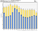
This looks good, but it's an ensemble average out to February 5th. The 3.5/4.0" showing for RDU is probably close to the average for that date of winter. We're looking/hoping for a higher-than-normal winter snow totals on the extended models. This is supposed to be an above normal snow year (remember all the predictions from fall). If this is all we can hope for, we need to come to the conclusion that our good winters are now going to be what we use to average 10 years ago.
 
This looks good, but it's an ensemble average out to February 5th. The 3.5/4.0" showing for RDU is probably close to the average for that date of winter. We're looking/hoping for a higher-than-normal winter snow totals on the extended models. This is supposed to be an above normal snow year (remember all the predictions from fall). If this is all we can hope for, we need to come to the conclusion that our good winters are now going to be what we use to average 10 years ago.

Yeap the early to mid 2010s were great and now they suck. I hope we can over-perform this year with the extra moisture in the atmosphere.


Sent from my iPhone using Tapatalk
 
It may mean nothing, but the look on all the ensembles is very interesting. I don’t remember that much heat being distributed over Europe/Eurasia. Just seems like the pattern shown will eventually drop the apex of the cold air into NA in time. Really liking Webbs mid to late January call of potential.
 
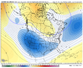
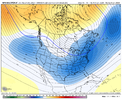
The ECMWF & GFS Ensembles giving us different flavors of winter storm patterns (Miller B/CAD & Miller A respectively) circulation-wise, but of course cold air is the big question mark, esp early in January. The deeper we go in January, the better things should get cold air wise, tho I'm not sure yet if the circulation pattern will look at least this good (or better) until late month.

I'd honestly be real excited about this if we didn't have a raging Pacific Jet beforehand zapping what little snow cover and cold air we have to work w/ atm. Even still, it would be crazy to think there's a 0% chance of a winter storm here, tho I don't believe we're all that far above it (10% maybe at the very most).


ecmwf-ensemble-avg-namer-z500_anom_1day-4456000.png

gfs-ensemble-all-avg-namer-z500_anom_1day-4564000.png
 
I’d argue most of NC snow storms haven’t come with temps in the low 20s or teens. Some of the best snows I’ve seen besides places I’ve lived in higher elevations is snows around 30 degrees.

This is incorrect

So it’s normally 32/15 days preceding a winter storm ? I can’t recall many winter storms here like that, I can recall a good amount where it was warm prior though.
Huh??

Not sure how my post came across in a way that prompted these responses. I never said anything about low 20 or teens, or 32/15 combinations. I said that the forcasts show temps in the upper 40s (for highs) and the lower 30s to upper 20s (for lows) which is pretty average (or just a couple below) and that won't likely get the job done for snow. Basically we need a better cold push to get the goods.
This used to be common back in the late 70's and early 80's. The best example I can remember is 1982 with the Atlanta snowjam system. That was proceeded by temps below 0 a couple of nights, with high in the mid 20's the day before it hit the Carolinas. Precip type was never in question for that one for most of us.


It may mean nothing, but the look on all the ensembles is very interesting. I don’t remember that much heat being distributed over Europe/Eurasia. Just seems like the pattern shown will eventually drop the apex of the cold air into NA in time. Really liking Webbs mid to late January call of potential.
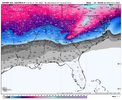
Something like this? ?
gem-ens_T2ma_namer_63.png
 
Back
Top