tennessee storm
Member
Ł I lll l
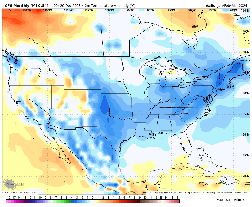
now let’s look at the precip map for that 30 day …periodWow! That's a strong cold anomaly for a 30 day average.