Its dormant. What are trying to killI'm in a bermuda grass facebook group and some of the guys on there do it and it looks amazing. About to blanket spray my Bermuda with a low concentration glyphosate today. Hopefully it's dormant
-
Hello, please take a minute to check out our awesome content, contributed by the wonderful members of our community. We hope you'll add your own thoughts and opinions by making a free account!
You are using an out of date browser. It may not display this or other websites correctly.
You should upgrade or use an alternative browser.
You should upgrade or use an alternative browser.
Misc Winter 22-23 Whamby and Banter Thread Part 2
- Thread starter packfan98
- Start date
your ground temps are much warmer than mostGrass is greening up down here. Went brown for a few weeks. Feeling like Georgia.
LukeBarrette
im north of 90% of people on here so yeah
Meteorology Student
Member
2024 Supporter
2017-2023 Supporter
Poa and another weed that I can't IDIts dormant. What are trying to kill
Heelyes
Member
- Joined
- Jan 23, 2021
- Messages
- 4,603
- Reaction score
- 15,199
- Location
- Lebanon Township, Durham County NC
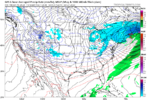
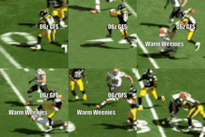
18z GFS ain’t bout that life this run
DadOfJax
Member
Shut itDrop it
NoSnowATL
Member
Twist it
Shout it
NBAcentel
Member
Dad of jax Vs the board lol
NoSnowATL
Member
Kicking is hard. Yikes
It’s the resort where they have the Savannah and animals. Animal Kingdom LodgeIs this animal kingdom ?
Not sure I’d recommend the blanket spray planPoa and another weed that I can't ID
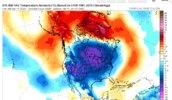
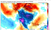
70s here Thursday. Gotta get that pendulum swinging back from one extreme to the other to get the good snowstorms.
Good luck with POA. You can also use Aneu during the growing season. It has been able to eventually kill out POA. Send me a picture of the other weedPoa and another weed that I can't ID
Bye, Brady. Hope you stay gone this time.
ajr
Member
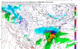
Another weird extra-tropical storm (this time in the North Sea):
Some additional technical info:
Some additional technical info:
Last edited:
NoSnowATL
Member
GFS is right this time?
rburrel2
Member
NoSnowATL
Member
372hrs.We punt first half of February right?View attachment 130518
Heelyes
Member
I have as much faith in the 372 as the 72hr gfs372hrs.
NBAcentel
Member
Always 372 hours away372hrs.
rburrel2
Member
So yes?372hrs.
NBAcentel
Member
we haven't even had a consistent storm stay on majority of modeling under day 7 this winter so for right now, yes. Just pattern looking better for now.So yes?
Pattern recognition mode. Like usual
rburrel2
Member
rburrel2
Member
Agreed... but punt mode is after you've recognized the pattern will 100% suck so you turn off the computer for a week. I think I'll keep watching the models for now.we haven't even had a consistent storm stay on majority of modeling under day 7 this winter so for right now, yes. Just pattern looking better for now.
Pattern recognition mode. Like usual
rburrel2
Member
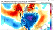
All the ensembles absolutely torch Greenland to the north pole all the way through hours 360/384... I don't hate it.
- Joined
- Jan 23, 2021
- Messages
- 4,603
- Reaction score
- 15,199
- Location
- Lebanon Township, Durham County NC
Drizzle Snizzle
Member
Warm air isn’t far away. Wouldn’t take much for that warm air in Florida to creep north.
Webberweather53
Meteorologist
Pattern looks objectively better (mainly due to -NAO in week 2) but still no legit storm signal (yet) inside the medium range.So yes?
NoSnowATL
Member
smast16
Member
Never count out an inland LA to OH express route.Apps runners look be in play also
NoSnowATL
Member
CltNative90
Member
Obviously taking everything from the long range GFS with a mound of salt at this point. It’ll most likely show a completely different solution at 12z. Ensembles aren’t showing anything close to what the operational is showing storm wise, other than a trend toward a potential favorable pattern.
That being said, I have had a cabin in Little Switzerland booked for February 1-5 since November and the potential has my attention. I have gone from anticipating rain and temps in the 50s to the prospect of getting snowed in, or having to adjust my arrival date so I can even make it up there. Could be an interesting couple weeks seeing how this unfolds.
That being said, I have had a cabin in Little Switzerland booked for February 1-5 since November and the potential has my attention. I have gone from anticipating rain and temps in the 50s to the prospect of getting snowed in, or having to adjust my arrival date so I can even make it up there. Could be an interesting couple weeks seeing how this unfolds.
LukeBarrette
im north of 90% of people on here so yeah
Meteorology Student
Member
2024 Supporter
2017-2023 Supporter
Avalanche
Member
Just dropped in to see how the winter cancel was coming along.
Wave after wave after wave, somebody make it stop
- Joined
- Jan 23, 2021
- Messages
- 4,603
- Reaction score
- 15,199
- Location
- Lebanon Township, Durham County NC
Dont see a thread for this sort of thing but something super cool just happened.
We bought our house 12/2020. We put 3% down on a conventional loan. The house has increased to 410k by our latest broker price opinion. PMI is gone and we saved 51k. What a time to be alive.
We bought our house 12/2020. We put 3% down on a conventional loan. The house has increased to 410k by our latest broker price opinion. PMI is gone and we saved 51k. What a time to be alive.

