Brent
Member
That's the default pattern we go to these days, but I'm cautiously optimistic that it will be colder than last winter
Lol that's not exactly gonna be hard. Like honestly if we can't do better than that mess I give up
That's the default pattern we go to these days, but I'm cautiously optimistic that it will be colder than last winter
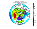
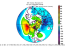
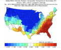
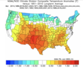
My way too early & honest overall impression of this upcoming winter based on these analog years (whose SST composite is posted above) is we might be in for quite a roller coaster ride across much of the CONUS & N America.
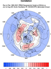
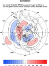
The La Niña, warm Tropical West Pacific, west QBO, & high solar combo is usually one that favors a strong + poleward shifted Aleutian ridge, w/ more frequent bouts of -EPO/-WPO that occasionally seed North America w/ brutally cold air from Siberia, although the Nina-induced SE US ridge may resist its southward progression at certain points. The prevalence of a -EPO/-WPO this winter seems to be showing up time & time again.
Oth, signals are pretty mixed over the North Atlantic & polar cap, though a -NAM/-AO/-NAO is slightly favored if anything. I generally agree w/ that based on recent history of -ENSO winters & how things are starting to unfold leading into this winter and what some of the indicators are (like high solar + west qbo + La Niña) that normally in conjunction are more conducive to sudden stratospheric warming events.
In terms of modern winters, years like 2013-14 & 1988-89 really seem to stand out as some of the best analogs compared to the rest of the pack.
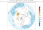
View attachment 151080
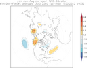
View attachment 151079
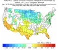
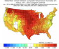
The month-to-month variability in this composite of years is honestly wild. Says a lot about where I think we might be headed this year. Sure, I think a milder-than-average winter is likely in the cards for us in the southern tier of the CONUS, but how we get there doesn't exactly look straightforward at all. Even if our mean temps are warmer-than-average (which I think they'll probably be this year), there should going to be enough cold air floating around in our general vicinity (N American continent) for legitimate opportunities at wintry weather to come knocking if we briefly line a few things up. Couldn't necessarily say that about last winter for the most part.
December
View attachment 151081
January
View attachment 151084
February
View attachment 151083
March
View attachment 151082
Weird 13-14 was big here but 88-89 was meh.. better than last year but not by much
13-14 was great here, especially from late January on. 88-89 looks good just looking at the snowfall that season… within a week of each other mid to late February after a small system in mid December. Between that though was an absolute torchWeird 13-14 was big here but 88-89 was meh.. better than last year but not by much
I remember on the weather channel seeing Carl Parker back in mid November 2013 showing big HP's coming south out of Canada and at that point I had that feeling we were in for a long long winter here.13-14 was great here, especially from late January on. 88-89 looks good just looking at the snowfall that season… within a week of each other mid to late February after a small system in mid December. Between that though was an absolute torch
Webb, was 2013-14 winter more of a neutral enso winter? Definitely dominant -epo/epo all winter with only very brief bouts of -ao/nao from what I rememberHere's a Quick Look at how I put these analog years together.
The arbitrary point system for some 2024-25 winter analogs:
+2.0 pts: East-based La Niña
+0.0 pts: “Hybrid” La Niña
-2.0 pts: Central Pacific Nina
+1.5 pts: Warm West Pacific
+0.0 pts: “Neutral” West Pacific
-1.5 pts: “Cool” West Pacific
+1.0 pt: -AMO Tripole
+1.5 pts: -AMO tripole AND warm Atlantic Canada
+2.0 pts: -AMO tripole, warm Atlantic Canada, & warm MDR (very hard to do)
-1.0 pt: +AMO tripole
+0.5 pt: < 100 (adjusted) ACE non-El Nino hurricane season
+1 pt: Solar max (> 0.5 sigma sunspot numbers for Aug (climo: 1750-present))
0 pts: Neutral Solar (< 0.5 sigma & > -0.5 sigma sunspot numbers)
-1 pt: Solar min (< -0.5 sigma sunspot numbers)
QBO: Bronimann et al., 2007 (1900-1952) & University of Berlin (1953-Present)
+1 pts: 50 hPa West QBO
-1 Pts: 50 hPa East QBO
+1 pt: 50 hPa West QBO AND Solar Max
-1 pt: 50 hPa East QBO AND Solar Min
NAO: Jones NAO (1821-Present)
+1 pt: Jun-Jul-Aug +NAO (> 0.5 sigma)
+1.5 pts: Jun-Jul-Aug +NAO (> 0.5 sigma) AND Sep -NAO
-1 pt: Jun-Jul-Aug -NAO (< -0.5 sigma)
IOD (DMI, HADISST 1870-Present)
+1 pt: Negative or Neutral IOD (< 0.5 sigma)
-1 pt: Positive IOD ( > 0.5 sigma)
Sep -WPO (Standardized 500mb height difference between 30-50N, 110-200E and 55-80N, 110-200E)
+0.5 pt: Positive WPO ( > 0.5 sigma)
0 pt: Neutral WPO (< 0.5 & >-0.5 sigma)
-0.5 pt: Negative WPO (< -0.5 sigma)
Sep -AO (1st EOF of SLP poleward of 20N, NOAA 20CRv3 (1876-2015), NCEP R1 (2016-Present)
+0.5 pt: Negative AO (< -0.5 sigma)
0 pt: Neutral AO (< 0.5 & >-0.5 sigma)
-0.5 pt: Positive AO (> 0.5 sigma)
Max Possible Points: 17.5
Top 20 Winters:
#1 2013-14: 13.0 pts
#2 1988-89: 11.5 pts
#3 1882-83: 9.5 pts
#3 1892-93: 9.5 pts
#5 2017-18: 9.0 pts
#5 2020-21: 9.0 pts
#5 2022-23: 9.0 pts
#8 1970-71: 8.5 pts
#8 1981-82: 8.5 pts
#10 1967-68: 8.0 pts
#11 1938-39: 7.5 pts
#11 1973-74: 7.5 pts
#11 2005-06: 7.5 pts
#14 1889-90: 7.0 pts
#14 1894-95: 7.0 pts
#14 1920-21: 7.0 pts
#14 1961-62: 7.0 pts
#18 1955-56: 6.5 pts
#18 1999-00: 6.5 pts
#18 2000-01: 6.5 pts
You should have a better chance with the trough being further west this winter with bigger cold shots imoLol that's not exactly gonna be hard. Like honestly if we can't do better than that mess I give up
In the 2021-2022 winter, once I noticed the niña being more east based, I predicted it to be a colder winter, despite a lot of people on bandwagon on it being warm because of strength of the niña. Position of the niño or niña in the Pacific is as important or even more important than the overall strength imoGoing along with what Webber has discussed (from CPC):
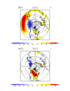
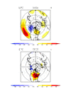
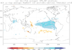
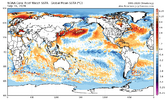
Going along with what Webber has discussed (from CPC):
You’re correct and you could tell even in that blowtorch that ended December and brought in the New Year that the indicies were lining up well for the eastern 2/3rds of the country.In the 2021-2022 winter, once I noticed the niña being more east based, I predicted it to be a colder winter, despite a lot of people on bandwagon on it being warm because of strength of the niña. Position of the niño or niña in the Pacific is as important or even more important than the overall strength imo
I was shocked that it was that warm in December for sure back thenYou’re correct and you could tell even in that blowtorch that ended December and brought in the New Year that the indicies were lining up well for the eastern 2/3rds of the country.
I was shocked that it was that warm in December for sure back then
Feb 1989 was a wild ride in the Carolinas. Very warm to start and then cold a week later will lows in the single digits and teens, then back to 80 a week later. Just 2 days after that, a major icestorm hit. It got fairly warm again that next week but was quickly followed up with a snowstorm.Weak (ish) La Niña winters like this tend to be some of the hardest ones to forecast and possess some of the largest variability from event-to-event. Even small changes in long wave placement can mean the difference between a blowtorch & being bitterly cold. Subtle things can make a much bigger difference in years like this.
That winter and spring were crazy in the Carolinas. Warm, then icy, then back to warm, then quickly to snow. Then May 5 brought a tornado outbreak in the piedmont of both states.13-14 was great here, especially from late January on. 88-89 looks good just looking at the snowfall that season… within a week of each other mid to late February after a small system in mid December. Between that though was an absolute torch
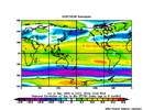
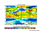
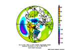
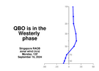
It was definitely cold shots for sure. We had a monster ice storm/sleet storm begging of Feb 96 here in Mid South, but it got so cold so quick that most of it was to our south and east.I've posted before about the la nina year 1996. That was a great winter for many of us. It was a weak la nina (which is what we want), but there were other critical factors listed here (..which is outside of my knowledge):
Stormchaserchuck at American Weather says that if we get a -nao in October, it almost guarantees a +nao in winter. He said it happened the last five winters
If anyone is interested, bamwx has a YouTube video called WINTER WEATHER WEDNESDAYS that posts every Wednesday. They talk about the upcoming winter and indicators that lead them to go one way or the other in terms of what will more than likely unfold this winter.
I seem to remember in mid March that year there was also I very hard cold snap. Afternoon temperatures in the mid 20s in CLTThat winter and spring were crazy in the Carolinas. Warm, then icy, then back to warm, then quickly to snow. Then May 5 brought a tornado outbreak in the piedmont of both states.
I'm really not sure about this. I've seen so many things that are supposed to be leading factors but end up being nothing really. Especially when it comes to the NAO...Stormchaserchuck at American Weather says that if we get a -nao in October, it almost guarantees a +nao in winter. He said it happened the last five winters
Maybe it was 3 years ago I can't even rememberWe should have never had four weekends in a row a couple years ago in North Carolina with snow
Lmao we already suck!
Lmao we already suck!
