Iceagewhereartthou
Member
Lmao we already suck!
Whatttt almost every month of the year below average, who coulda seen that coming!Here. Farmer’s Almanac. Zone 4. View attachment 151353
Feb 19-26 has my interest peaked!Whatttt almost every month of the year below average, who coulda seen that coming!
Ahh memories
We got a big snow storm ourself in the mid south a few days prior. Places in central and south Arkansas received 12-23inches but dry air forced most of it south of usAhh memories
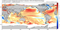
Larry, if the Aleutian ridge is flat this winter, meaning not poleward, we will be extremely warm here. However, if it's more poleward, I think big cold shots will come down, especially if we get the -epo/wpo couplet imo. What was interesting is that last winters niño, which is typically backloaded, was colder early on and progressed warmer later in winter.With La Nina and a very strong -PDO likely, I’d be surprised if the SE isn’t warmer than last winter’s mainly near to modestly warmer than normal. The best shot at BN is typically in the N US with that combo. Odds are very good the NE and especially the Midwest won’t be as warm as the torch that they had up there last winter.
They booming already
.They booming already
Looks like the pattern for the last three weeks here , maybe
I guess we hope for a few weeks of enough cold and moisture to come together. It only takes one event. We don't average much snow per year anyway around hereJB came out with his winter forecast and joins the parade of us who think it will be an above normal winter in the East/South with below normal snow (and precip) in general
JB came out with his winter forecast and joins the parade of us who think it will be an above normal winter in the East/South with below normal snow (and precip) in general
Not. Good though. He goes with warm with I 100 percent agree…. Because he loves the hype up of cold …This is actually the only thing that has given the slightest inclination that we may have a chance for a cold winter.
Not. Good though. He goes with warm with I 100 percent agree…. Because he loves the hype up of cold …


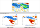
The outcome was alot colder that winter for sureIf JB’s current forecast were to not be later cooled, it would easily be his warmest final forecast for the SE/E US since at least 2014-5. (I don’t have access to the ones right before 2014-5.) The key is whether or not he’ll cool it down substantially like he did in late Nov for 20-21. The weenie and business side of him both want to do this again so badly and I wouldn’t at all be surprised if he does just that/if that is planned.
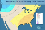
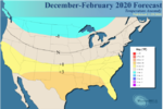
20-21 initial forecast made in Aug:
View attachment 151790
20-21 much colder update made in late Nov:
View attachment 151791
Probably still in the 80s hereIt has begun View attachment 151873
You don't want to be in the bullseye this far out.It has begun View attachment 151873
You don't want to be in the bullseye this far out.
Denver can literally get snow this time of year can’t they ?Yeah luckily I'm not
Although it's crazy Denver is still hitting 90... Winter still seems so far away even though it's happened in October here before
Seeing those yellows in Florida makes me worry that the southeast may to worry about the southeast ridge.
We will have to worry about it. That is a typical thing during niñas.Seeing those yellows in Florida makes me worry that the southeast may to worry about the southeast ridge.
I would be happy if just one of the three months verified like that.

Man, that’s ugly! Good thing he’s right about 10% of the time!If JB’s current forecast were to not be later cooled, it would easily be his warmest final forecast for the SE/E US since at least 2014-5. (I don’t have access to the ones right before 2014-5.) The key is whether or not he’ll cool it down substantially like he did in late Nov for 20-21. The weenie and business side of him both want to do this again so badly and I wouldn’t at all be surprised if he does just that/if that is planned.
20-21 initial forecast made in Aug:
View attachment 151790
20-21 much colder update made in late Nov:
View attachment 151791
Man, that’s ugly! Good thing he’s right about 10% of the time!

While I respect all of the early forecasts, I think I will just wait and see what transpires as the past years in my memory have all have been busts. I think I will err on the side of no snow until I see it on the ground. Amazing to me how much we have progressed technology wise but still cant say 100% what the weather will be tomorrow.
