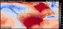
That screams WilksdudView attachment 150457 random weather person on yt. At least he got the southern states right.
View attachment 150458
-
Hello, please take a minute to check out our awesome content, contributed by the wonderful members of our community. We hope you'll add your own thoughts and opinions by making a free account!
You are using an out of date browser. It may not display this or other websites correctly.
You should upgrade or use an alternative browser.
You should upgrade or use an alternative browser.
Wintry Winter 2024-25 Discussion
- Thread starter SD
- Start date
Webberweather53
Meteorologist
Mild with one small snowstorm
Sounds about right for this winter
Webberweather53
Meteorologist
My prediction for this winter: more tornado outbreaks than snowstorms.
lexxnchloe
Member
JBs detailed winter forecast

 www.weatherbell.com

WeatherBELL Analytics
Precision weather forecasting, data services and decision support for your industry
So no different than the last couple years. Sounds rightMy prediction for this winter: more tornado outbreaks than snowstorms.
JBs detailed winter forecast

WeatherBELL Analytics
Precision weather forecasting, data services and decision support for your industrywww.weatherbell.com
JB is already doing his typical monkey wrenching when he doesn’t forecast a cold snowy winter so as to take the emphasis off of his AN winter forecast and keep people clicking. Now he’s harping on a cold Dec. I wouldn’t be surprised if he like he did in 2020 later revises his winter forecast colder.
Last edited:
tennessee storm
Member
Don’t he always lolJB is already doing his typical monkey wrenching when he doesn’t forecast a cold snowy winter so as to take the emphasis off of his AN winter forecast and keep people clicking. Now he’s harping on a cold Dec. I wouldn’t be surprised if he like he did in 2020 later revises his winter forecast colder.
Webberweather53
Meteorologist
My prediction for this winter: more tornado outbreaks than snowstorms.
I'm obviously (kind of) pulling everyone's legs here. In all seriousness, here a few of my way too early thoughts on this winter:
We're probably headed for a weak, if not moderate La Niña this winter (in fact one is already developing). However, I have a suspicion that this year may not follow the canonical mold of suppressed Aleutian ridge/-PNA/SE US ridge for large stretches of the winter, especially in Dec-Jan.
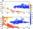
For one thing, as is often the case w/ weaker, first year La Ninas like this year, this La Niña looks "east-based", which tends to actually favor a negative NAO.
E.g.: Impacts of the two types of La Niña on the NAO during Winter
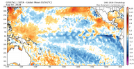
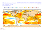
Also, this year is squarely in the westerly phase of the QBO, which normally shifts the Aleutian ridge poleward towards Alaska, increasing the risk for -EPO/-WPOs (HM/Anthony Masiello has talked about this for over a decade now).
The other thing that seems to be in our corner this year is the fact that we're in an increasingly westerly QBO: https://psl.noaa.gov/data/correlation/qbo.data
A west QBO coupled with solar maximum, and a La Niña is arguably the most favorable QBO, Solar, & ENSO combination historically for a sudden stratospheric warming event, which would support the potential for -NAO this winter.
E.g. Labitzke et al (2006) found that of the 11 west qbo sudden stratospheric warming events that occurred prior to the mid-2000s or so, 10 of those 11 happened during solar max (like this year!) https://journals.ametsoc.org/view/journals/atsc/64/4/jas3883.1.xml
Here's how cool ENSO winters w/ varying QBO behavior compare over the Northern Hemisphere since 1953:
500mb pattern for cool neutral - Nina winters w/ west -> east transitioning QBOs before winter. Pretty canonical Nina pattern here w/ slightly suppressed Aleutian Ridge & SE US ridge w/ +NAO/+TNH.
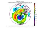
500mb pattern for cool neutral - Nina winters w/ east -> west transitioning QBOs before winter (like this year). Notice the Aleutian Ridge is shifted poleward & there's a -NAO, with a much more suppressed SE US ridge.
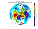
500mb difference composite between the most recent 10 east -> west & west -> east QBO cool ENSO winters basically yields the NAO pattern. This means that -NAO is much more favored when we're transitioning from east to west QBO w/ cool ENSO (like this year). This is aside from the fact that as mentioned previously solar max, & of course warm Atlantic are all also trying to help favorably influence our chances for a -NAO this coming winter.
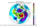
All told, although it's pretty early in the grand scheme of things, I'm much more cautiously optimistic than folks for what this winter may hold over the East & Southeast US than say Joe Bastardi. Compared to last winter, I don't see this playing as much into the canonical ENSO script as much & I'm much less confident in a "torch" happening, at least through December & January (February might be a different story).
BHS1975
Member
I'm obviously (kind of) pulling everyone's legs here. In all seriousness, here a few of my way too early thoughts on this winter:
We're probably headed for a weak, if not moderate La Niña this winter (in fact one is already developing). However, I have a suspicion that this year may not follow the canonical mold of suppressed Aleutian ridge/-PNA/SE US ridge for large stretches of the winter, especially in Dec-Jan.
For one thing, as is often the case w/ weaker, first year La Ninas like this year, this La Niña looks "east-based", which tends to actually favor a negative NAO.
E.g.: Impacts of the two types of La Niña on the NAO during Winter
View attachment 150740
View attachment 150738
View attachment 150739
Also, this year is squarely in the westerly phase of the QBO, which normally shifts the Aleutian ridge poleward towards Alaska, increasing the risk for -EPO/-WPOs (HM/Anthony Masiello has talked about this for over a decade now).
The other thing that seems to be in our corner this year is the fact that we're in an increasingly westerly QBO: https://psl.noaa.gov/data/correlation/qbo.data
A west QBO coupled with solar maximum, and a La Niña is arguably the most favorable QBO, Solar, & ENSO combination historically for a sudden stratospheric warming event, which would support the potential for -NAO this winter.
E.g. Labitzke et al (2006) found that of the 11 west qbo sudden stratospheric warming events that occurred prior to the mid-2000s or so, 10 of those 11 happened during solar max (like this year!) https://journals.ametsoc.org/view/journals/atsc/64/4/jas3883.1.xml
Here's how cool ENSO winters w/ varying QBO behavior compare over the Northern Hemisphere since 1953:
500mb pattern for cool neutral - Nina winters w/ west -> east transitioning QBOs before winter. Pretty canonical Nina pattern here w/ slightly suppressed Aleutian Ridge & SE US ridge w/ +NAO/+TNH.
View attachment 150741
500mb pattern for cool neutral - Nina winters w/ east -> west transitioning QBOs before winter (like this year). Notice the Aleutian Ridge is shifted poleward & there's a -NAO, with a much more suppressed SE US ridge.
View attachment 150743
500mb difference composite between the most recent 10 east -> west & west -> east QBO cool ENSO winters basically yields the NAO pattern. This means that -NAO is much more favored when we're transitioning from east to west QBO w/ cool ENSO (like this year). This is aside from the fact that as mentioned previously solar max, & of course warm Atlantic are all also trying to help favorably influence our chances for a -NAO this coming winter.
View attachment 150742
All told, although it's pretty early in the grand scheme of things, I'm much more cautiously optimistic than folks for what this winter may hold over the East & Southeast US than say Joe Bastardi. Compared to last winter, I don't see this playing as much into the canonical ENSO script as much & I'm much less confident in a "torch" happening, at least through December & January (February might be a different story).
I mean it can't be any worse.
Sent from my iPhone using Tapatalk
The fact that this is going to be first year La Niña does at least give some hope in December and at least the first half of January based on climo. We should have some extended stretches of strong blocking and a -NAO during that time which would at least give us east of the Apps a chance. The big question is as has seemed to be the case the last few years is… are we ever going to time strong blocking with a favorable MJO. If we do then maybe we can put together a period like we saw in January 2022I'm obviously (kind of) pulling everyone's legs here. In all seriousness, here a few of my way too early thoughts on this winter:
We're probably headed for a weak, if not moderate La Niña this winter (in fact one is already developing). However, I have a suspicion that this year may not follow the canonical mold of suppressed Aleutian ridge/-PNA/SE US ridge for large stretches of the winter, especially in Dec-Jan.
For one thing, as is often the case w/ weaker, first year La Ninas like this year, this La Niña looks "east-based", which tends to actually favor a negative NAO.
E.g.: Impacts of the two types of La Niña on the NAO during Winter
View attachment 150740
View attachment 150738
View attachment 150739
Also, this year is squarely in the westerly phase of the QBO, which normally shifts the Aleutian ridge poleward towards Alaska, increasing the risk for -EPO/-WPOs (HM/Anthony Masiello has talked about this for over a decade now).
The other thing that seems to be in our corner this year is the fact that we're in an increasingly westerly QBO: https://psl.noaa.gov/data/correlation/qbo.data
A west QBO coupled with solar maximum, and a La Niña is arguably the most favorable QBO, Solar, & ENSO combination historically for a sudden stratospheric warming event, which would support the potential for -NAO this winter.
E.g. Labitzke et al (2006) found that of the 11 west qbo sudden stratospheric warming events that occurred prior to the mid-2000s or so, 10 of those 11 happened during solar max (like this year!) https://journals.ametsoc.org/view/journals/atsc/64/4/jas3883.1.xml
Here's how cool ENSO winters w/ varying QBO behavior compare over the Northern Hemisphere since 1953:
500mb pattern for cool neutral - Nina winters w/ west -> east transitioning QBOs before winter. Pretty canonical Nina pattern here w/ slightly suppressed Aleutian Ridge & SE US ridge w/ +NAO/+TNH.
View attachment 150741
500mb pattern for cool neutral - Nina winters w/ east -> west transitioning QBOs before winter (like this year). Notice the Aleutian Ridge is shifted poleward & there's a -NAO, with a much more suppressed SE US ridge.
View attachment 150743
500mb difference composite between the most recent 10 east -> west & west -> east QBO cool ENSO winters basically yields the NAO pattern. This means that -NAO is much more favored when we're transitioning from east to west QBO w/ cool ENSO (like this year). This is aside from the fact that as mentioned previously solar max, & of course warm Atlantic are all also trying to help favorably influence our chances for a -NAO this coming winter.
View attachment 150742
All told, although it's pretty early in the grand scheme of things, I'm much more cautiously optimistic than folks for what this winter may hold over the East & Southeast US than say Joe Bastardi. Compared to last winter, I don't see this playing as much into the canonical ENSO script as much & I'm much less confident in a "torch" happening, at least through December & January (February might be a different story).
ForsythSnow
Moderator
What's worse than 3 snowless winters?I mean it can't be any worse.
Sent from my iPhone using Tapatalk
4 snowless winters. I don't know how it can actually be worse than warm and snowless. I'd take warm average and one big snow that melts in 2 days over 0.
I'm obviously (kind of) pulling everyone's legs here. In all seriousness, here a few of my way too early thoughts on this winter:
We're probably headed for a weak, if not moderate La Niña this winter (in fact one is already developing). However, I have a suspicion that this year may not follow the canonical mold of suppressed Aleutian ridge/-PNA/SE US ridge for large stretches of the winter, especially in Dec-Jan.
For one thing, as is often the case w/ weaker, first year La Ninas like this year, this La Niña looks "east-based", which tends to actually favor a negative NAO.
E.g.: Impacts of the two types of La Niña on the NAO during Winter
View attachment 150740
View attachment 150738
View attachment 150739
Also, this year is squarely in the westerly phase of the QBO, which normally shifts the Aleutian ridge poleward towards Alaska, increasing the risk for -EPO/-WPOs (HM/Anthony Masiello has talked about this for over a decade now).
The other thing that seems to be in our corner this year is the fact that we're in an increasingly westerly QBO: https://psl.noaa.gov/data/correlation/qbo.data
A west QBO coupled with solar maximum, and a La Niña is arguably the most favorable QBO, Solar, & ENSO combination historically for a sudden stratospheric warming event, which would support the potential for -NAO this winter.
E.g. Labitzke et al (2006) found that of the 11 west qbo sudden stratospheric warming events that occurred prior to the mid-2000s or so, 10 of those 11 happened during solar max (like this year!) https://journals.ametsoc.org/view/journals/atsc/64/4/jas3883.1.xml
Here's how cool ENSO winters w/ varying QBO behavior compare over the Northern Hemisphere since 1953:
500mb pattern for cool neutral - Nina winters w/ west -> east transitioning QBOs before winter. Pretty canonical Nina pattern here w/ slightly suppressed Aleutian Ridge & SE US ridge w/ +NAO/+TNH.
View attachment 150741
500mb pattern for cool neutral - Nina winters w/ east -> west transitioning QBOs before winter (like this year). Notice the Aleutian Ridge is shifted poleward & there's a -NAO, with a much more suppressed SE US ridge.
View attachment 150743
500mb difference composite between the most recent 10 east -> west & west -> east QBO cool ENSO winters basically yields the NAO pattern. This means that -NAO is much more favored when we're transitioning from east to west QBO w/ cool ENSO (like this year). This is aside from the fact that as mentioned previously solar max, & of course warm Atlantic are all also trying to help favorably influence our chances for a -NAO this coming winter.
View attachment 150742
All told, although it's pretty early in the grand scheme of things, I'm much more cautiously optimistic than folks for what this winter may hold over the East & Southeast US than say Joe Bastardi. Compared to last winter, I don't see this playing as much into the canonical ENSO script as much & I'm much less confident in a "torch" happening, at least through December & January (February might be a different story).
Thanks for your post. I hope you’re right!
1. Whereas I’d love to see it and wouldn’t be surprised to have a few -NAO periods and perhaps one -NAO month, I’m very skeptical of much of a chance for a DJF averaged -NAO this winter and am predicting either a +NAO again this winter or at best neutral (-0.25 to +0.25), especially with it near a solar max. Why? There have been only 6 of the last 35 winters with a sub -0.25 average NAO: 1984-5, 1986-7, 1995-6, 2009-10, 2010-1, and 2020-1. All had DJF sunspots of <35 (vs 85 long term average) and all were within ~2 years of a solar min.
NAO by month:
Monthly sunspots: https://www.sidc.be/SILSO/DATA/SN_m_tot_V2.0.txt
2. Based on my past research of QBO/ENSO combos, I found the El Niño/E combo (like last winter and hopefully again next winter) to be the one with the highest frequency of major SSWs. And we did have several last winter. Despite that, we still had a strong +NAO averaged winter. -NAO winters have been so hard to come by in recent decades outside of being near solar mins. Regardless, I feel there’s a good chance for a major SSWE between late Jan and Mar.
3. I’d love to be wrong in my -NAO thinking this winter! Regardless, I’m hopeful for 2025-6, when the latest CANSIPS has a Modoki El Niño and we should have E QBO (though -NAO avg over DJF would again be tough to get imho). Modoki Nino/E is my favorite combo these days.
4. I also think weak to moderate La Nina this winter (weak ONI based and moderate RONI based).
Last edited:
itryatmanysportsespgolf70
Member
The default is towards warm in this climate change global warming situations. Not many thought last February would be as warm as it was especially in niño. With +qbo and solar max or higher sunspots, that in itself should allow it to be much colder than last winter imo.
Drizzle Snizzle
Member
Nobody has any clue what this winter will be like. It could be the coldest winter ever, warmest winter ever, or anywhere in between.
Nobody has any clue what this winter will be like. It could be the coldest winter ever, warmest winter ever, or anywhere in between.
That’s the case just about every winter, especially while still in early Sept. Weather forecasting is quite humbling!
BHS1975
Member
What's worse than 3 snowless winters?
4 snowless winters. I don't know how it can actually be worse than warm and snowless. I'd take warm average and one big snow that melts in 2 days over 0.
I was talking about last winter in which I didn't get a single flake or ice pellet or even a glaze.
Sent from my iPhone using Tapatalk
Brent
Member
I mean it can't be any worse.
Sent from my iPhone using Tapatalk
This. There's no way it can get worse here. Lol
Feel free to quote me in March but like everything that could go wrong last winter went wrong and I will stand by that til I'm proven otherwise
LickWx
Member
You are the greatest forecaster ever and SouthernWX is so lucky to have you! The best forecasterI'm obviously (kind of) pulling everyone's legs here. In all seriousness, here a few of my way too early thoughts on this winter:
We're probably headed for a weak, if not moderate La Niña this winter (in fact one is already developing). However, I have a suspicion that this year may not follow the canonical mold of suppressed Aleutian ridge/-PNA/SE US ridge for large stretches of the winter, especially in Dec-Jan.
For one thing, as is often the case w/ weaker, first year La Ninas like this year, this La Niña looks "east-based", which tends to actually favor a negative NAO.
E.g.: Impacts of the two types of La Niña on the NAO during Winter
View attachment 150740
View attachment 150738
View attachment 150739
Also, this year is squarely in the westerly phase of the QBO, which normally shifts the Aleutian ridge poleward towards Alaska, increasing the risk for -EPO/-WPOs (HM/Anthony Masiello has talked about this for over a decade now).
The other thing that seems to be in our corner this year is the fact that we're in an increasingly westerly QBO: https://psl.noaa.gov/data/correlation/qbo.data
A west QBO coupled with solar maximum, and a La Niña is arguably the most favorable QBO, Solar, & ENSO combination historically for a sudden stratospheric warming event, which would support the potential for -NAO this winter.
E.g. Labitzke et al (2006) found that of the 11 west qbo sudden stratospheric warming events that occurred prior to the mid-2000s or so, 10 of those 11 happened during solar max (like this year!) https://journals.ametsoc.org/view/journals/atsc/64/4/jas3883.1.xml
Here's how cool ENSO winters w/ varying QBO behavior compare over the Northern Hemisphere since 1953:
500mb pattern for cool neutral - Nina winters w/ west -> east transitioning QBOs before winter. Pretty canonical Nina pattern here w/ slightly suppressed Aleutian Ridge & SE US ridge w/ +NAO/+TNH.
View attachment 150741
500mb pattern for cool neutral - Nina winters w/ east -> west transitioning QBOs before winter (like this year). Notice the Aleutian Ridge is shifted poleward & there's a -NAO, with a much more suppressed SE US ridge.
View attachment 150743
500mb difference composite between the most recent 10 east -> west & west -> east QBO cool ENSO winters basically yields the NAO pattern. This means that -NAO is much more favored when we're transitioning from east to west QBO w/ cool ENSO (like this year). This is aside from the fact that as mentioned previously solar max, & of course warm Atlantic are all also trying to help favorably influence our chances for a -NAO this coming winter.
View attachment 150742
All told, although it's pretty early in the grand scheme of things, I'm much more cautiously optimistic than folks for what this winter may hold over the East & Southeast US than say Joe Bastardi. Compared to last winter, I don't see this playing as much into the canonical ENSO script as much & I'm much less confident in a "torch" happening, at least through December & January (February might be a different story).
Snowlover34
Member
Honestly i could care less about what happened last winter especially while living in Phenix city Alabama now since i just moved north of Huntsville in Hazel Green Alabama. I’m putting all my chips on the board to see a snowstorm even if it just flurries i’d say that would be a win in my book after suffering bad the last 3 winters without seeing a flake.
Prestige Worldwide
Member
I’ll take that, it’s easier going in 3-5 months out that the results will be the same!Ben Noll continues bringing the heat- literally and figuratively View attachment 150825
lexxnchloe
Member
Lets the forecasts for winter keep getting so warm 80 will feel like a cold wave. Maybe they will all bust like the cane season forecasts.Ben Noll continues bringing the heat- literally and figuratively View attachment 150825
I don't trust any winter forecast. I guess the la nina would argue for a warmer SE outcome, but there are so many more factors to consider. And if it ends up closer to neutral or weak that could help our (winter) prospects. But just get me to early December and I'll start looking at the pattern forecast two weeks at a time.
MichaelJ
Member
I don't think there is any way we avoid a very mild winter in the SE. With a la nina and the historical (last 5-6 winters) propensity for the MJO to slowly rotate thru phases 4-5 and 6, then add in a high solar, spells warm in the SE
itryatmanysportsespgolf70
Member
Not every time, but most times, when you get a +qbo transition from -qbo and have high solar, actually you get more blocking but we shall see.I don't think there is any way we avoid a very mild winter in the SE. With a la nina and the historical (last 5-6 winters) propensity for the MJO to slowly rotate thru phases 4-5 and 6, then add in a high solar, spells warm in the SE
tennessee storm
Member
Yeah jb done said he expects the mjo be predominantly in phase 4 to 5 most of the winter season coming upI don't think there is any way we avoid a very mild winter in the SE. With a la nina and the historical (last 5-6 winters) propensity for the MJO to slowly rotate thru phases 4-5 and 6, then add in a high solar, spells warm in the SE
Yeah jb done said he expects the mjo be predominantly in phase 4 to 5 most of the winter season coming up
I think I hear the angels singing.
About these above-average seasonal outlooks. I remind everyone of the hurricane season near unanimous predictions of a hyperactive season.
The sun hasn't even crossed the equator yet. The truth of the matter is no one knows what the winter holds for us.
The sun hasn't even crossed the equator yet. The truth of the matter is no one knows what the winter holds for us.
He's going with persistence. Not always the best forecasting approach, but personally, I give it a higher weighting when it comes to winter forecasting. The mjo lives in 4-6 in the winter now.Yeah jb done said he expects the mjo be predominantly in phase 4 to 5 most of the winter season coming up
i.e., painjust get me to early December and I'll start looking at the pattern forecast two weeks at a time.
Brent
Member
About these above-average seasonal outlooks. I remind everyone of the hurricane season near unanimous predictions of a hyperactive season.
The sun hasn't even crossed the equator yet. The truth of the matter is no one knows what the winter holds for us.
True I mean people thought we'd have a big winter last year and it sucked so I don't put much stock into these predictions
I mean yeah above average temps are probably gonna win out but even as bad as the last two winters have been here we've still had an extremely cold stretch for a week or so
At the end of the day where most of us live is just gonna be a problem. I mean I have a 9 inch climo here and we've had 3 inches in the last two years combined... we just have to hope we get a good pattern for a few days here and there when it matters
Last edited:
itryatmanysportsespgolf70
Member
I agree Brent. Try to cash in if we can get a few weeks of cold and moisture. Our average is 5 inches snow here, which is just a little less than your area. I've said this before that if we are to get a cold pattern, it will come down to -epo/wpo combo. That can lead to real cold.True I mean people thought we'd have a big winter last year and it sucked so I don't put much stock into these predictions
I mean yeah above average temps are probably gonna win out but even as bad as the last two winters have been here we've still had an extremely cold stretch for a week or so
At the end of the day where most of us live is just gonna be a problem. I mean I have a 9 inch climo here and we've had 3 inches in the last two years combined... we just have to hope we get a good pattern for a few days here and there when it matters
itryatmanysportsespgolf70
Member
It don't always happen like this, but my favorite two favorite things are a ridge over Alaska, and Arctic front stall to our south with many waves riding along it
Brent
Member
I agree Brent. Try to cash in if we can get a few weeks of cold and moisture. Our average is 5 inches snow here, which is just a little less than your area. I've said this before that if we are to get a cold pattern, it will come down to -epo/wpo combo. That can lead to real cold.
Honestly I don't even want real cold. We barely had any snow when it was so cold.
Give me 25-30 and heavy rates any day over that. That's why I was so mad over the donut hole in February that would have been the perfect storm but like all last winter besides the week in January there was no cold air
Webberweather53
Meteorologist
Made a thread earlier today on X/twitter highlighting a few of my early thoughts about winter.
Made a thread earlier today on X/twitter highlighting a few of my early thoughts about winter.
When is the winter forecast coming out?
I’ll give it to you right now. Similar to this summer in terms of temps. Possibly a little more rain. Absolutely 0 snow.When is the winter forecast coming out?
Brent
Member
When is the winter forecast coming out?
Everything I've seen so far is above normal temps
tennessee storm
Member
It’s out…. Above average temps pretty much east of the Rockies except for the far northeastWhen is the winter forecast coming out?
itryatmanysportsespgolf70
Member
That's the default pattern we go to these days, but I'm cautiously optimistic that it will be colder than last winterIt’s out…. Above average temps pretty much east of the Rockies except for the far northeast

