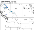
Yeah… if I remember correctly after the 1/2-1/3/2002 storm, ATL, CLT, GSP, GSO, and RDU all had double the amount of snow that season as both Minneapolis and Chicago had received up till that point.You could always run into a 2001-2002
-
Hello, please take a minute to check out our awesome content, contributed by the wonderful members of our community. We hope you'll add your own thoughts and opinions by making a free account!
You are using an out of date browser. It may not display this or other websites correctly.
You should upgrade or use an alternative browser.
You should upgrade or use an alternative browser.
Wintry Winter 2024-25 Discussion
- Thread starter SD
- Start date
itryatmanysportsespgolf70
Member
I'm wondering if Ben knolls prediction was at all accurate last winter?Yeah… if I remember correctly after the 1/2-1/3/2002 storm, ATL, CLT, GSP, GSO, and RDU all had double the amount of snow that season as both Minneapolis and Chicago had received up till that point.
Brent
Member
I'm wondering if Ben knolls prediction was at all accurate last winter?
Does anyone have it? I know people locally hyped our winter here mostly due to El Nino and we're dead wrong
The long range forecasts for winters usually are if they call for a lot of snow.Does anyone have it? I know people locally hyped our winter here mostly due to El Nino and we're dead wrong
It's not his forecast it's just a mean and I think it was snowy last yearDoes anyone have it? I know people locally hyped our winter here mostly due to El Nino and we're dead wrong
Brent
Member
NBAcentel
Member
My first impression of this winter looking at drivers - warm across much of the country, especially the SE. the best chances of BN temps and more snow would be the central/northern Great Plains and upper Midwest
Iceagewhereartthou
Member
So a carbon copy of the last two winters; regardless of the drivers and patterns. It's the new norm unfortunately.My first impression of this winter looking at drivers - warm across much of the country, especially the SE. the best chances of BN temps and more snow would be the central/northern Great Plains and upper Midwest
LickWx
Member
I hope so, last few winters Raleigh has essentially been the new Columbia sc/ Wilmington average wise, maybe this year we can be like TallahasseeSo a carbon copy of the last two winters; regardless of the drivers and patterns. It's the new norm unfortunately.
Idk guys what if this year turns out like 70-71 67-68 13-14 10-11
LickWx
Member
Nope, we have now entered a new climate those winters are part of an old dead climate!Idk guys what if this year turns out like 70-71 67-68 13-14 10-11
Brent
Member
Idk guys what if this year turns out like 70-71 67-68 13-14 10-11
I would kill for 10-11 here. Still the biggest snowstorm Tulsa has ever seen
Even 67-68 was big here for recent standards
All those years had above average snow
..
1 spoon for the Pepto for the heartburn of seeing the models shift north
1 spoon for the ice cream to help with mood/sadness
1 spoon to stir the coffee to compensate for lost sleep
Oh not this again... does it ever predict a warm winterView attachment 150042
1 spoon for the Pepto for the heartburn of seeing the models shift north
1 spoon for the ice cream to help with mood/sadness
1 spoon to stir the coffee to compensate for lost sleep
What usually gets me banned is when we are close but no cigar and it gets to me and I start acting a fool. However I don’t believe we will even get any close calls this year so I think I’m safe. I’m actually leaning towards it never snowing again here. I think it’s a real possibility.My winter prediction is @Stevo24 gets banned this winter after he goes 3 years without a flake! I may end up joining him
Have you really not seen a single flake the past two seasons?My winter prediction is @Stevo24 gets banned this winter after he goes 3 years without a flake! I may end up joining him
NCSnow winter outlook is to avg slightly AN temp wise D,J,F. Below normal qpf and snow climo.
Big story item for this winter will be an Artic outbreak. Probably only 72-96 hours max as the PV only briefly gets dislodged, before going back an getting wound up tight. Shot at a 0 low outside mtns in NC. As dry ground will allow max radiational cooling last night of outbreak as winds go calm.
If you get the grass covered east of the mtns,go buy a lottery ticket next day.
Now even though its La Nina. We can always whip up a 2013. You never know with LR wx forecasting.
Winter will be no worse than the past 2 winters. That I can gurantee.
If u got money. Book a trip to Valdez Alaska. This pic was from there. Only snows about 300-500 inches a year right around that town.
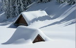

Not a single flake since Jan 2022.Have you really not seen a single flake the past two seasons?
Someone should toss some climate maps together just counting 2009-2024. They're going to likely be more relevant, haha.
Well at least they understand probably warm …
 www.farmersalmanac.com

Farmers’ Almanac Winter 2025 Extended Weather Forecast
Farmers' Almanac 2025 winter weather forecast calls for a wet winter whirlwind! Find out what that means for your region.
iGRXY
Member
We haven't seen a flake since January 2022. Before that we had some grass toppers in 2019 & 2020. Oconee, Pickens, and western Greenville did well in 2020 or 2021 with a quick 2-5" that melted by the next day.Have you really not seen a single flake the past two seasons?
iGRXY
Member
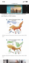
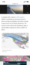
These are never right. What ever the ENSO State is they just copy and paste what the temp and precip maps are suppose to look like for a La Nina or El Nino. The previous couple La Ninas we got a ton of rainfall during the winter.Fro, what up! You know winter is close when there’s a Fro sighting! View attachment 150211View attachment 150210
I just assumed the favored CAD locations had at a least a snow shower or two during that time period. That’s incredible.We haven't seen a flake since January 2022. Before that we had some grass toppers in 2019 & 2020. Oconee, Pickens, and western Greenville did well in 2020 or 2021 with a quick 2-5" that melted by the next day.
WEATHERBOYROY
Member
I am getting more and more inclined to think we are going to be in a neutral to very weak La nina since we are still in a warm neutral (+2) through July.
Cad Wedge NC
Member
No, we are just back to the winters of the 1950's. Nothing new...Nope, we have now entered a new climate those winters are part of an old dead climate!
LickWx
Member
Well per the political thread the 50s were a better time so hey! That’s a good thing , we want the 50sNo, we are just back to the winters of the 1950's. Nothing new...
Drizzle Snizzle
Member
People definitely dressed nicer in the 50s. I see pictures from that era and you see people all dressed up just to go to the grocery store.Well per the political thread the 50s were a better time so hey! That’s a good thing , we want the 50s
I thought we weren't being that thread into other threadsWell per the political thread the 50s were a better time so hey! That’s a good thing , we want the 50s
I think the lean is going to continue to be warmer until something major changes. Some kind of ocean current reversing or shutting down, a supervolcano going off, nuclear war, an asteroid, a pole shift, or some kind of solar or atmospheric phenomenon is going to have to happen to reverse things. I know I could full well be wrong on that, but it doesn't feel like we're just in a 10 or 20 year cycle here.
If I had to put out a winter forecast today I'd go +1-3 Dec +2-4 Jan +6-8 Feb. Min temps for most of the region in the upper single digits (North/ normally colder) to upper 10s (south/urban centers). I think with the cold likely dumping in the rockies and upper Midwest areas of TX, AR, Ms, TN, NAl probably sneak in 1 or 2 significant overunning events, for us the carolinas if we score big its likely a miller a. Most likely period for cold/snow is 12/20-1/10 (possibly later as you go west), another lower confidence period late in November into the first handful of days in December. No reason to really predict snowfall vs average since our seasonal totals are low enough one good storm in an overall warm pattern puts you at 100+%. Caveats right now are the SPV, how much north Atlantic blocking is realized if any, how strong does the nina get, when does it start breaking down and where does the western ridge setup. But it's still late August so this will likely change
Last edited:
I guess while I do think climate change is part of it ( sorry for mentioning that in this thread) I still have memories of just how horrendous the 90s were around here for winter weather. So that’s why I think a big part of just how bad the last few years has been is more cyclical than anything else. Keep in mind that even with how bad things have been since 2019, there have been 4 very good to great winters in the last 15 years… ,‘09-10, ‘10-11, ‘13-14, and ‘14-15I think the lean is going to continue to be warmer until something major changes. Some kind of ocean current reversing or shutting down, a supervolcano going off, nuclear war, an asteroid, a pole shift, or some kind of solar or atmospheric phenomenon is going to have to happen to reverse things. I know I could full well be wrong on that, but it doesn't feel like we're just in a 10 or 20 year cycle here.
JHS
Member
Feb 2020, I think.We haven't seen a flake since January 2022. Before that we had some grass toppers in 2019 & 2020. Oconee, Pickens, and western Greenville did well in 2020 or 2021 with a quick 2-5" that melted by the next day.
JHS
Member
Ice is easier to get than snow in the CAD region, but we have not had any of that either.I just assumed the favored CAD locations had at a least a snow shower or two during that time period. That’s incredible.
JHS
Member
This sounds a lot like how the winter of 1998-99 went around here. The CAD region had 2 ice storms during that 12/20-1/10 period you mentioned. Then winter was basically over outside of the mountains except for a minor ice event in March.If I had to put out a winter forecast today I'd go +1-3 Dec +2-4 Jan +6-8 Feb. Min temps for most of the region in the upper single digits (North/ normally colder) to upper 10s (south/urban centers). I think with the cold likely dumping in the rockies and upper Midwest areas of TX, AR, Ms, TN, NAl probably sneak in 1 or 2 significant overunning events, for us the carolinas if we score big its likely a miller a. Most likely period for cold/snow is 12/20-1/10 (possibly later as you go west), another lower confidence period late in November into the first handful of days in December. No reason to really predict snowfall vs average since our seasonal totals are low enough one good storm in an overall warm pattern puts you at 100+%. Caveats right now are the SPV, how much north Atlantic blocking is realized if any, how strong does the nina get, when does it start breaking down and where does the western ridge setup. But it's still late August so this will likely change
JHS
Member
If not for March 1993 and the winter of 1995-96 many of us would have had little to no snow from Jan 1990 through Dec 1999. We did get a major ice storm in the CAD region in 1999 too, but yes, the 1990's were not good at all.I guess while I do think climate change is part of it ( sorry for mentioning that in this thread) I still have memories of just how horrendous the 90s were around here for winter weather. So that’s why I think a big part of just how bad the last few years has been is more cyclical than anything else. Keep in mind that even with how bad things have been since 2019, there have been 4 very good to great winters in the last 15 years… ,‘09-10, ‘10-11, ‘13-14, and ‘14-15
I've got 13-14 on the analog board so farI guess while I do think climate change is part of it ( sorry for mentioning that in this thread) I still have memories of just how horrendous the 90s were around here for winter weather. So that’s why I think a big part of just how bad the last few years has been is more cyclical than anything else. Keep in mind that even with how bad things have been since 2019, there have been 4 very good to great winters in the last 15 years… ,‘09-10, ‘10-11, ‘13-14, and ‘14-15
- Joined
- Jan 23, 2021
- Messages
- 4,602
- Reaction score
- 15,197
- Location
- Lebanon Township, Durham County NC
I’m listeningI've got 13-14 on the analog board so far
If not for March 1993 and the winter of 1995-96 many of us would have had little to no snow from Jan 1990 through Dec 1999. We did get a major ice storm in the CAD region in 1999 too, but yes, the 1990's were not good at all.
KATL got 5” on 1/18/92. I know someone in the far S burbs who got 8”! OTOH, I received significantly less on the northside with ~2.5”, which melted very quickly, as I recall.


