986mb was what Isaias was at when it made landfall near Holden Beach in 2020 with winds at 90mph. Now I wouldn’t expect winds that high with this because of the larger wind field.thats what im thinking, 10 more mb drop to 986, That should produce a nice little system
-
Hello, please take a minute to check out our awesome content, contributed by the wonderful members of our community. We hope you'll add your own thoughts and opinions by making a free account!
You are using an out of date browser. It may not display this or other websites correctly.
You should upgrade or use an alternative browser.
You should upgrade or use an alternative browser.
Tropical TS OPHELIA ?
- Thread starter Downeastnc
- Start date
lexxnchloe
Member
I agree, but it might translate to stronger gusts in a wider area986mb was what Isaias was at when it made landfall near Holden Beach in 2020 with winds at 90mph. Now I wouldn’t expect winds that high with this because of the larger wind field.
Downeastnc
Member
986mb was what Isaias was at when it made landfall near Holden Beach in 2020 with winds at 90mph. Now I wouldn’t expect winds that high with this because of the larger wind field.
His wind field was hot garbage, I went right through the eastern eyewall, barely got into the center and I think peak gust at PGV was 47 lol....
The storm if it is at 996 is 4 or 5 mb ahead of the models for this time frame and close to what some of the lower Nam 3k runs had it at...those Nam3k runs that are near 996 for the 8am this morning time frame all got to the low 980's at landfall.
Shaggy
Member
Hi res are dead set on a NW motion through llandfallProbably going to see a left turn soon if not already
Yeah I was on Oak Island when Isaias made landfall so I got into the eastern eyewall. Our beach house is two rows from the beach near the Yaupon Pier and the pier had a top sustained wind of 76mph with a top gust of 91. Just a few miles inland near Bolivia that caught the same part of the eyewall only had a top gust to 56 so it fell apart very quickly.His wind field was hot garbage, I went right through the eastern eyewall, barely got into the center and I think peak gust at PGV was 47 lol....
The storm if it is at 996 is 4 or 5 mb ahead of the models for this time frame and close to what some of the lower Nam 3k runs had it at...those Nam3k runs that are near 996 for the 8am this morning time frame all got to the low 980's at landfall.
Belle Lechat
Member
- Joined
- Aug 29, 2021
- Messages
- 1,529
- Reaction score
- 1,215
Is that an eye forming?


NoSnowATL
Member
High cloud tops. Center is south of the clouds. This is a top heavy Low.Is that an eye forming?

lexxnchloe
Member
Still looks a little sheared but i think we will have an eye like feature at landfallIs that an eye forming?

lexxnchloe
Member
Belle Lechat
Member
- Joined
- Aug 29, 2021
- Messages
- 1,529
- Reaction score
- 1,215
Shaggy
Member
Definitely not a tropical look but it is improving
lexxnchloe
Member
Every reason to think this will be a 75-80 mph cane at landfall.
lexxnchloe
Member
Actually i think its improving rapidlyDefinitely not a tropical look but it is improving
Downeastnc
Member
Crazy how "close" the storm looks on radar and sat when its actually not that "close" at least according to the NHC 8am fix....also the center is still mostly naked and south of the big blob of storms.., of course if we had a plane in it then we would have a much better idea of what kind of structure was there.....
Fountainguy97
Member
Not far from seeing a transition to sub-tropical or tropical right now. That hot tower north of center needs to wrap around and then its bombs away. As it approaches land the friction will really help to tighten the core up.
The baroclinic forces are maturing this morning with the associated trough going negative. In this mature stage we watch for the transition to tropical as storms wrap up-shear around the center this evening.
Going to be one of those storms we say "glad it didn't have 12 more hours over water"
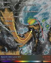
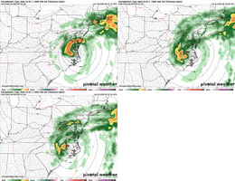
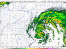
HRRR brings a nasty little core onshore tmrw morning.
The baroclinic forces are maturing this morning with the associated trough going negative. In this mature stage we watch for the transition to tropical as storms wrap up-shear around the center this evening.
Going to be one of those storms we say "glad it didn't have 12 more hours over water"

HRRR brings a nasty little core onshore tmrw morning.

Last edited:
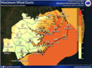
With the shear being what it is, we won't see the typical "core" around the center of this storm so pinpointing the exact landfall isn't important. The strongest winds will occur well north of the center and will probably occur this evening into tonight for Coastal NC. Not expecting anything too crazy for most areas, but we could see some gusts to tropical storm force ahead of the center coming onshore.

- Joined
- Jan 23, 2021
- Messages
- 4,601
- Reaction score
- 15,196
- Location
- Lebanon Township, Durham County NC
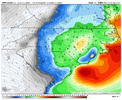
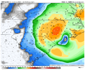
NAM really wants to extend TS conditions to just about @Rain Cold's house
lexxnchloe
Member
can you post a map?NAM really wants to extend TS conditions to just about @Rain Cold's house
- Joined
- Jan 23, 2021
- Messages
- 4,601
- Reaction score
- 15,196
- Location
- Lebanon Township, Durham County NC
- Joined
- Jan 23, 2021
- Messages
- 4,601
- Reaction score
- 15,196
- Location
- Lebanon Township, Durham County NC
It seems pretty consistent that the hairiest time for this event will be from 12AM-6AM from probably US1(ish) to US17.
lexxnchloe
Member
Sounds about rightIt seems pretty consistent that the hairiest time for this event will be from 12AM-6AM from probably US1(ish) to US17.
11am advisory still at 996mb but they did increase intensity at landfall to 65 mph
NoSnowATL
Member
Tries to wrap up right before landfall but runs out of time. I think somehow it will be Hurricane but in real life max winds around 70mph is my guess and stays hybrid.


This thing on
lexxnchloe
Member
Finally
75kts FL, 60-65kts surface. Should be at 70mph probably now. Definitely think hitting a cane is not out of the question now.
75kts FL, 60-65kts surface. Should be at 70mph probably now. Definitely think hitting a cane is not out of the question now.
JHS
Member
It is back up for me.This thing on
lexxnchloe
Member
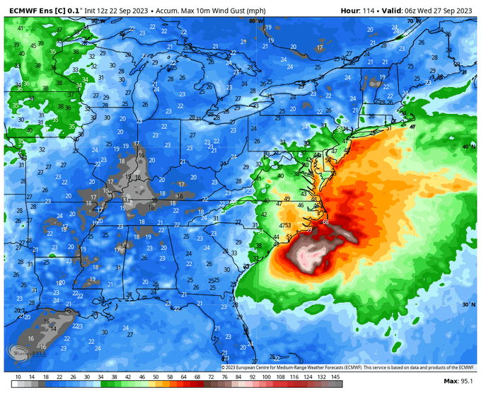
Euro down to 988 at landfall early tomorrow


lexxnchloe
Member
Looks like recon is headed toward that convective burst on the W side. It'll be interesting to see if the llc tries to tuck under it
lexxnchloe
Member
lexxnchloe
Member
Looks like recon has it at 988mb now
If that’s right, I don’t think even the latest NAM had the pressure that low this early. It will be interesting to see if the NHC upgrades to Hurricane Warnings at the next advisoryLooks like recon has it at 988mb now
lexxnchloe
Member
Im going by thisIf that’s right, I don’t think even the latest NAM had the pressure that low this early. It will be interesting to see if the NHC upgrades to Hurricane Warnings at the next advisory

lexxnchloe
Member
Center drop down to 987 mb
lexxnchloe
Member
lexxnchloe
Member
992 at 2pm to 987 now
Going from possible tropical storm to tropical storm to hurricane in less than 24 hours.
lexxnchloe
Member
Convection is wrapping up now. A deepening storm at landfall will bring higher gusts inlandGoing from possible tropical storm to tropical storm to hurricane in less than 24 hours.


