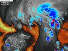
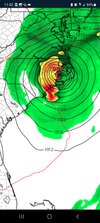
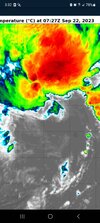
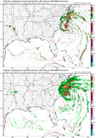
NAM doing it's thing again, Cat 1 looks like
-
Hello, please take a minute to check out our awesome content, contributed by the wonderful members of our community. We hope you'll add your own thoughts and opinions by making a free account!
You are using an out of date browser. It may not display this or other websites correctly.
You should upgrade or use an alternative browser.
You should upgrade or use an alternative browser.
Tropical TS OPHELIA ?
- Thread starter Downeastnc
- Start date
Shaggy
Member
Still seems to be the hi res versus the globals on intensity. They better sort it out less than 36 hours to goNAM doing it's thing again, Cat 1 looks like
Downeastnc
Member
Still seems to be the hi res versus the globals on intensity. They better sort it out less than 36 hours to go
NAM's are also much more west, and moving more WNW or NW at landfall, the globals are further east more Emerald Isle and more N with the track....the 3k is back down to 977 at landfall this run....and most of these are landfalling by 2am tomorrow night so more like 28 hrs to go.
This could easily be one of those cases where the winds do not have time to catch up to the pressure drops before landfall...
lexxnchloe
Member
Nam seems a little too fast
lexxnchloe
Member
according to the latest bulletin its barely moving and its gone from 1012 to 1007mb
SUMMARY OF 1100 PM EDT...0300 UTC...INFORMATION
-----------------------------------------------
LOCATION...29.5N 75.3W
ABOUT 355 MI...570 KM SE OF CHARLESTON SOUTH CAROLINA
ABOUT 395 MI...635 KM S OF CAPE HATTERAS NORTH CAROLINA
MAXIMUM SUSTAINED WINDS...40 MPH...65 KM/H
PRESENT MOVEMENT...NNE OR 15 DEGREES AT 3 MPH...6 KM/H
MINIMUM CENTRAL PRESSURE...1007 MB...29.74 INCHES
Nighttime proxy-visible satellite imagery suggests that the center
of the low pressure system off the southeastern U.S. coast has
become better defined this evening. Nearly all of the associated
deep convection remains oriented in a curved band extending around
the northern and eastern sides of the circulation, although a few
convective elements are beginning to fill in on the back side of
the system as well. Based on 1-minute wind observations from NOAA
buoy 41002 and ship reports, the initial intensity is raised to 35
kt, with all tropical-storm-force winds currently north of the
center on the north side of an attached warm front.
Last edited:
Brent
Member
What a mess. Sorry I'm not seeing anything close to a hurricane here...
Downeastnc
Member
What a mess. Sorry I'm not seeing anything close to a hurricane here...
I mean its not really suppose to look like a hurricane till later Friday into Friday night....
Downeastnc
Member
blueheronNC
Member
Much better left-of-track (inland NC) precip this 00z run of the GFS. I’d think the setup would favor that sort of enhancement
Downeastnc
Member
Belle Lechat
Member
- Joined
- Aug 29, 2021
- Messages
- 1,529
- Reaction score
- 1,215
Downeastnc
Member
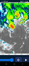
Definitely improving its structure, the LLC is trying to tuck up under this current thunderstorm complex.
Belle Lechat
Member
- Joined
- Aug 29, 2021
- Messages
- 1,529
- Reaction score
- 1,215

1006 mb
Formation Chance through 48 hours...high...70 percent
Belle Lechat
Member
- Joined
- Aug 29, 2021
- Messages
- 1,529
- Reaction score
- 1,215
Firing up in the center.
Downeastnc
Member
Really wish they had started recon flights tonight..
NHC still on east side of guidance IMO
NHC still on east side of guidance IMO
Downeastnc
Member
00z Euro is stronger and west a bit landfalls on Emerald Isle 989mb...then tracks right up Hwy 17.
Downeastnc
Member
Belle Lechat
Member
- Joined
- Aug 29, 2021
- Messages
- 1,529
- Reaction score
- 1,215
Really wish they had started recon flights tonight..
I wonder if they'd put a flight up sooner.
Live Recon in the Atlantic Basin - Tropical Atlantic
View the latest Atlantic hurricane recon in Google Earth and Cesium.
tropicalatlantic.com
Recon Data | CyclonicWx
Real-time recon data from aircraft flying into tropical cyclones.
cyclonicwx.com
WEATHER RECONNAISSANCE FLIGHTS
CARCAH, NATIONAL HURRICANE CENTER, MIAMI, FL.
1150 AM EDT THU 21 SEPTEMBER 2023
SUBJECT: TROPICAL CYCLONE PLAN OF THE DAY (TCPOD)
VALID 22/1100Z TO 23/1100Z SEPTEMBER 2023
TCPOD NUMBER.....23-114
I. ATLANTIC REQUIREMENTS
1. POTENTIAL TROPICAL CYCLONE SIXTEEN
FLIGHT ONE - TEAL 71
A. 22/1730Z
B. AFXXX 0116A INVEST
C. 22/1450Z Departure Time
D. 32.5N 75.5W
E. 22/1700Z TO 22/2330Z
F. SFC TO 10,000 FT
G. INVEST
FLIGHT TWO - TEAL 72
A. 23/0530Z,1130Z
B. AFXXX 0216A CYCLONE
C. 23/0245Z
D. 34.2N 76.1W
E. 23/0500Z TO 23/1130Z
F. SFC TO 10,000 FT
G. FIX
| Summer Plan |
|---|
| A. Fix/Invest Time B. Mission Identifier C. Departure Time D. Forecast Position E. Time on Station F. Altitude(s) on Station G. Remarks (if needed) |
Last edited:
Belle Lechat
Member
- Joined
- Aug 29, 2021
- Messages
- 1,529
- Reaction score
- 1,215

Last edited:
Downeastnc
Member
Downeastnc
Member
Belle Lechat
Member
- Joined
- Aug 29, 2021
- Messages
- 1,529
- Reaction score
- 1,215
5:00 AM EDT Fri Sep 22
Moving: N at 14 mph
Min pressure: 1000 mb
Max sustained: 50 mph

Moving: N at 14 mph
Min pressure: 1000 mb
Max sustained: 50 mph

Their discussion says movement at N at about 7kt but their advisory says 14mph. I don't think it's moving that fast yet, but that llc is jumping around so difficult to ascertain. Recon would be nice, anyway, pressure is falling and trying it's best to transition to tropical5:00 AM EDT Fri Sep 22
Moving: N at 14 mph
Min pressure: 1000 mb
Max sustained: 50 mph

Belle Lechat
Member
- Joined
- Aug 29, 2021
- Messages
- 1,529
- Reaction score
- 1,215
From 3:30Z to 8:40Z


Belle Lechat
Member
- Joined
- Aug 29, 2021
- Messages
- 1,529
- Reaction score
- 1,215
Shaggy
Member
Models are jumping the center like crazy. Hfs started out 50 miles west at 18hrs only to jump from dang near cape fear to cape lookout in the next 6 hours. Not sure models are gonna useful for exact landfall pointTheir discussion says movement at N at about 7kt but their advisory says 14mph. I don't think it's moving that fast yet, but that llc is jumping around so difficult to ascertain. Recon would be nice, anyway, pressure is falling and trying it's best to transition to tropical
Not until and if, it gets a well defined center and can completely go tropicalModels are jumping the center like crazy. Hfs started out 50 miles west at 18hrs only to jump from dang near cape fear to cape lookout in the next 6 hours. Not sure models are gonna useful for exact landfall point
Downeastnc
Member
Not until and if, it gets a well defined center and can completely go tropical
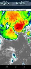
Which is currently happening and hopefully by lunchtime it will be tropical.
Really need a plane in it...not sure why they are not already flying it since it landfalls tonight...
This is always a problem until the center of circulation becomes closed and the models have a fixed point to initialize from. It should close off by lunch time.Models are jumping the center like crazy. Hfs started out 50 miles west at 18hrs only to jump from dang near cape fear to cape lookout in the next 6 hours. Not sure models are gonna useful for exact landfall point
lexxnchloe
Member
Really coming together. JB says it will be a minimal cane
lexxnchloe
Member
Belle Lechat
Member
- Joined
- Aug 29, 2021
- Messages
- 1,529
- Reaction score
- 1,215
8:00 AM EDT Fri Sep 22
Moving: N at 14 mph
Min pressure: 996 mb
Max sustained: 50 mph

Moving: N at 14 mph
Min pressure: 996 mb
Max sustained: 50 mph

Downeastnc
Member
Going to be onshore in 16-20 hrs so whatever its going to do it needs to do it quick, in order for anyone inland to see winds over say 50ish there is going to have to be a fairly solid little core....almost all the models have little to no backside wind....
lexxnchloe
Member
steady pressure drop from 1012 yesterday to 996 now.
Downeastnc
Member
steady pressure drop from 1012 yesterday to 996 now.
Makes those low to mid 980's numbers more believable if it is already 996...if it drops 1 MB every two hrs till landfall that would be another 8-10 MB.
Probably going to see a left turn soon if not already
Downeastnc
Member
Why later today on recon......its frustrating they dont have planes in there now and we got to wait another 6+ hrs for them to go...
lexxnchloe
Member
thats what im thinking, 10 more mb drop to 986, That should produce a nice little systemMakes those low to mid 980's numbers more believable if it is already 996...if it drops 1 MB every two hrs till landfall that would be another 8-10 MB.
lexxnchloe
Member
Why later today on recon......its frustrating they dont have planes in there now and we got to wait another 6+ hrs for them to go...
Will be interesting to see what the pressure is when the plane goes in

