• Hello, please take a minute to check out our awesome content, contributed by the wonderful members of our community. We hope you'll add your own thoughts and opinions by making a free account!

Tropical TS OPHELIA ?

Potential Tropical Cyclone Sixteen Advisory Number 1
NWS National Hurricane Center Miami FL AL162023
1100 AM EDT Thu Sep 21 2023

...LOW PRESSURE AREA EXPECTED TO BRING TROPICAL STORM CONDITIONS
AND THE POTENTIAL FOR LIFE-THREATENING STORM SURGE TO PORTIONS OF
THE SOUTHEAST AND MID-ATLANTIC COASTS...


SUMMARY OF 1100 AM EDT...1500 UTC...INFORMATION
-----------------------------------------------
LOCATION...28.7N 75.9W
ABOUT 370 MI...595 KM SE OF CHARLESTON SOUTH CAROLINA
ABOUT 450 MI...725 KM S OF CAPE HATTERAS NORTH CAROLINA
MAXIMUM SUSTAINED WINDS...35 MPH...55 KM/H
PRESENT MOVEMENT...N OR 10 DEGREES AT 9 MPH...15 KM/H
MINIMUM CENTRAL PRESSURE...1012 MB...29.89 INCHES


WATCHES AND WARNINGS
--------------------
CHANGES WITH THIS ADVISORY:

A Tropical Storm Warning has been issued from Cape Fear, North
Carolina, northward to Fenwick Island, Delaware, including
Albemarle and Pamlico Sounds, and the Chesapeake Bay south of
Smith Point.

A Storm Surge Watch has been issued from Surf City, North Carolina
to Chincoteague, Virginia, and the for the Chesapeake Bay south of
Smith Point, including Albemarle and Pamlico Sounds.

SUMMARY OF WATCHES AND WARNINGS IN EFFECT:

A Tropical Storm Warning is in effect for...
* Cape Fear NC to Fenwick Island DE
* Chesapeake Bay south of Smith Point
* Albemarle and Pamlico Sounds

A Storm Surge Watch is in effect for...
* Surf City NC to Chincoteague VA
* Chesapeake Bay south of Smith Point
* Albemarle and Pamlico Sounds

A Tropical Storm Warning means that tropical storm conditions are
expected somewhere within the warning area within 36 hours.

A Storm Surge Watch means there is a possibility of life-
threatening inundation, from rising water moving inland from the
coastline, in the indicated locations during the next 48 hours.
For a depiction of areas at risk, please see the National Weather
Service Storm Surge Watch/Warning Graphic, available at
hurricanes.gov.

For storm information specific to your area, including possible
inland watches and warnings, please monitor products issued by your
local National Weather Service forecast office.
 
If the 3k Nam is right then you will be right side of the center so figure you good for gust to near cane strength, the hi res models dont really have a lot of tornado threat in them right now...
Thats good news so far. Thank you
 
No wonder they got started at 11, this suggest a large and organized low level wind field with a closed surface low

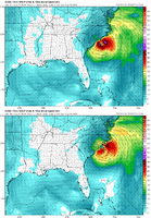
hy_2b_20230921_10_101_flag.thumb.png.c121e4026a21227edade4e9ad6d60287.png
 
GFS now the east outlier lol....it has a big jump so it moves the center where as the other models seem to keep the one forming this morning

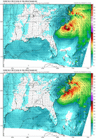
gfs_mslp_pcpn_frzn_seus_8.png
 
Last edited:
lets not forget this, the last 12-18 hrs before landfall going to be over some very warm water, it really comes down to shear which looks like its going to be around to some degree the entire time, though it does weaken quite a bit Friday afternoon into night....so if it can hold on to a well defined LLC, and then the lower shear period matches up with the best water temps its easy to see why the models are gungho with strengthening it into the 980's...

usatlant.cf.gif
 
I guess we Georga weenies will just have to live with the cool, breezy conditions on the backside while you Carolina weenies crank up the generators.

Looks to be a decent blow for coastal areas and just inland with fully leafed-out trees.
 
Yeah it looked the opposite the other day (I got that all wrong lol)
It's messy. As long as have this convection shaped like a 7 to the north, northeast, east of the center the tendency is going to be for the llc to chase the convection or centers to spin up and down with convective bursts. Then you add in new convective bursts closer to the LLC as it tries to get some tropical characteristics and you get a bouncy track like the 3k. If you build the convection near the center and start to stack this it'll likely lean left. If it stays void of convection and sheared it'll lean east. I'd personally go with the nhc forecast but any random convective bursts overnight or tomorrow that can wrap the actual center can quickly change this to a up 40 to 95 track vs the sounds
 
The short timing on this kinda reminds me a bit of Isaias in 2020. I was at Oak Island during that one and 18 hours before it hit, most people on island had no idea that there could be a hurricane coming as most forecast kept it a tropical storm. We were to the east of the where landfall occurred between Ocean Isle and Holden Beach and the storm hit as it was still strengthening and at a perpendicular angle causing a 7ft storm surge.
 
Back
Top