Downeastnc
Member
Oooof

Sent from my iPhone using Tapatalk

Yeah but that is still all relative.....its above normal off NE but still colder than needed to support a tropical system...
Oooof
Sent from my iPhone using Tapatalk
Another test to see which model handles tropics better this year.. on a global model scale .. off to the racesEuro and cmc are weaker and east
TROPICAL STORM HENRI
FLIGHT ONE - TEAL 71 FLIGHT TWO - NOAA 49
A. 19/1800Z A. 20/0000Z
B. AFXXX 0108A HENRI B. NOAA9 0208A HENRI
C. 19/1500Z C. 19/1730Z
D. 30.0N 70.6W D. NA
E. 19/1630Z TO 19/2000Z E. NA
F. SFC TO 10,000 FT F. 41,000 TO 45,000 FT
FLIGHT THREE - NOAA 49 FLIGHT FOUR - NOAA 43
A. 20/1200Z A. 20/1200Z
B. NOAA9 0308A HENRI B. NOAA3 0408A HENRI
C. 20/0530Z C. 20/0800Z
D. NA D. 30.7N 72.4W
E. NA E. 20/1000Z TO 20/1400Z
F. 41,000 TO 45,000 FT F. SFC TO 15,000 FT
FLIGHT FIVE - TEAL 72
A. 20/1200Z
B. AFXXX 0508A HENRI
C. 20/0900Z
D. 30.7N 72.4W
E. 20/1030Z TO 20/1400Z
F. SFC TO 15,000 FT
B. BEGIN 6-HRLY FIXES ON HENRI AT 20/2330Z.
C. TWO MORE NOAA 49 G-IV SYNOPTIC SURVEILLANCE MISSIONS AROUND
HENRI FOR THE 21/0000Z AND 21/1200Z SYNOPTIC TIMES,
DEPARTING KLAL AT 20/1730Z AND 21/0503Z.
D. NOAA P-3 TAIL DOPPLER RADAR MISSIONS INTO HENRI DEPARTING
KLAL AT 20/2000Z AND 21/0800Z.
Yeah but that is still all relative.....its above normal off NE but still colder than needed to support a tropical system...


See you say launch balloons but when they do you’ll be all like “oMg GUyzzzZ I SaW a UFo”Like that they are going to be doing special balloon launches and starting the GIV missions. This will be the most interesting time for any major shifts in the models.
See you say launch balloons but when they do you’ll be all like “oMg GUyzzzZ I SaW a UFo”
Henri is most definitely a hurricane? I don’t know why they are being so conservative at the NHC!!Massive west shift wowView attachment 88691

Interestingly the 18z GFS shifted east but it's the 18z and it's interesting to see if the 0z continues the trend east.
View attachment 88707
When does the upper data start making its entry into the models?
Since you mentioned it... The NAM is so fun.Forgive me for i know I have used a forbidden model for the tropics but the 3k nam so far is a pretty significant SW shift through 28 hours.

NHC track actually didn't shift more west and may have actually gone a hair east at the end but again until we get recon data I wouldn't etch anything in stone yetView attachment 88714


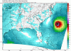
Shear really taking a toll on Henri overnight which should ensure well off the OBX. Also no model or ensemble member even brushes OBX now but the threat for NY to NE is very real, again as noted by eps strength dependent
View attachment 88718
Yep no doubt and no way all models are off that much, it is interesting though that it is a little more south than they estimated and continues to move s of due west, I guess any deviation closer to the coast initially becomes more problematic in NE laterYeah unless the models miss the trough digging as deep as they have it then this stays well offshore OBX


Yep no doubt and no way all models are off that much, it is interesting though that it is a little more south than they estimated and continues to move s of due west, I guess any deviation closer to the coast initially becomes more problematic in NE later
The GMI and ASCAT data revealed that the center is slightly farther
south than previously estimated, and Henri has been moving south of
due west

.png")


.png")
