Belle Lechat
Member
- Joined
- Aug 29, 2021
- Messages
- 692
- Reaction score
- 509
Yea I adjusted to the latest trends today. Most of their forecast is banking on the consistent runs of yesterday and 0z. I know I caved some but you have to adjust to the newer runs imo.Really?
WHERE...PORTIONS OF SOUTHEAST GEORGIA, INCLUDING THE FOLLOWING
AREAS, BULLOCH, CANDLER, COASTAL BRYAN, COASTAL CHATHAM, COASTAL
LIBERTY, COASTAL MCINTOSH, EFFINGHAM, EVANS, INLAND BRYAN, INLAND
CHATHAM, INLAND LIBERTY, INLAND MCINTOSH, JENKINS, LONG, SCREVEN
AND TATTNALL AND SOUTHEAST SOUTH CAROLINA, INCLUDING THE FOLLOWING
AREAS, ALLENDALE, BEAUFORT, CHARLESTON, COASTAL COLLETON, COASTAL
JASPER, DORCHESTER, HAMPTON, INLAND BERKELEY, INLAND COLLETON,
INLAND JASPER AND TIDAL BERKELEY.
* WHEN...FROM LATE TONIGHT THROUGH FRIDAY MORNING.
* IMPACTS...POTENTIALLY HISTORIC RAINFALL AMOUNTS WILL LIKELY RESULT
IN SEVERE WIDESPREAD FLASH FLOODING.
* ADDITIONAL DETAILS...
- TROPICAL STORM DEBBY IS EXPECTED TO STALL NEAR THE AREA MID
TO LATE WEEK. WIDESPREAD RAINFALL AMOUNTS OF 10 TO 20 INCHES,
WITH LOCAL AMOUNTS TOWARD 30 INCHES ARE EXPECTED.
- HTTP://www.weather.gov/SAFETY/FLOOD

Really?
WHERE...PORTIONS OF SOUTHEAST GEORGIA, INCLUDING THE FOLLOWING
AREAS, BULLOCH, CANDLER, COASTAL BRYAN, COASTAL CHATHAM, COASTAL
LIBERTY, COASTAL MCINTOSH, EFFINGHAM, EVANS, INLAND BRYAN, INLAND
CHATHAM, INLAND LIBERTY, INLAND MCINTOSH, JENKINS, LONG, SCREVEN
AND TATTNALL AND SOUTHEAST SOUTH CAROLINA, INCLUDING THE FOLLOWING
AREAS, ALLENDALE, BEAUFORT, CHARLESTON, COASTAL COLLETON, COASTAL
JASPER, DORCHESTER, HAMPTON, INLAND BERKELEY, INLAND COLLETON,
INLAND JASPER AND TIDAL BERKELEY.
* WHEN...FROM LATE TONIGHT THROUGH FRIDAY MORNING.
* IMPACTS...POTENTIALLY HISTORIC RAINFALL AMOUNTS WILL LIKELY RESULT
IN SEVERE WIDESPREAD FLASH FLOODING.
* ADDITIONAL DETAILS...
- TROPICAL STORM DEBBY IS EXPECTED TO STALL NEAR THE AREA MID
TO LATE WEEK. WIDESPREAD RAINFALL AMOUNTS OF 10 TO 20 INCHES,
WITH LOCAL AMOUNTS TOWARD 30 INCHES ARE EXPECTED.
- HTTP://www.weather.gov/SAFETY/FLOOD
Can’t say I agree with this. Easy to pick certain models but doesn’t the NHC have a little more western track? Hard to disagree with them. Not saying your opinion won’t be right just doesn’t seem so atm!The GFS is way off in left field literally, the ICON/Euro/Ukie all have it over or near eastern NC on Thursday, the GFS has it over the AL/GA border on its way back to the GOM....
ICON is by far the worse for up here in NC, that kind of rainfall will push the rivers especially the Tar well into flood stage.
This would be bad....the Euro is only half of this with about the same track as ICON....not sure how to take what the GFS is doing but for now it seems unlikely that the storm goes from off the GA coast to reentering the GOM at the AL/MS border....
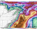
View attachment 149331
Gefs doesn't really support the gfs op run eiither thoughCan’t say I agree with this. Easy to pick certain models but doesn’t the NHC have a little more western track? Hard to disagree with them. Not saying your opinion won’t be right just doesn’t seem so atm!
Can’t say I agree with this. Easy to pick certain models but doesn’t the NHC have a little more western track? Hard to disagree with them. Not saying your opinion won’t be right just doesn’t seem so atm!

NHC is on the western side of the envelope and is implicitly implying a slowdown or stallout which channels moisture on the eastern side of Debby into Coastal GA/SC as it crawls. I was looking at WPC individual day maps and each day generally has 5-8" rainfalls over a few days in the same general areas. Ultimately, they're relying on a blend of model averaging and implicitly stalling Debby out for a time.This really is not supported at the moment by any model other than the crazy GFS runs....and it takes it 10 days to get to those type of totals. Certainly would expect 8-12" though in most of that area by Wed or Thursday.
I understand that but you are posting the GEFS. , the gfs has been rather crazy. Maybe take a blend of all of them!They dont make big changes update to update, they will continue to tick it east, unless the Euro/Icon and Ukie cave to the GFS which is very very unlikely at this point...but they cant just totally discount the GFS and to a lesser extent to the CMC...even the GFS ensembles that show a stronger system continue to trend east and I think some point today the GFS caves as usual.
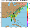
View attachment 149332
the
Maybe I missed a current run but didn’t it have a hard west turn back towards Ga/ Al ?Gefs doesn't really support the gfs op run eiither though
Nothing to the extent of the op run. The ones that do hook it back wewt mostly stay over GA/SC while the a handful of members resemble the Euro and icon and more it offshore and up the coastMaybe I missed a current run but didn’t it have a hard west turn back towards Ga/ Al ?

Probably going to be stronger than shown on models! Good call there!Yeah if anything the GFS is spreading out, lots of variation in how it handles the ATL ridge strength and placement, which will obviously impact the path quite a bit.
The Euro is much more clustered around a SC/NC second landfall and shows only a few stall and west turns with the strongest storms clustered over eastern NC like the ICON so this makes sense weaker is west, so the weaker it is into Florida then the higher the chances it stalls and turns west maybe.
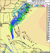
View attachment 149341
