Well, we know how these have blown up quickly the past few years.I was looking at the model runs and the ICON has Debby as a 964mb hurricane off of Myrtle Beach before making landfall again. That would be a Cat 3 hurricane if that were to verify. Let's hope its out in left field with its estimate of storm strength.
-
Hello, please take a minute to check out our awesome content, contributed by the wonderful members of our community. We hope you'll add your own thoughts and opinions by making a free account!
You are using an out of date browser. It may not display this or other websites correctly.
You should upgrade or use an alternative browser.
You should upgrade or use an alternative browser.
Hurricane Debby
- Thread starter Brent
- Start date
I mentioned earlier that while 964mb seems extreme, I think 980-985mb is very possible depending on how much time it has over water and how well it’s still structured when emerging into water. That would likely be a high end cat 1, and with it hitting while still strengthening and at a right angle to the coast, it would still bring in a significant storm surge to the north of the center, depending on low or high tide. I was at Oak Island during Isaias in 2020 and saw that first hand.I was looking at the model runs and the ICON has Debby as a 964mb hurricane off of Myrtle Beach before making landfall again. That would be a Cat 3 hurricane if that were to verify. Let's hope it’s out in left field with its estimate of storm strength.
Daffin Park is overflowing into roads and neighborhoods now.
Sctvman
Member
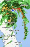
The KCLX (Charleston) radar (which is out in the middle of nowhere) has gone down.
Stormsfury
Member
1 million dollars worth of cocaine washed ashore due to Hurricane Debby.

 www.facebook.com
Live Storm Chasers
$1 million worth of of Cocaine washed ashore in the Florida Keys from Hurricane Debby! 25 packages weighing 70 pounds. The person who found it turned it over to law enforcement. 📸 US Border Patrol
www.facebook.com
Wobbled east again. The eastern part of the circulation is now entering the Atlantic. At this rate it could just form a new center and throw all the models off with Atlantic development.

It does not take much imagination to figure out how bad that ICON scenario would be with widespread flooding already occurring.
Anyway, not seeing as much rotation with storms out in the Atlantic as I expected. Hopefully that trend continues.
Anyway, not seeing as much rotation with storms out in the Atlantic as I expected. Hopefully that trend continues.
Oof. That would close I-95 again for a week or two at Lumberton again.I know I'm not as beloved a contributor as @KyloG, but hopefully I can sub this time.
View attachment 149519
- Joined
- Jan 23, 2021
- Messages
- 4,604
- Reaction score
- 15,202
- Location
- Lebanon Township, Durham County NC
Look, Fayetteville can use a good bath but that’s a bit extremeI know I'm not as beloved a contributor as @KyloG, but hopefully I can sub this time
View attachment 149519
Been a steady rain with times of torrential downpours in Charleston today. So far not much flooding at least in Mount Pleasant. Went to the gym, everybody on the roads doing the same ole thing.
3km NAM certainly advertising the potential for some rotating cells. No doubt will be a threat.It does not take much imagination to figure out how bad that ICON scenario would be with widespread flooding already occurring.
Anyway, not seeing as much rotation with storms out in the Atlantic as I expected. Hopefully that trend continues.

Haha we only like him for the mapsI know I'm not as beloved a contributor as @KyloG, but hopefully I can sub this time
View attachment 149519
Thanks man!
lexxnchloe
Member
Euro a little SW and weaker. Little time over water and just over cool shelf water.

More rain for Central SC. Also wind increase for us also on model.Euro a little SW and weaker. Little time over water and just over cool shelf water.
View attachment 149522
Off topic...somewhat....are we rolling the OBS into this thread?
lexxnchloe
Member
Yes, SC will get the brunt of it no doubtMore rain for Central SC. Also wind increase for us also on model.
jaw719
Member
Any chance this thing misses Pinehurst? Gotta boys trip coming up this weekend, haha.
18z EPS spread tightened up a lot (finally) with the track.

lexxnchloe
Member
Looks reasonable. Gaps are showing up between bands on radar now and its degrading on Satellite. S central SC thru central NC will get alot of rain with gusty winds and storms in SC18z EPS spread tightened up a lot (finally) with the track.
View attachment 149524

Rotating cells increase when tropical systems slow and stall. Should increase overnight given her speed now.It does not take much imagination to figure out how bad that ICON scenario would be with widespread flooding already occurring.
Anyway, not seeing as much rotation with storms out in the Atlantic as I expected. Hopefully that trend continues.
Mentally comparing things with Ian I suppose. That was wild to see all those rotating cells coming ashore.Rotating cells increase when tropical systems slow and stall. Should increase overnight given her speed now.
JHS
Member
Oh boy the Euro brings wind and a lot of rain all the way over to highway 221 in NC and SC. I know the wind map is wrong, but if that track is right, we get gusts up to around 40 mph here and around 5 inches of rain.
Where are yall seeing 18z Euro maps? They're not out on TT yet and I don't see them on weathermodels
JHS
Member
Pivotal Weather.Where are yall seeing 18z Euro maps? They're not out on TT yet and I don't see them on weathermodels
Thanks. Looks like 6z and 18z are pay.Pivotal Weather.
ENCSnowdawg
Member
Pivotal only showing 12z, I don't know why they listed it as 18zPivotal Weather.
ENCSnowdawg
Member
I thought so too.Thanks. Looks like 6z and 18z are pay.
JHS
Member
18z is pay only I'm afraid.Pivotal only showing 12z, I don't know why they listed it as 18z
iGRXY
Member

Looks like a cluster near Charleston and now south of Myrtle Beach near Georgetown. NHC track is east (specifically inland) of 85% of these runs so we will see if they start shifting the track further west.
lexxnchloe
Member
Thanks. Looks like 6z and 18z are pay.


Also has the reg Euro and all the models. 110% free 0Z 6Z 12Z 18Z
JHS
Member
They might now, after that 18z Euro run. One more shift west like that would really change things for both of us if it was right of course.View attachment 149528
Looks like a cluster near Charleston and now south of Myrtle Beach near Georgetown. NHC track is east (specifically inland) of 85% of these runs so we will see if they start shifting the track further west.
What do people do down here for frog,snake,gator seeking higher grounds? This **** is so loud. Having to wear ear plugs INSIDE. Trying to relocate them but hatching everywhere
lexxnchloe
Member
Never gets over the gulf streamView attachment 149528
Looks like a cluster near Charleston and now south of Myrtle Beach near Georgetown. NHC track is east (specifically inland) of 85% of these runs so we will see if they start shifting the track further west.
Blue_Ridge_Escarpment
Member
Confirmed tornado touchdown on Edisto. Just spent last week there 
Sctvman
Member
JHS
Member
The 18z Euro AI is basically the same as it was it 12z.