Shaggy
Member
Wonder if the cmc is pulling off a rare win keeling this one onshore from here on out!
Have a hard time believing the Canadian with its returns on accuracy. Euro or ICON, I would believe.Wonder if the cmc is pulling off a rare win keeling this one onshore from here on out!
Yeah especially since then ukie is similar to those two modelsHave a hard time believing the Canadian with its returns on accuracy. Euro or ICON, I would believe.
I could see the euro trending either way, doesn’t matter to me as I’m not going to see much outside of a few inches of rain. I’m just wondering how strong she’ll be on the 2nd land fall?Yeah especially since then ukie is similar to those two models
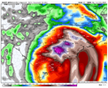
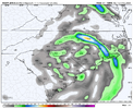
RGEM has a 1"/hr band that just rakes I-95 corridor and is still going strong at the end of the run as you noted. Some massive QPF totals already. It has been quite consistent with the totals and they are definitely possible IMO.Rgem seems worrisome. Pretty massive totals at 84 and still going strong.
View attachment 149465
View attachment 149466


That map is troubling for the Eastern portions of the Carolinas and Georgia. It dumps over twenty inches of rain in some locations and Debby is still meandering through South Carolina on Thursday. Add that to the ten plus inches that some areas have received recently and you are looking at some major if not catastrophic flooding along the rivers in those places.Rgem seems worrisome. Pretty massive totals at 84 and still going strong.
View attachment 149465
View attachment 149466
I would after the past few years!The waffling of models here is funny, if the GFS said widespread 30-inch snow totals, (winter), you wouldn't toss that one, would you?
Fran? Nothing like that since. Flooding may have been worse in the coastal counties in 99 but Sep 6 1996 will be etched into my mind as the worst storm I have lived through.Certainly does seem that we could see widespread river flooding that will rival Matthew and Florence or even the other F name storm I will not utter.
Yeah. I'm not saying the rgem is right, but it feels like to me that some of the other models are under-doing the amounts over inland sections. The rgem feels extreme, but the system may end up being very slow moving, like the models have been showing. And if that continues to be the case, I would expect higher amounts to be reflected across the board as we move in.That map is troubling for the Eastern portions of the Carolinas and Georgia. It dumps over twenty inches of rain in some locations and Debby is still meandering through South Carolina on Thursday. Add that to the ten plus inches that some areas have received recently and you are looking at some major if not catastrophic flooding along the rivers in those places.
He’s referring to Floyd in 1999Fran? Nothing like that since. Flooding may have been worse in the coastal counties in 99 but Sep 6 1996 will be etched into my mind as the worst storm I have lived through.
Fran? Nothing like that since. Flooding may have been worse in the coastal counties in 99 but Sep 6 1996 will be etched into my mind as the worst storm I have lived through.
I would say that it’s an outlier same as the gfs. Don’t see agreement from it from other models or the NHC track at the moment. It could happen but I doubt it at the moment!Yeah. I'm not saying the rgem is right, but it feels like to me that some of the other models are under-doing the amounts over inland sections. The rgem feels extreme, but the system may end up being very slow moving, like the models have been showing. And if that continues to be the case, I would expect higher amounts to be reflected across the board as we move in.
Understood , Fran is my memory but understand Floyd for your location! I had just flown out to be stationed in Okinawa for a year but looked at the news for the area of the Neuse/Trent. Catastrophic flooding from Goldsboro to the Coast.Fran was bad gusted to 110 here at PGV and was by far the windiest cane here in my lifetime...I meant Floyd though who is the benchmark for flooding on the Tar and Neuse..
Yeah. I'm not saying the rgem is right, but it feels like to me that some of the other models are under-doing the amounts over inland sections. The rgem feels extreme, but the system may end up being very slow moving, like the models have been showing. And if that continues to be the case, I would expect higher amounts to be reflected across the board as we move in.
You mean town? No cities in Harnett County! LolWinds are going to be atm for my city at high teens low 20s.
Floyd brings back memories. I was dating my wife then and she was living near Goldsboro. Her father and one of her uncles had their homes condemned due to the flooding around the Neuse River. The only time I have ever hydroplaned while I was driving occurred right after Floyd was pulling away from North Carolina on Highway 70 near Princeton. I ended up making it back to my house with about $ 1,000.00 worth of damage to the car I was driving. Ironically, my wife's name is Debbie. The dog in my avatar is named Gordon and his name is on this year's list of storm names too.Understood , Fran is my memory but understand Floyd for your location! I had just flown out to be stationed in Okinawa for a year but looked at the news for the area of the Neuse/Trent. Catastrophic flooding from Goldsboro to the Coast.
Yeah…Brad typically does go with the WPC guidance, and they usually do really wellBrad P’s rain call for now!
Absolutely!Yeah…Brad typically does go with the WPC guidance, and they usually do really well
Expected though. Light rain in the Creek also. The start of a very long week ahead.Already raining in Charleston. That's not good.
Erwin is right in the storms path. Great...
I advise you to always watch your local news and weather reports for update on counties.@Rain Cold @Webberweather53 @SD Does anybody know what the impacts is regarding wind in Harnett County? I have PTSD over Florence, and this is shaping up to be a Florence.
