• Hello, please take a minute to check out our awesome content, contributed by the wonderful members of our community. We hope you'll add your own thoughts and opinions by making a free account!

Hurricane Debby

September 2, 2022
Savannah saw the most August rainfall since 1995, according to National Weather Service data. The 8.31 inches of precipitation far surpassed the norm of 5.46 inches. Additionally, some parts of Savannah saw significantly more rain than others — the 8.31 inches was measured at the Savannah-Hilton Head International Airport. Hunter Army Airfield's gauge measured 14 inches of rain.

The forecast for Labor Day weekend is for several inches more rain.

The August rainfall was the most since September 2021, when Savannah recorded 9 inches of rain, including 6.66 inches in one day. The last wetter August came in 1995, when the local area was swamped by 17 inches in rain, including 12 inches in a four-day period and 5.75 inches in a single day.
 
5:00 AM EDT Sun Aug 4
Location: 25.5°N 84.0°W
Moving: NNW at 13 mph
Min pressure: 1001 mb
Max sustained: 50 mph


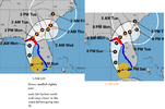
034742_5day_cone_no_line_and_wind.png
 
Some of the models are starting to cave to a more climo track which results in much less rain. 6” will still flood Savannah to Charlestown but that’s a lot better than 24”! I’m liking the trends this morning and I believe the NHC will nudge those totals downward closer to 6-10”.
 
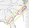
Final Call. 6-10” for most in the yellow (some areas 4-8”) and 12” to 24” in the pink with the greatest totals south-west of Wilmington NC into South Carolina. IMG_3252.jpeg
 
Some of the models are starting to cave to a more climo track which results in much less rain. 6” will still flood Savannah to Charlestown but that’s a lot better than 24”! I’m liking the trends this morning and I believe the NHC will nudge those totals downward closer to 6-10”.
Really?

WHERE...PORTIONS OF SOUTHEAST GEORGIA, INCLUDING THE FOLLOWING
AREAS, BULLOCH, CANDLER, COASTAL BRYAN, COASTAL CHATHAM, COASTAL
LIBERTY, COASTAL MCINTOSH, EFFINGHAM, EVANS, INLAND BRYAN, INLAND
CHATHAM, INLAND LIBERTY, INLAND MCINTOSH, JENKINS, LONG, SCREVEN
AND TATTNALL AND SOUTHEAST SOUTH CAROLINA, INCLUDING THE FOLLOWING
AREAS, ALLENDALE, BEAUFORT, CHARLESTON, COASTAL COLLETON, COASTAL
JASPER, DORCHESTER, HAMPTON, INLAND BERKELEY, INLAND COLLETON,
INLAND JASPER AND TIDAL BERKELEY.

* WHEN...FROM LATE TONIGHT THROUGH FRIDAY MORNING.

* IMPACTS...POTENTIALLY HISTORIC RAINFALL AMOUNTS WILL LIKELY RESULT
IN SEVERE WIDESPREAD FLASH FLOODING.

* ADDITIONAL DETAILS...
- TROPICAL STORM DEBBY IS EXPECTED TO STALL NEAR THE AREA MID
TO LATE WEEK. WIDESPREAD RAINFALL AMOUNTS OF 10 TO 20 INCHES,
WITH LOCAL AMOUNTS TOWARD 30 INCHES ARE EXPECTED.
- HTTP://www.weather.gov/SAFETY/FLOOD
 
...DEBBY EXPECTED TO STRENGTHEN RAPIDLY BEFORE LANDFALL IN THE FLORIDA BIG BEND REGION...

8:00 AM EDT Sun Aug 4
Location: 26.3°N 84.2°W
Moving: NNW at 13 mph
Min pressure: 1001 mb
Max sustained: 60 mph


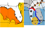
095141_5day_cone_no_line_and_wind.png
 
Back
Top