• Hello, please take a minute to check out our awesome content, contributed by the wonderful members of our community. We hope you'll add your own thoughts and opinions by making a free account!

Tropical Tropical Storm Barry

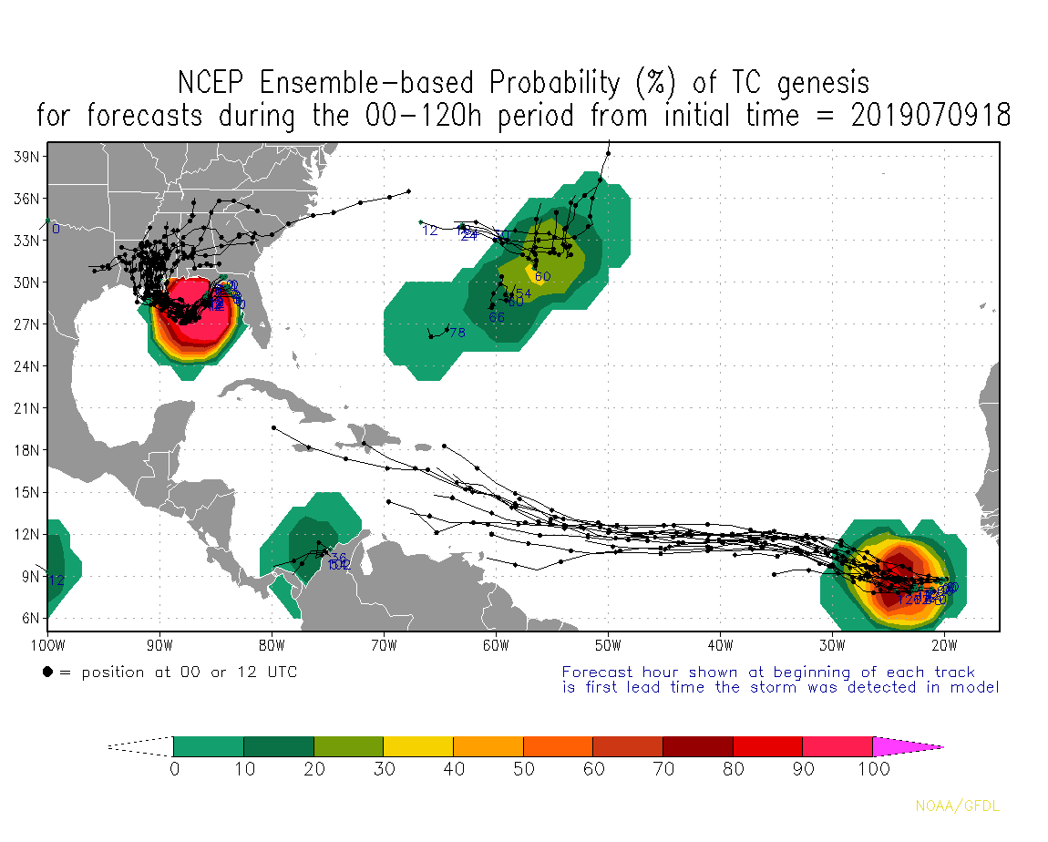
With both high pressure, one to the west and other east, I can see a north trend and east like what these models are showing
6e9682a930dd44c157fad53ac475612f811961f1a8661f2da362f76e85afece5.png
 
With these water temps and low shear, and 4 to 5 days creeping in gulf can really cause big trouble.

Decent 26C isotherm to work with but proximity to land and shear will be the key factors here as usual. The shallow continental shelf waters just off LA and TX could be an issue if it gets going and is slow moving.

1562683651864.png
 
Decent 26C isotherm to work with but proximity to land and shear will be the key factors here as usual. The shallow continental shelf waters just off LA and TX could be an issue if it gets going and is slow moving.

View attachment 20925

I’ve noticed very slow movers usually don’t landfall as strong as faster movers. The warm water only has so much energy and it starts to get tapped out. The energy isn’t limitless. Related to this are the rain cooled temperatures and lack of sunshine on the water, both of which cause the SSTs to cool.

*Edited to add last sentence
 
Last edited:
Here's my two cents on this. The GFS (Fv3 version) last year showed a good amount of skill in depicting the intensity of systems, especially in environments where shear was a concern. The fact that this whole time it has had an extremely sloppy, messy system that stays close to land and struggles to develop is very telling IMO. I'm leaning towards the idea of just a broad low pressure that never tightens up and brings a lot of showers and storms to the Gulf Coast vs a further south and tightly wrapped storm that bombs out like the Euro/ICON are showing.

So far observations are supporting the ECMWF solution and not the fv3.

Screen Shot 2019-07-09 at 11.02.19 AM.png
 
3k nam bombs barry over the gulf of mexico. View attachment 20926

It struggles with convection tho, it often shows crazy solutions, it’ll probably show a crazy one soon due to it always struggling with convection near the center warming the eye and dropping the pressure, I think barry will struggle due to shallow water, which will give it less energy and the east side will likely look much better than the west side of the storm, still could become a strong ts tho
 
As did I late last night, but newer observations are leaning in the ECMWF's direction

We'll see what happens, I'm not convinced of the Euro/ICON hurricane scenarios. It's certainly plausible if this can get far enough south and under some good UL conditions but I like the idea of a weaker, sloppy system like the GFS is showing. This will be a good test for the upgraded Euro.
 
We'll see what happens, I'm not convinced of the Euro/ICON hurricane scenarios. It's certainly plausible if this can get far enough south and under some good UL conditions but I like the idea of a weaker, sloppy system like the GFS is showing. This will be a good test for the upgraded Euro.

It's a tug-of-war between low-level frictional convergence & strong horizonal shear near the FL panhandle plus the already somewhat prominent surface trough extending all the way into GA vs diabatically-forced surface pressure falls underneath the sheared convection out over the Gulf of Mexico. Both are competing for surface vorticity generation and upward motion and I'm not sure who will win although I'd lean ever so slightly to the Euro camp given its performance thus far (GFS didn't even have the low into the Gulf into a few days ago & kept taking the system out to the NE, the ECMWF in earlier suites was effectively showing what consensus is now). The GFS didn't have the convection that's now firing over the Gulf while the Euro was underselling the surface trough to the NE. Tough call really, I personally would like the northern solution to pan out to give more of the board some much needed rain and diminish the severity of direct impacts. Comes down to mesoscale processes that are exceptionally difficult to forecast and ones we have limited understanding of.
 
Back
Top