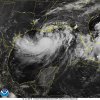
its tomorrow or never, honestly I think tomorrow is when the models had it taking off anyway(and also had it going to Texas to give it more time), the Louisiana option was always gonna be weaker I feel just because of less time
speaking of Texas, the UKMET finally went to Louisiana this run after many runs going towards SE TX
TROPICAL STORM BARRY ANALYSED POSITION : 27.9N 88.9W
ATCF IDENTIFIER : AL022019
LEAD CENTRAL MAXIMUM WIND
VERIFYING TIME TIME POSITION PRESSURE (MB) SPEED (KNOTS)
-------------- ---- -------- ------------- -------------
0000UTC 12.07.2019 0 27.9N 88.9W 1002 35
1200UTC 12.07.2019 12 27.8N 90.5W 999 41
0000UTC 13.07.2019 24 28.6N 91.4W 994 42
1200UTC 13.07.2019 36 29.1N 92.5W 987 67
0000UTC 14.07.2019 48 30.1N 93.7W 987 52
1200UTC 14.07.2019 60 31.4N 94.5W 994 40
0000UTC 15.07.2019 72 33.0N 95.2W 993 27
1200UTC 15.07.2019 84 33.9N 96.0W 1000 24
0000UTC 16.07.2019 96 CEASED TRACKING
The UKMET had been doing a Jose to Houston thanks to left bias. In 2017, the UKMET was all alone in going at FL with Jose 5 times in a row and all at cat 4-5 to boot before then suddenly shifting way east.


