-
Hello, please take a minute to check out our awesome content, contributed by the wonderful members of our community. We hope you'll add your own thoughts and opinions by making a free account!
You are using an out of date browser. It may not display this or other websites correctly.
You should upgrade or use an alternative browser.
You should upgrade or use an alternative browser.
Misc Sizzling Shenanigans: warm season whamby
- Thread starter SD
- Start date
- Status
- Not open for further replies.
Reformation Cadence was my favorite when I drank beer.Sweetwater has an array of beers, I'm not aware of a wheat beer like Blue Moon though. I would argue that Creature Comforts Tropicalia is probably the most popular craft beer in Georgia, at the moment.
Drizzle Snizzle
Member
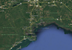
Near the St Marks Lighthouse at Apalachee BayAigh't everyone, we are approximately in the 24-36 hour range of potential landfall for Helene. Put your best guess for potential direct landfall in this thread. I'll start, I'm going with Alligator Point, just southeast of Sopchoppy.
View attachment 151830
NoSnowATL
Member
Port LeonAigh't everyone, we are approximately in the 24-36 hour range of potential landfall for Helene. Put your best guess for potential direct landfall in this thread. I'll start, I'm going with Alligator Point, just southeast of Sopchoppy.
View attachment 151830
- Joined
- Jan 5, 2017
- Messages
- 3,769
- Reaction score
- 5,966
Mouth of the Aucilla River. I'm riding the Euro all the way.Aigh't everyone, we are approximately in the 24-36 hour range of potential landfall for Helene. Put your best guess for potential direct landfall in this thread. I'll start, I'm going with Alligator Point, just southeast of Sopchoppy.
View attachment 151830
I personally think that Athens could be the center's track when all is said and done.. walloping GSP over to CLT and CAE even.
We shall see. That eastern side means serious business wind wise.
We shall see. That eastern side means serious business wind wise.
Triplephase93
Member
Wakulla beach
Rotterdam
severestorm
Member
I'm thinking a CAT 2 at landfall IMO
Are you looking at the Korean model again?Rotterdam
Drizzle Snizzle
Member
I'm leaning towards Strong Cat 2 or Weak Cat 3.I'm thinking a CAT 2 at landfall IMO
Danny Bonds in house model sure is holding onto that solution.I personally think that Athens could be the center's track when all is said and done.. walloping GSP over to CLT and CAE even.
We shall see. That eastern side means serious business wind wise.
ForsythSnow
Moderator
Hopefully wrong but I'm guessing cat 4 145 mph Alligator pointI'm leaning towards Strong Cat 2 or Weak Cat 3.
- Joined
- Jan 23, 2021
- Messages
- 4,601
- Reaction score
- 15,196
- Location
- Lebanon Township, Durham County NC
Start with the Clemson fans after last weekendI haven't banned anyone in ages but I'm getting that old fashioned feeling in my loins
- Joined
- Jan 23, 2021
- Messages
- 4,601
- Reaction score
- 15,196
- Location
- Lebanon Township, Durham County NC
That seems to be where the worst has been forecast for some time nowI personally think that Athens could be the center's track when all is said and done.. walloping GSP over to CLT and CAE even.
We shall see. That eastern side means serious business wind wise.
Hopefully wrong but I'm guessing cat 4 145 mph Alligator point
Right now I’m leaning 120-125mph Cat 3, probably a half a cane.
Triplephase93
Member
Low end cat 3 125 wind
They are on ignore alreadyStart with the Clemson fans after last weekend
NoSnowATL
Member
tick west
NoSnowATL
Member
FIFYI'm hoping towards Strong Cat 2 or Weak Cat 3.
Drizzle Snizzle
Member
The closer it gets to reality the more scared I get.FIFY
Playing catchup this afternoon and every 3rd post is crying about the NHC doing what they are supposed to do…generate a forecast using every tool they have. Just because they don’t forecast it into your backyard when a couple of Global models show something similar doesn’t mean you should be up in arms about it. Most of you wouldn’t know what the globals were showing if they weren’t posted here anyway. Ok rant over. Things looking like they are about to ramp up…dry are will be completely ingested soon and may clear out an eye on the process!
severestorm
Member
doordash shut down already ahead of the tropical system for me. 
Brent
Member
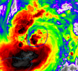
That recon pass was not remotely impressive. 
This thing is gonna have to get moving soon if it's going to bomb
This thing is gonna have to get moving soon if it's going to bomb
pressure is still dropping enough but i agree, only 24 hours left. the eyewall is still a moat that needs to constrict someThat recon pass was not remotely impressive.
This thing is gonna have to get moving soon if it's going to bomb
edit - this secondary band needs to constrict and choke out the flotsam inside of it for this storm to get going

severestorm
Member
I think NHC is going to have to walk back some predictions.
Nope. The dry air will be gone by 06z tonight. just in time for the warm loop current. It will take off.
The play by play of what's going on in the grocery store in the Helene thread is riveting stuff.
sorry i put analysis in the wrong place forgot this was this was the silly thread
You'll find better discussion here most of the time.sorry i put analysis in the wrong place forgot this was this was the silly thread
We have an issue with 3-4 posters who just won't learn. Not sure what we are gonna do, but we'll figure it out.
severestorm
Member
sounds good. what's your thoughts on the shear? Will that abate?Nope. The dry air will be gone by 06z tonight. just in time for the warm loop current. It will take off.
I know the environment is supposed to clear out completely.. id assume there will be some southwest shear that tries to weaken her shortly before landfall.sounds good. what's your thoughts on the shear? Will that abate?
Browsing some other more tropical oriented discussion forums... we are not the only ones talking about the globals vs hurricane models
My best advice to everyone is to just assume you're getting 70+ mph winds and hope you don't at this point.
My best advice to everyone is to just assume you're getting 70+ mph winds and hope you don't at this point.
Forgot about this place. I’m rusty. Let me learn to get comfortable in here again.
Forgot about this place. I’m rusty. Let me learn to get comfortable in here again.
Get the diapers, I will get the lotion
- Status
- Not open for further replies.


