• Hello, please take a minute to check out our awesome content, contributed by the wonderful members of our community. We hope you'll add your own thoughts and opinions by making a free account!

Severe weather potential May 2 - 4

TORNADO WATCH OUTLINE UPDATE FOR WT 133
NWS STORM PREDICTION CENTER NORMAN OK
350 PM CDT MON MAY 3 2021

TORNADO WATCH 133 IS IN EFFECT UNTIL 1100 PM CDT FOR THE
FOLLOWING LOCATIONS

TXC027-035-085-093-097-099-113-119-121-139-143-147-181-193-213-
217-221-223-231-251-257-277-281-309-333-349-367-379-397-425-439-
467-497-040400-
/O.NEW.KWNS.TO.A.0133.210503T2050Z-210504T0400Z/

TX
. TEXAS COUNTIES INCLUDED ARE

BELL BOSQUE COLLIN
COMANCHE COOKE CORYELL
DALLAS DELTA DENTON
ELLIS ERATH FANNIN
GRAYSON HAMILTON HENDERSON
HILL HOOD HOPKINS
HUNT JOHNSON KAUFMAN
LAMAR LAMPASAS MCLENNAN
MILLS NAVARRO PARKER
RAINS ROCKWALL SOMERVELL
TARRANT VAN ZANDT WISE
$$


ATTN...WFO...TSA...FWD...OUN...
TORNADO WATCH OUTLINE UPDATE FOR WT 133
NWS STORM PREDICTION CENTER NORMAN OK
350 PM CDT MON MAY 3 2021

TORNADO WATCH 133 IS IN EFFECT UNTIL 1100 PM CDT FOR THE
FOLLOWING LOCATIONS

OKC001-005-013-019-021-023-029-061-063-069-077-079-085-091-095-
099-101-107-111-121-123-127-133-135-040400-
/O.NEW.KWNS.TO.A.0133.210503T2050Z-210504T0400Z/

OK
. OKLAHOMA COUNTIES INCLUDED ARE

ADAIR ATOKA BRYAN
CARTER CHEROKEE CHOCTAW
COAL HASKELL HUGHES
JOHNSTON LATIMER LE FLORE
LOVE MARSHALL MCINTOSH
MURRAY MUSKOGEE OKFUSKEE
OKMULGEE PITTSBURG PONTOTOC
PUSHMATAHA SEMINOLE SEQUOYAH
$$

1620075242347.png

URGENT - IMMEDIATE BROADCAST REQUESTED
Tornado Watch Number 133
NWS Storm Prediction Center Norman OK
350 PM CDT Mon May 3 2021

The NWS Storm Prediction Center has issued a

* Tornado Watch for portions of
Southeast Oklahoma
North-central Texas

* Effective this Monday afternoon and evening from 350 PM until
1100 PM CDT.

* Primary threats include...
A few tornadoes likely with a couple intense tornadoes possible
Scattered damaging winds and isolated significant gusts to 80
mph likely
Scattered large hail and isolated very large hail events to 3.5
inches in diameter likely

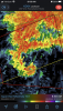
SUMMARY...Intense supercells are expected to initiate along the
dryline in north-central Texas and the surface front in southeast
Oklahoma by about 6 PM CDT. Very large hail will be the primary
initial threat, but tornadoes and significant severe winds will be
possible as well. Supercells should grow upscale into one or more
clusters with an increasing risk of damaging winds this evening.

The tornado watch area is approximately along and 60 statute miles
east and west of a line from 10 miles northeast of Muskogee OK to 40
miles southwest of Waco TX. For a complete depiction of the watch
see the associated watch outline update (WOUS64 KWNS WOU3).

PRECAUTIONARY/PREPAREDNESS ACTIONS...

REMEMBER...A Tornado Watch means conditions are favorable for
tornadoes and severe thunderstorms in and close to the watch
area. Persons in these areas should be on the lookout for
threatening weather conditions and listen for later statements
and possible warnings.

&&

OTHER WATCH INFORMATION...CONTINUE...WW 128...WW 129...WW
130
...WW 131...WW 132...

AVIATION...Tornadoes and a few severe thunderstorms with hail
surface and aloft to 3.5 inches. Extreme turbulence and surface wind
gusts to 70 knots. A few cumulonimbi with maximum tops to 600. Mean
storm motion vector 25030.

...Grams
 
So I want to go home but can't. I work in Loganville, GA and currently for the past hour or so these storms have been training over Loganville and every time I look to go, there's a 2 second window and BOOM more rain!!! Guess it's a good thing I have grading to do! Y'all be safe tonight and tomorrow!


Edit/update- Finally got a break and made it home, roads weren't too bad but many of my back roads could have future issues!
 
Last edited:
Damage report from that earlier warned cell in NC Stanley county shows as possible tornado damage. Chicken houses destroyed and a car blown off the road.
 
Tornado Warning in effect for Johnson and Hood Counties in TX, with a confirmed TOG.

If I'm not mistaken, this would be the first 2021 tornado report in FWD's CWA.
 
Over 7 inches at my house since 8am this morning, lot's of training setting up across Atlanta. Pitch black dark, booming thunder, vivid lightning, my street lights are on,,,LOL.
2.57 so far but the tempest usually has to revise up. All of the creeks are up to the tops of their banks. Tomorrow could get interesting.
 
HRRR's sounding still shows just a wee bit of capping in place. Combined with the less than impressive low level flow may be why the storms haven't been as robust as they could be (so far) and seem to be getting messy. This may end up sparing the heart of DFW from anything too severe.

A ton of hail reports though (all 2" or less).
 
Not a bad setup Wednesday, plenty of deep layer dry air, moderate Dcape, and lower PWATs along with straight Hodographs support a hail/wind risk 33D994D8-43EE-4E91-BE90-971766DC4A77.png65F20770-53A6-45F9-B721-91B211384BDB.png
 
Insane amount of lightning with the storms across TX and OK.

Nearly 1,800 strikes per minute.
 
The Tornado Watch in TX has been replaced with a Severe Thunderstorm Watch until 3am.
 
Per the SPC, there were at least 2 fatalities yesterday.

One was caused by the tornado in Douglasville, GA that caused a tree to fall on top of someone, and the other was a semi-truck driver that was caught on the tornado that crossed I-35 just outside of Waxahachie, TX.
 
I hope this line can really solidify in future runs ... I mean there’s heating of the day out east of it I don’t see why it doesn’t mature more .. even sun looks to get out and about east of it .. don’t really know why is seems to stay multi cellular and semi weak
Hrrr mixes dews down into the upper 50s/near 60. If that's the case you can forget it but the HRRR has a tendency to get over mixy
 
Some of the local birmingham news stations are putting us under a moderate risk for tornadoes lol. I'm more worried about the possible derecho later

Yeah, the tornado risk has dropped a good bit since the Euro completely caved yesterday. Still a risk for tornadoes with last nights Euro run, but much more unidirectional from 850mb to 500mb. Any supercells will probably grow upscale.

The funny part is the Euro is still printing out supercells. It must have decided to try to outdo the supercell machine that is the HRRR.
Lol, I'm just going to go with the idea of qcls tornadoes and a main line. Spc put a 45 risk for wind damage so I'm going to hedge on that. Might be a tornado or two. But after yesterday's performance I wouldn't put the euro a step above the HRRR lol
 
Why did the SPC remove the slight risk for WNC/upstate the hrrr is consistent at bringing strong winds/hailcores with the strongest multicells

Yeah, makes zero sense. I didn't expect to wake up to the sun shining. There is just way too much fuel out there this morning for us not to get multiple rounds of storms some of which are going to strong/svr.
 
Flooding might be a huge concern this evening as areas that have already received 2-8 inches of rain might see another 3-6 inches. Areas in KY and TN have seen 5-8 inches within last 6 hours, and the atmosphere looks to reload during peak day-time heating before a second round tonight. I think some places in Alabama could see an area of 5-7" of rain given models consistently illustrate training storms 6+ hours.
 
Flooding might be a huge concern this evening as areas that have already received 2-8 inches of rain might see another 3-6 inches. Areas in KY and TN have seen 5-8 inches within last 6 hours, and the atmosphere looks to reload during peak day-time heating before a second round tonight. I think some places in Alabama could see an area of 5-7" of rain given models consistently illustrate training storms 6+ hours.
94ewbg.gif
 
Tornado Warning South of Jackson, MS. http://www.tornadohq.com/

000
WFUS54 KJAN 041319
TORJAN
MSC029-121-127-041415-
/O.NEW.KJAN.TO.W.0048.210504T1319Z-210504T1415Z/

BULLETIN - EAS ACTIVATION REQUESTED
TORNADO WARNING
NATIONAL WEATHER SERVICE JACKSON MS
819 AM CDT TUE MAY 4 2021

THE NATIONAL WEATHER SERVICE IN JACKSON HAS ISSUED A

* TORNADO WARNING FOR...
SOUTHWESTERN RANKIN COUNTY IN CENTRAL MISSISSIPPI...
NORTHWESTERN SIMPSON COUNTY IN CENTRAL MISSISSIPPI...
NORTHEASTERN COPIAH COUNTY IN CENTRAL MISSISSIPPI...

* UNTIL 915 AM CDT.

* AT 819 AM CDT, A SEVERE THUNDERSTORM CAPABLE OF PRODUCING A TORNADO
WAS LOCATED NEAR CRYSTAL SPRINGS, MOVING EAST AT 20 MPH.
 
Yeah, makes zero sense. I didn't expect to wake up to the sun shining. There is just way too much fuel out there this morning for us not to get multiple rounds of storms some of which are going to strong/svr.
I agree... I’ve had a feeling since Sunday that today would be a bigger deal for the upstate and WNC including CLT metro. The sun is out and heating things up quick and the air just has that feel to it. I was suprised things got as active here yesterday after seeing overcast skies all morning and today there a lot fuel to set things off.
 
Still pretty broad though. But if I'm correct last few days it's showed a outflow boundary from a decaying mcs moving through MS into alabama so it may be near that. Currently working so I can't really look at what alls going on lol.

Absolutely beautiful structure.

Great look for maintaining the supercell per mesoanalysis. Shear is a little low, but great turning with height.
 
I agree... I’ve had a feeling since Sunday that today would be a bigger deal for the upstate and WNC including CLT metro. The sun is out and heating things up quick and the air just has that feel to it. I was suprised things got as active here yesterday after seeing overcast skies all morning and today there a lot fuel to set things off.

Agreed. Brad P's latest VBLOG alluded to this as well. Their inhouse model shows a pretty stout QLCS moving through late afternoon. And he even said he wouldn't be surprised to see the slight risk expand back towards are area.
 
Hmm CC is still messy, but may have a tornado on the ground.
 

Attachments

  • 05227C51-8B2E-4769-9F65-D6B5745EA51E.png
    05227C51-8B2E-4769-9F65-D6B5745EA51E.png
    404.6 KB · Views: 18
Back
Top