Z
-
Hello, please take a minute to check out our awesome content, contributed by the wonderful members of our community. We hope you'll add your own thoughts and opinions by making a free account!
You are using an out of date browser. It may not display this or other websites correctly.
You should upgrade or use an alternative browser.
You should upgrade or use an alternative browser.
Severe Severe Weather February 16th -18 2022
- Thread starter Darklordsuperstorm
- Start date
Not much suggesting a moderate risk. Not much suggesting a tornado outbreak. Storms look quite messy. Severe wind seems to be the biggest threat. With tornadoes looking like more of a threat for Mississippi than anywhere else. Nam looks more like a squall line with some imbedded rotation. All in all it’s meh imo
HSVweather
Member
HSVweather
Member
Z
Zander98al
Guest
Could still see a moderate outlined. Would be right before though.
How we hit 71 today is baffling. That's the forecasted high and we are locked in 49-51, in situ wedge. Thick clouds, drizzle starting
WEATHERBOYROY
Member
YOU GOTTA BE KIDDING! Soldiers in foxholes still crack jokes!Lives are at stake, no time for this foolishness in here
bigstick10
Member
NBAcentel
Member
Z
Zander98al
Guest
And thats what all the weenie and clown faces littering all the message in here are for as well. Not here until recently when the enchanced risk everybody thought this was dud and nothing to worry about. I was persistent in my idea. If anybody should be able to put a bit of a joke it should be me. I stuck with this since day 7...That’s what whamby is for. Jokes and banter!
It seems like everybody from other than Alabama and Mississippi that is not being effected has absolutely CRAPPED on this threat and thread. And then each time what I was persistent on happened. I'm no fortune teller, I forecast on what I know and the patterns I've experienced and can see. And most Carolina / people outside people dont understand the patterns we have.
Fountainguy97
Member
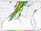
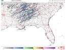
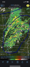
Latest hrrr is even messier View attachment 113779
Yeah today looks like the typical messy storm mode severe day. Probably a few spinups and tornadoes but with this much convection things will struggle to stay discreet. Those leading edge cells on hrrr are the highest risk storms.
HSVweather
Member
Z
Zander98al
Guest
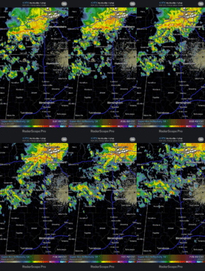
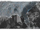
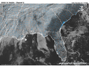
Yeah it was pouring sunshine in here at Homewood. Feels like a spring day. ?Just a few breaks in the MS delta and a good cloud break in central AL
View attachment 113782
HSVweather
Member
HSVweather
Member
HSVweather
Member
No one crapped on the threat. You over hyped it. We were hampering expectations. You’re not the only one that experiences severe weather and not the only one who has years of experience tracking these type of events. The chance for severe weather like damaging wind gusts was easy to see far out. The look for a tornado outbreak has never really been there yet you and some others threw out constant statements like “this looks increasingly worrisome for tornadoes” or “leaning towards a tornado outbreak” on repeat for 6 days. If anyone sees tornados it will probably be Mississippi. Even then I don’t think this will be considered a tornado outbreak(6-10 naders within a given area). This threat has always been damaging winds with a few tornadoes possible if they can latch onto dynamics well. 1-2 maybe stronger than average but nothing that tips the scale of an outbreak. Me and others have been saying this for days and this is what looks likely at the moment.And thats what all the weenie and clown faces littering all the message in here are for as well. Not here until recently when the enchanced risk everybody thought this was dud and nothing to worry about. I was persistent in my idea. If anybody should be able to put a bit of a joke it should be me. I stuck with this since day 7...
It seems like everybody from other than Alabama and Mississippi that is not being effected has absolutely CRAPPED on this threat and thread. And then each time what I was persistent on happened. I'm no fortune teller, I forecast on what I know and the patterns I've experienced and can see. And most Carolina / people outside people dont understand the patterns we have.
Z
Zander98al
Guest
and yes the threat was crapped on as my posts on the possibility that i saw happening was met with stark criticism, my views are not by the book, I use a bit of foresight which you need in weather, sure I can lean towards a tornado outbreak because that's the potential it had I've said it had high potential. And no I didn't over hype because this event has come to fruition has it not? I see that y'all where hampering expectations. I was giving out the possibilities of what could happen. Yes but you have not experienced Alabama weather for your whole life. You probably know Carolina weather. Heck if I moved out there it would be a clean slate for me I know nothing of patterns there. But was our statements right for worrisome potential of tornadoes? Yes.No one crapped on the threat. You over hyped it. We were hampering expectations. You’re not the only one that experiences severe weather and not the only one who has years of experience tracking these type of events. The chance for severe weather like damaging wind gusts was easy to see far out. The look for a tornado outbreak has never really been there yet you and some others threw out constant statements like “this looks increasingly worrisome for tornadoes” or “leaning towards a tornado outbreak” on repeat for 6 days. If anyone sees tornados it will probably be Mississippi. Even then I don’t think this will be considered a tornado outbreak(6-10 naders within a given area). This threat has always been damaging winds with a few tornadoes possible if they can latch onto dynamics well. 1-2 maybe stronger than average but nothing that tips the scale of an outbreak. Me and others have been saying this for days and this is what looks likely at the moment.
BUT. Enough, I'm done arguing did my suspicions come true yes? Can this still be a dud yes? Could this produce a tornado outbreak yes.
Fountainguy97
Member
and yes the threat was crapped on as my posts on the possibility that i saw happening was met with stark criticism, my views are not by the book, I use a bit of foresight which you need in weather, sure I can lean towards a tornado outbreak because that's the potential it had I've said it had high potential. And no I didn't over hype because this event has come to fruition has it not? I see that y'all where hampering expectations. I was giving out the possibilities of what could happen. Yes but you have not experienced Alabama weather for your whole life. You probably know Carolina weather. Heck if I moved out there it would be a clean slate for me I know nothing of patterns there. But was our statements right for worrisome potential of tornadoes? Yes.
BUT. Enough, I'm done arguing did my suspicions come true yes? Can this still be a dud yes? Could this produce a tornado outbreak yes.
Bro... these are literally your first posts in this thread. SIX DAYS before the event.
With respect, all you did was hype and cut down the extremely educated posters suggesting a more messy day. Which is that is happening rather than a day of full discreet supercells.
Getting some serious super Tuesday vibes with this system for some reason. But a bit more further south in terms of risk. Still a long ways out, but my general take is I'm reminded a bit of super Tuesday.
The more I continue to look at it the more I'm amazed. It's been a bit since we've seen a setup this good. Go back to the march 2020 outbreaks. But tune up the wind shear more. Also of note. Disregard the big blobs of simulated radar on global models. They do that for some events. Globals models had big blobs for April 27th and we all know how that ended up. Very dynamic systems aren't always good at having global models determining storm mode
All signs are legit screaming tornado outbreak at this point. And the consistency between all global models is INCREDIBLY uncanny. We will likely see a upgrade in risk to 30% by tommorow or the next day. Mesoscale models can undercut some of the severity or make it greater but overall the synoptic scale favors a tornado outbreak.
Yes, there will be a few tornados today. Yes, today is a severe weather event. Yes, people need to be informed. Is this a top of the graph severe event? Not even remotely close.
Last edited:
Z
Zander98al
Guest
I said at the time that's what it looked like, but weather changes analogs of the synoptic scale indicated my vibes were validated, still stand by my thoughts then of a possible tornado oubtreak. And nobody was even posting on here because of a winter weather threat, so no I was cutting anything out... And also I never said this was a day of full discreet cells where are you getting this from.. and never said it wasn't going to be messy... everything was on point with how I still feel.Bro... these are literally your first posts in this thread. SIX DAYS before the event.
With respect, all you did was hype and cut down the extremely educated posters suggesting a more messy day. Which is that is happening rather than a day of full discreet supercells.
Yes, there will be a few tornados today. Yes, today is a severe weather event. Yes, people need to be informed. Is this a top of the graph severe event? Not even remotely close.
NWMSGuy
Member
...meanwhile back in MS it appears that there are some breaks in the cloud cover. Let's see how this unfolds.
Hpdb301
Member
Banter please
Sent from my Armor 9 using Tapatalk
Sent from my Armor 9 using Tapatalk
HSVweather
Member
Z
Zander98al
Guest
Don't think separating will be good. I feel like invalidating others thoughts on a event should stop but idk. All I'm trying to do is take a lead and see what a possibility of happening is.Bottom line is we need separate thread for bama Ms TN etc for weather compared to NC SC Ga folks. Just not the same and clutters the board/topic
Z
Zander98al
Guest
EMTime
Member
The sun is peeking through in Lee County ms. Winds are screaming out of the south.
Usmeagle2005
Member
Yes here in west Tupelo we are getting some quick peaks of sun. Not enough too much warming so far.The sun is peeking through in Lee County ms. Winds are screaming out of the south.
LickWx
Member
Criticism is not invalidating . If you post on a forum , and especially if you start suggesting extremes then you should expect to be met with strong criticism . No hard feelingsDon't think separating will be good. I feel like invalidating others thoughts on a event should stop but idk. All I'm trying to do is take a lead and see what a possibility of happening is.
iGRXY
Member
I still say you may get a couple rotating cells but that looks to be closer towards Mississippi and closer to the coast where you get more SB Cape. Nothing really screams tornadoes with this system. An outbreak is multiple tornadoes across multiple states. This doesn't even scream scattered and is much more isolated if it even happens at all. The biggest threat with this system is going to be from the straight line winds. Now that definitely can cause problems as I wouldn't be surprised to see gusts around 60-70 mph with some of these storms but without any SB Cape you're not going to get any widespread tornadoes if you can get any of them at all.
Z
Zander98al
Guest
Good post lickwx ?. Either way I'm over it now, really good angle on the issue though.Criticism is not invalidating . If you post on a forum , and especially if you start suggesting extremes then you should expect to be met with strong criticism . No hard feelings
On topic, stop the nonsense, the arguing, the trolling, the overhyping, etc. Discuss possible severe and that's it. Dang unbelievable
LickWx
Member
Yeah your a good poster . I think it’s good that you post a lot , net benefit to the forum .Good post lickwx ?. Either way I'm over it now, really good angle on the issue though.
HSVweather
Member
Z
Zander98al
Guest
Last post from me off topic ,then all severe weather. Appreciate the opposing views lickwx really hit it home, just because you get criticism doesn't mean someone is invalidating your opinion on a event or situation, I think that really needs to be heeded. Arguments and bickering is inevitable eventually. But taking something personal from someone not agreeing with how you think things will play, out is stupid. Trolling though is just trolling though so that needs to chill a bit lol.
Z
Zander98al
Guest
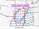
Not sure how much the tornadocast can be trusted I think it flopped pretty bad on the last two events. Good to keep in mind though.
HSVweather
Member
Yes, definitely take it with little confidence. I hesitated even posting.Not sure how much the tornadocast can be trusted I think it flopped pretty bad on the last two events. Good to keep in mind though.
HSVweather
Member
HSVweather
Member


