Z
-
Hello, please take a minute to check out our awesome content, contributed by the wonderful members of our community. We hope you'll add your own thoughts and opinions by making a free account!
You are using an out of date browser. It may not display this or other websites correctly.
You should upgrade or use an alternative browser.
You should upgrade or use an alternative browser.
Severe Severe Weather February 16th -18 2022
- Thread starter Darklordsuperstorm
- Start date
Z
Zander98al
Guest
Z
Zander98al
Guest
Z
Zander98al
Guest
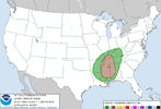
Just my opinion here. But I think we may actually see a substantial risk for a few longer track supercells, maybe tornadoes. Some of the limiting factors look like there are starting to turn around. There may even be breaks in the clouds during the day as well. Even if it is just around 1000-1500j it's still a good bit for a winter event. Although with the amount of shear you'd probably rather see 3000+. Temps look like they could reach near 70 and dewpoint not far behind. Hm. Really itching at the bit to see 18z convection models. That north Alabama / north Mississippi looks to be pretty volatile. I'd like to do a more detailed look later when I get home. But all hands should be on deck for a decent threat. I really think this could boom.
RollTide18
Member
The chief meteorologist on 19 last night showed wind gusts in the 40-50 mph range for Thursday outside of thunderstorms. Yikes!
During the Easter 2020 event, the power actually went out hours before the storms even hit, it did come back on before the storms hit before going out again though.
Z
Zander98al
Guest
Z
Zander98al
Guest
That is 700mb to 500mb, the issue is the surface to 700mb.15z rap has lapse rates pretty high
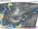
this system has speeded up a bit as well it looks like View attachment 113605
Z
Zander98al
Guest
? I've always seen comments on the 700mb- 500mb mattering. I think from the 15z rap it was around 6.0 for surface up. which isn't great but isn't the worst. 18z hrrr coming out along with other models. Peek at what those show.That is 700mb to 500mb, the issue is the surface to 700mb.
NBAcentel
Member
pretty ugly area of warmth aloft esp at 700mb, with limited low level instability? I've always seen comments on the 700mb- 500mb mattering. I think from the 15z rap it was around 6.0 for surface up. which isn't great but isn't the worst. 18z hrrr coming out along with other models. Peek at what those show.
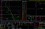
The GFS has low level lapse rates of 6.2-6.3 in some areas but cape and 0-3km cape is very low.? I've always seen comments on the 700mb- 500mb mattering. I think from the 15z rap it was around 6.0 for surface up. which isn't great but isn't the worst. 18z hrrr coming out along with other models. Peek at what those show.
Z
Zander98al
Guest
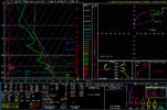
Wouldn't temps getting around in the high 60s low 70s be able to overcome that. Yeah that limited low level cape will limit tornado formation a good bit. Although I'd wait until HRRR came into range. I'd trust it most on forecasting the low level instability. Also peak those lapse rates fro above the surface to 3km. Theyve come up a good bit. ?pretty ugly area of warmth aloft esp at 700mb, with limited low level instability View attachment 113608
Z
Zander98al
Guest
I'm going to wait until the HRRR gets in range. 18z comes out, see what it says on the low level instability and low level lapse rates. 18z should start rolling out here soon. I'f we get breaks in the clouds and sunshine. Those low level lapse rates are going to go up.The GFS has low level lapse rates of 6.2-6.3 in some areas but cape and 0-3km cape is very low.
Z
Zander98al
Guest
Z
Zander98al
Guest
Z
Zander98al
Guest
Z
Zander98al
Guest
18z model only goes out to 12 o'clock Thursday with temps in the low 70s already. Very well may reach 75 in portions of Alabama and upper 60s dewpoint possibly. With a wide warm sector.
NBAcentel
Member
Have to remember that short range models in the longer range (HRRR/RAP) for ex aren't great at all, now that at hr 24 is much more interesting
HSVweather
Member
Huntsville afternoon AFD on this event
A risk for strong to severe storms continues, especially for our
more western areas. The main threats appear to be damaging winds.
Very high shear preceding the system, and somewhat higher model
produced instability keeps a tornado threat in as well. Am thinking
that a Quasi-Linear Convective System feature/squall line will bring
a higher severe threat. Models were trending more to a latter squall
line/frontal passage occurring more on Thu evening. High temperatures
on Thu, especially if more sun breaks through could rise to around 70
in a few spots (which could enhance the severe risk). Winds ahead of
the system especially Wed night into Thu evening could get breezy to
windy, with gusts over 35 mph possible Thu/Thu night. A Wind Advisory
may be needed if this trend continues.
Man this sure had dried up some for the Carolina’s folk who are dealing with drought. Was looking forward to heavy rain
Z
Zander98al
Guest
Maybe a faulty thinking but... 500-850 sbcape seems very low for a 65 dewpoint. Something seems wonky about that. Usually they go up. Usually see 500-850 cape in a 55-60 dewpoint range. Saw 1000-1250 sbcape in a January tornado with a 60 dewpoint. That went on to produce a ef3. Just seems very wonky. And yes I know there isn't much sunlight, even so. It still seems low. Watch it slowly go up in future HRRR runs or something. Just doesn't sit right with me seems oddly low.
Last edited by a moderator:
NBAcentel
Member
It’s that low because there’s warm air aloft at 700mb and cloud cover, a cape killing combo, there’s reasons why in the summer sometimes there’s really high dews but poor SBcape, because there’s mid level warmth, also it’s the cool seasonMaybe a faulty thinking but... 500-850 sbcape seems very low for a 65 dewpoint. Something seems wonky about that. Usually they go up. Usually see 500-850 cape in a 55-60 dewpoint range. Saw 1000-1250 sbcape in a January tornado with a 60 dewpoint. That went on to produce a ef3. Just seems very wonky. And yes I know there isn't much sunlight, even so. It still seems low. Watch it slowly go up in future HRRR runs or something. Just doesn't sit right with me seems oddly low.
Z
Zander98al
Guest
Am I the only one really not impressed by this setup? The winds will be there for sure, but looks like WAAAAY too much shear and not enough cape and that is going to shred any updrafts apart quickly.
Z
Zander98al
Guest
Lol your not the only one I think fro and arc feel the same. Ive commented a few times on the storms being torn apart with little instability and very strong wind shear, but it's a winter event any tornado threat bears watching and I felt like this event could boom. I thought we would really need to hit 2000j to sustain anything but who knows. All these storms are going to be super wispy more and likely.Am I the only one really not impressed by this setup? The winds will be there for sure, but looks like WAAAAY too much shear and not enough cape and that is going to shred any updrafts apart quickly.
Z
Zander98al
Guest
Well the 00z HRRR Is now hovering around 1000j of sbcape in MS/AL ?. Kinda lines up with my thinking earlier that it was too little currently. Still think it's a bit low but we will see. going to be a bunch of low topped supercells that's for sure.
NBAcentel
Member
Z
Zander98al
Guest
NBAcentel
Member
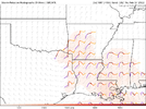
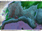
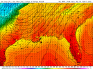
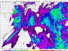
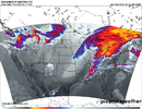
QLCS it is hahaMeh, this looks favorable more for a QLCS, highly forced and sheared. low level and mid level lapse rates aren’t really great at all, Hodographs are favorable for cyclic stuff if anything was to develop “out ahead” but the overall thermodynamics aren’t great and wind parameters aloft lean to more of a QLCS threat, nothing eye popping about this and looks like your typical cool season severe wx event. Still far out tho and prone to changes, globals typically decouple the BL to fast as well View attachment 113383View attachment 113384View attachment 113382
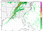
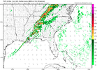
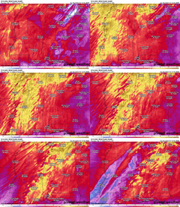
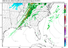
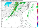
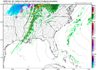
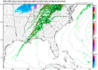
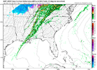
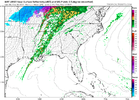
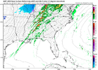
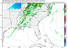
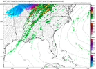
Hrrr shows a semi broken line of supercells rolling through bham at 5 o'clock. Here's updraft helicity through the final frame of 00z hrrr.View attachment 113633View attachment 113634
Last edited:
Z
Zander98al
Guest
No need to toot your own horn. Moment you think you know a bunch is the moment you usually fall on your face ?. Weather is ever evolving.QLCS it is haha
Z
Zander98al
Guest
BufordWX
Member
Glad we are finally gonna see some good soaking rains here tomorrow night. OKC has only had about 2.0” in the past 3 months or so. It has been a while since there have storms here and there might even be an elevated hailer in there.
HSVweather
Member
accu35
Member
0z HRRR showing some 45-50 gust winds for MS/Al ?
HSVweather
Member
HSVweather
Member
Z
Zander98al
Guest
Z
Zander98al
Guest
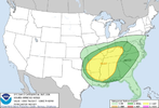
Trends will be important to watch today. Winds are already starting to crank out of the south, I'f models underestimate moisture advection or cloud breaks it'll spell bad news. You'll more and likely see a enchanced risk tommorow for a chunk of missipi and portions of west Alabama
Z

