NBAcentel
Member
Overlap of everything looks far better in western miss/LA/AR, system loses a favorable tilt further east and everything becomes unraveled For areas more east
Overlap of everything looks far better in western miss/LA/AR, system loses a favorable tilt further east and everything becomes unraveled For areas more east
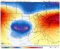
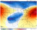
A lot of those things will be determined by mesoscale models/features. Your overlooking the broad picture setup wise. The GFS is catching up to the increase in thermodynamics out west on the day 5 period like I mentioned earlier. Thermodynamics will rise as we get closer.Messy, lots of elevated convection with lots of 850mb WAA and nil T/D spreads signaling cloud cover/stratiform and elevated thunderstorms with piss poor mid/low level lapse rates, and the area south of the boundary that has 1-2 storms that take advantage of the streamwise vorticity near the boundary and become cyclic. Basically your average cool season setup View attachment 113392View attachment 113393View attachment 113394View attachment 113395
This synoptic scale pattern isn’t really as favorable for AL/eastern MS and just areas further east in general, it’s not just about CAPE and wind shearA lot of those things will be determined by mesoscale models/features. Your overlooking the broad picture setup wise. The GFS is catching up to the increase in thermodynamics out west on the day 5 period like I mentioned earlier. Thermodynamics will rise as we get closer.


Way way to early look at messy storm mode this far out … which doubt with large warm sector may be bit messy around the frontal boundary northStill don't agree with your idea lol l, you'd have to convince me more. Shear and instability arent the only thing to weather but it's apart of the three main ingredients for sever weather shear/lift/instability. We've had many tornado outbreaks with lows being as far away as Nebraska. Still think there's considerable threat for a possible tornado outbreak.
And most of the south's tornado outbreaks are on days of messy convective modes
Honestly due to a big event that happened this week, it’s been nothing but a blur and I have barely looked at anything.Checked the CMC for funnies. And it's exactly the same as the GFS and EURO. But more pronounced on a dry line. Can't believe global models are locking down so consistently already. This has potential for a pretty high end day. Models usually lockdown pretty well on high end events from a decent ways out. Shear is out of the roof on this one. Which may be a downfall if there's not enough substance in the way of instability. But there's no way that global models are correct right now on instability. If history tells me right a big jump on in CAPE will come. @Arcc what do you think on this event, fellow alabamian.
Here’s a summary. Looks like a classic/seasonable cool season event, nothing out the ordinary and nothing to crazy per models, but something that can still cause issues as they have in the pastHonestly due to a big event that happened this week, it’s been nothing but a blur and I have barely looked at anything.
They will increase, you'll have a decent bit of instability into Kentucky and probably north Arkansas depending how far south the low travels. I'm begging to think there may be convection that blows up a good bit ahead of the main bunch, that is reliant on how fast the warm sector sets up really. 18z GFS moved north with more instability and higher instability again. Continuing the trend I mentioned that will occur, already pushing near 1000j of cape in splotches just below of Birmingham.Nice write-up from Memphis. Sounds like they believe instability levels will change as the event draws closer.
Area Forecast Discussion
National Weather Service Memphis TN
350 PM CST Fri Feb 11 2022
.DISCUSSION...
A cold front will move through the forecast area tonight bringing
a chance for a few showers. It should be too warm and moisture
starved for snow so have removed the mention of snow this
issuance. The confidence is low so have elected to remove it.
Temperatures will be noticeably cooler Saturday we will struggle
to get to 40 degrees for a lot of the area. Cold temperatures will
be the main story this weekend, as lows drop back into the low to
mid 20s for Sunday morning. High pressure starts over the area
early next week as temperatures will modify back into the 50s.
Southwest flow will kick in by mid week as a warmer and more moist
air filters into the Mid South. Guidance still points to a fairly
strong system impacting the forecast area on Thursday. So much so
that the Storm Prediction Center highlights the entire area in a
15 percent risk for severe weather for day 7. This is the
equivalent of a slight risk. This has definitely peaked interest.
We will have to monitor this situation for the next several days
as details become more clear. As of now the main limiting factor
looks to be instability, but this will absolutely change over the
next several days.
Cloud cover is very very important in regards to severe weather. Unless dynamics are perfect (which they aren’t) the more sun the better (if you like severe weather)Louisiana, Mississippi and Alabama have a lot of upside in terms of instability potential. My hunch is Thermodynamics are being under modeled a decent bit. Just off of face value it's evident. Really cloud cover won't be crucial to instability, as a LLJ pumps moisture up into the deep south. Although sunlight will more and likely help instability and the lapse rates, so any cloud breaks would be pretty bad for the overall setup.
A strong LLJ is more than enough a lot of times. 4/28/14 and 1/28/12 for example. But sunshine would be worse. Lapse rates are the biggest question as of now. Many times a LLJ can usher in unstable air very quickly. With this event you got a screaming LLJ in place for a day or two. Imstability is likely underdone a good bit.Cloud cover is very very important in regards to severe weather. Unless dynamics are perfect (which they aren’t) the more sun the better (if you like severe weather)
 even more so of a EML in south Mississippi. Almost a loaded gun, just the instability hasn't caught up yet and the lapse rates aren't the best which it will more and likely go up a bit as we get closer.
Had a feeling this would happen they usually start conservative and fine tune each day leading up to the eventRisk area adjusted eastward. Continued trend with the GFS on more moisture pulling northward. Also a bit better wind profiles for discreet convection.View attachment 113425
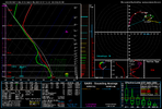
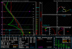
Wind fields look good there, but the thing that pops out to me is the very warm layer from 850 to 700mbs. Gonna absolutely need sunshine and higher surface temps to overcome that. Otherwise low toped, struggling showers will be the rule for most of the day.Taking a peak at a sounding over central Mississippi near the state line of Alabama. Starting to see a EML be showcased. View attachment 113428even more so of a EML in south Mississippi. Almost a loaded gun, just the instability hasn't caught up yet and the lapse rates aren't the best which it will more and likely go up a bit as we get closer. View attachment 113429
The screaming LLJ might be able to overcome that. But then again may not. Globals show overcast but we won't really know if there will be breaks or not till mesoscale models. I'm betting on the LLJ right now. It's absolutely going to be roaring.Wind fields look good there, but the thing that pops out to me is the very warm layer from 850 to 700mbs. Gonna absolutely need sunshine and higher surface temps to overcome that. Otherwise low toped, struggling showers will be the rule for most of the day.
yeah the lower level jet will help clear out things for sure whats being modeled is correct, its going be very strongThe screaming LLJ might be able to overcome that. But then again may not. Globals show overcast but we won't really know if there will be breaks or not till mesoscale models. I'm betting on the LLJ right now. It's absolutely going to be roaring.
I don't think it will clear cloud cover our, more so advect warmer air and increase the temperature to bust the cap. Not 100% sure but. The outbreak over the south on 4/28/14. Was aided by a low level jet. There was nothing in the way of sunlight. People in the south underestimate the effect of a strong LLJ sometimes.yeah the lower level jet will help clear out things for sure whats being modeled is correct, its going be very strong
This is actually what I have been seeing consistently popping up, soundings lacking sfc heating and warmer air aloft which would likely create faildrafts due to garbage low level lapse rates. Low level jet itself in these sort of grunge setups is actually responsible for low level cloud cover/showers and grunge due to the warm air aloft it brings. which WAA itself is a forcing agent itself. Sure kinematic factors for something notable but lots of thermodynamic factors for just a run of the mill wintertime severe eventWind fields look good there, but the thing that pops out to me is the very warm layer from 850 to 700mbs. Gonna absolutely need sunshine and higher surface temps to overcome that. Otherwise low toped, struggling showers will be the rule for most of the day.
Agree fully with this sentiment lol. I don't think we expect it to be a mega outbreak here or a copy of super Tuesday lol. When I see you saying a classic wintertime setup I consider solely a qcls spin up event. Which is what you usually see. But this event is not exactly like that. WAA can make for a sizeable event. 4/28/14 for example but In this event we're a tad closer to the low pressure this go around. With other factors. And lapse rates have ticked up for the severe weather timeframe in MS/AL. I see this event having a considerable upside, which I'f things go a certain way there may be a few devastating storms.All I’m saying is, this isn’t screaming a mega tornado outbreak or Super Tuesday outbreak or a big one in general like I have been seeing hyped, esp on Twitter. but more so your classic wintertime setup that brings 1 or so strong tornadoes which form along a boundary and several weaker ones
Don't think so, may actually be expanded a bit.If all is true being spoken. Spc should be trimmer down area soon
Memphis nws now saying Wednesday night timeframe now for our areaReed timmer talked about this an hour ago. He said the current trends have it shear out the more northeast it goes which would dampen the severe threat for Thursday but Wednesday confidence is increasing.
Still a good ensemble mix on how long is maintains being amped before it ejects and timing differences. Also timmer says we will probably see a tornado outbreak anyways lol. But idk ?. Don't need a perfect setup for a dangerous outbreak here. Any storm that produces a tornado is significant to me because it poses a risk to life and damage. Just a few tornadoes is enough to seem like a tornado outbreak to nearby residents.Reed timmer talked about this an hour ago. He said the current trends have it shear out the more northeast it goes which would dampen the severe threat for Thursday but Wednesday confidence is increasing.
Not necessarily... Nocturnal LLJs can actually cause increased boom potential at times because they can actually ramp up significantly... Especially between 1am and 5am...If the system comes through at night, that should lessen the severe threat somewhat, due to loss of heating! This looks nothing like super outbreak kind of stuff
