-
Hello, please take a minute to check out our awesome content, contributed by the wonderful members of our community. We hope you'll add your own thoughts and opinions by making a free account!
You are using an out of date browser. It may not display this or other websites correctly.
You should upgrade or use an alternative browser.
You should upgrade or use an alternative browser.
Severe Severe Weather February 16th -18 2022
- Thread starter Darklordsuperstorm
- Start date
NWMSGuy
Member
Z
Zander98al
Guest
Z
Zander98al
Guest
Z
Zander98al
Guest
Nws of bham says there's a few parameters in question, determining those factors the magnitude of the event could go up, but also dampen.
Next few days will be fun in deciphering these models. I think the thing the new bham was talking about was the temps and skinny cape profiles
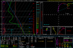
BUT that north Mississippi/east Arkansas has some nasty parameters. IMO that north Mississippi area is prime targeting for some strong storms. Matches up pretty well with what fro was saying on west Mississippi. But I would include all of north Mississippi as of right now. Spitting out pds tornado soundings. Although gotta wonder if these storms are going to just shear out, from such strong wind shear and lesser imstability.
Last edited by a moderator:
Z
Zander98al
Guest
Also I think we all In here appreciate @Arcc and @Myfrotho704_ analysis. Sadly we don't have a lot of board members from Alabama and Mississippi that post good analysis that are weather smart or book savvy lol. I know some along with other Alabama members but not enough. All I can really do is read the weather models and know a bit of Alabamas weather patterns that shape up. But my opions and perspectives of newbies are still good to the proffesionals as it opens the mind to other possibilities. I like to look at the possibilities of what I'f this happened or did this. Just would like to say. I think we all appreciate the seasoned and well knowledgeable posters here. Don't have many west of the apps. ? Keep posting analysis guys. My take is we still have a possibility of a higher end event if a piece or two falls into place for Alabama.
Z
Zander98al
Guest
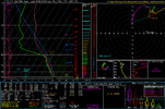
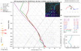
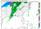
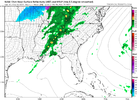
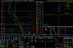
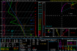
Soundings from Mississippi/Alabama state line. And sounding from Tuscaloosa Birmingham county line. Nasty soundings. When or if the cape rises could be a bad setup. 12km nam shows cellular storms. Almost a classic supercell structure with those hodos. Although they would be low topped if anything with the low instability shown at the current time.


Z
Zander98al
Guest
Those lapse rates are starting to become managble as well. Getting around 6.5 is almost a must at this point. We can't sleep on this event just yet.
Seems like the shear is almost outrunning the cape now that I take a closer look. Lol this might bust. ?
Seems like the shear is almost outrunning the cape now that I take a closer look. Lol this might bust. ?
Last edited by a moderator:
Z
Zander98al
Guest
Z
Zander98al
Guest
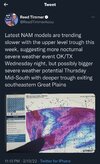
I don't think it's possible for reed timmer to not saying tornado outbreak in any weather sentence ???
I don't think it's possible for reed timmer to not saying tornado outbreak in any weather sentence ???
Yeah. Outbreak, substantial, big, huge, dangerous, monster. He has a certain way of speaking lol
Z
Zander98al
Guest
I tell you one thing the northern half of MS & AL and western Tennessee looks pretty nasty. Northern half of MS is pushing almost to 2000 j already dewpoint upper 60s. Will we see our first pds watch of the year for north MS? best paremeters for the event is there.
Darklordsuperstorm
Member
How are things looking down on the coast? Im sure the worst of the severe will be north of that area. Haven't really had a chance to take a deep dive and look into what the weather is gonna be like down there Thursday and FridayI tell you one thing the northern half of MS & AL and western Tennessee looks pretty nasty. Northern half of MS is pushing almost to 2000 j already dewpoint upper 60s. Will we see our first pds watch of the year for north MS? best paremeters for the event is there.
Z
Zander98al
Guest
Not really sure lol, I haven't looked I'll look when the 18z runs come.out. I'm curious as to what updraft Helcity swaths will look like when they start to get in range at 00z models tonight.How are things looking down on the coast? Im sure the worst of the severe will be north of that area. Haven't really had a chance to take a deep dive and look into what the weather is gonna be like down there Thursday and Friday
Z
Zander98al
Guest
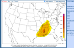
The new cwasp probabilities is lining up with current thinking of highest probabilities in north MS. That area looks like ground zero for the worst.
Z
Zander98al
Guest
12km nam shows mostly cellular development until the main gist gets to east Alabama. Begging to think the cap for this event will be a moderate. Really interested in the cams it looks like we will have to wait till tomorrow midday to really see what it will do. It looks like the system has slowed down a bit more.
Also @Darklordsuperstorm looks more like just regular thunderstorms on the gulf atleast near gulf shores and orange beach area. Shear.quickly lifts to the north before really interaction with good instability can occur. Too early to really pin down any risks though.
Also @Darklordsuperstorm looks more like just regular thunderstorms on the gulf atleast near gulf shores and orange beach area. Shear.quickly lifts to the north before really interaction with good instability can occur. Too early to really pin down any risks though.
Darklordsuperstorm
Member
It will be interesting to see what the nams amd hrrr show when they get into range.
Z
Zander98al
Guest
21z LR rap run is starting to get in range of the later afternoon night threat on wensday. And the warm sector is way ahead of schedule across the twin states. Dewpoints already at 60 in portions of west central Alabama. We may see a big boom. And the lapse rates are concerning as well. There way higher compared to the same timeframe of the nam. Ive got a bad gut feelingIt will be interesting to see what the nams amd hrrr show when they get into range.
Last edited by a moderator:
Z
Zander98al
Guest
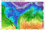
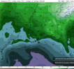
@#$&. Crap might hit the fan in forecasting and modeling here when the CAMS get in range. I don't like the look of the RAP. The RAP is hunting strongly at the cold bias in the nams forecast for this event. But I'll hold this with a grain of salt at the moment need some confirmation with the other cams. Dewpoint plots by nam and rap 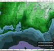


NBAcentel
Member
This setup just doesn’t scream a huge deal for areas further east then at least MS, main forcing might outrun the best thermodynamics (NAM shows this well), might be a QLCS that barrels through with MUCAPE and just makes this a not a big deal event, lots of signals showing up on the shorter range/globals for fails with this event. We’ve seen much much scarier looks
Z
Zander98al
Guest
I think the northwest quadrant of Alabama is in play but definetly north Mississippi looks good. Holds off on the qcls till it gets near bham. That eastern extent of the risk area might be adjusted and pulled back some.This setup just doesn’t scream a huge deal for areas further east then at least MS, main forcing might outrun the best thermodynamics (NAM shows this well), might be a QLCS that barrels through with MUCAPE and just makes this a not a big deal event, lots of signals showing up on the shorter range/globals for fails with this event. We’ve seen much much scarier looks
Z
Zander98al
Guest
Z
Zander98al
Guest
0z NAM may be the most bullish yet if you want garbage for AL.
Marycrowley
Member
What do you mean? Are you saying it’s looking worse for areas in west Alabama like Tuscaloosa?0z NAM may be the most bullish yet if you want garbage for AL.
HSVweather
Member
Z
Zander98al
Guest
I think he means that it'll be less severe lolWhat do you mean? Are you saying it’s looking worse for areas in west Alabama like Tuscaloosa?
Z
Zander98al
Guest
Starting to look pretty unimpressive now. Potential wise atleast lol. Still bears watching As we get closer and cams come more in range.
Last edited by a moderator:
Z
Zander98al
Guest
Z
Zander98al
Guest
12z models starting to come out. Although the conversation is this isnt a bad setup, I think it really needs watching. Like always if a piece of two falls into place this could be significant for somebody's area. Any severe threat that poses a risk should be watched. And also even if this is not looking like a tornado outbreak. If there's one storm that produces a tornado that hurts somebody or destroys something it makes it a bad weather day. And many significant tornadoes have formed in rather messy days. 98 oak Grove f5 occured on a day without a outbreak I think pretty sure that was one of just a few tornadoes that day, albeit though a high risk was issued that day.
A lot of details that can change things significantly just aren't able to be forecasted until very very close to the event. The ef2 that killed somebody a week and half ago. Changed significantly just 2 days out. Didn't even have severe weather parameters in the area that had the tornado 2 days out. So buckle up, may be some changes. either way it will be very windy and rainy that day.
A lot of details that can change things significantly just aren't able to be forecasted until very very close to the event. The ef2 that killed somebody a week and half ago. Changed significantly just 2 days out. Didn't even have severe weather parameters in the area that had the tornado 2 days out. So buckle up, may be some changes. either way it will be very windy and rainy that day.
Last edited by a moderator:
Z
Zander98al
Guest
NBAcentel
Member
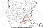
CIPS isn’t for closer range, more of a medium to long range signalerCips tornado risk highlights the possibility of a decent tornado risk in that northern MS/AL/TN area still. View attachment 113585
Z
Zander98al
Guest
Why isn't it? I thought it took previous similar events compared to current forecast parameters and gave a prediction on threatCIPS isn’t for closer range, more of a medium to long range signaler
Z
Zander98al
Guest
Bro this looks omnious as heck!
NBAcentel
Member
It’s just not a short range type of thing. Doesn’t account for mesoscale flaws in this setup which there’s plenty ofWhy isn't it? I thought it took previous similar events compared to current forecast parameters and gave a prediction on threat
Z
Zander98al
Guest
Bro this looks omnious as heck!
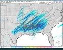
Just off this simulated radar. It screams outbreak. The updraft Helcity swaths are going to be nuts. I really think if you live in Alabama you should prepare for a decent severe threat just in case, probably won't be that bad, but expect the unexpected sometimes.
Z
Zander98al
Guest
Darklordsuperstorm
Member
Bro this looks omnious as heck!
It's crunch time. Today and tomorrow will reveal a lot about what this system is going to do.
Z
Zander98al
Guest
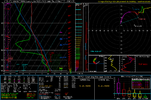
Nam 3km is VERY isolated with convection and a tad slower. But also has the Low top supercells starting to pop up but a bit later. The 3km nam also has cloud breaks. It's going to get very interesting. Sounding over central MS. At 4 o'clockIt's crunch time. Today and tomorrow will reveal a lot about what this system is going to do.
Last edited by a moderator:

