L
Logan Is An Idiot 02
Guest
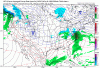
Cmc has some wraparound snow on the backside
Sent from my Pixel 3 using Tapatalk
Sent from my Pixel 3 using Tapatalk
I wish that High was sitting in upstate New York. Then things would seem promising.
Sent from my iPhone using Tapatalk
I was not looking at the correct run. Forgive meI know we can ignore but this shouldn't be allowed. Get the troll outta here
The CMC and RGEM always have way too strong of a cold bias with these types of events, even if there is consistency. I’d discount it.
Notice the confluence pressing farther SW in the New England statesGefs looks better, I like that ridging near the GL gettin better View attachment 57148View attachment 57149
Yep keeps getting better and betterNotice the confluence pressing farther SW in the New England states
Exactly! Us Sc and Ga folks know where we need it...learned a lot from Lookout...the Cad guru over the years.I wish that High was sitting in upstate New York. Then things would seem promising.
Welcome back! We’re glad to have you just in time for the potential winter weather. I was beginning to think you forgot about us.Well... look like I'm back from my summer hibernation.
")
Good to see you back. Bring us some mojo...Well... look like I'm back from my summer hibernation.
I live just above Lake Bowen and do very well during winter storms that get into the upstate. Have a friend that lives about 2 miles north of 85 in Spartanburg and he does well too. Have another friend that lives just south of DT Spartanburg and while the city is getting sleet, he’s getting mixing and a lot of rain. Amazing how tight the gradient is.Personally I think upstate areas that see Ice. will be place like campobello Marietta landrum Blacksburg north and east. Ice to rain
Sent from my iPhone using Tapatalk

Good to see you back. Bring us some mojo...
Delaware is a southern state when it comes to snowfall...CMC- DC to Bos crushing. Coastal plain of Delaware- nothing
Im in Chatham Co. And it isnt any better here than Wake, maybe a few exceptions.It's been absolutely nothing for me, winter weather wise, since I came back from New Hampshire. Hopefully this bad mojo ends this winter... maybe next week? I'm moving away from Zebulon and toward western Triangle by next spring so I'll be in a better position for next winter.
Whoa a wild mid atl poster appearsCMC- DC to Bos crushing. Coastal plain of Delaware- nothing
Gratifying when the midatlantic can share our pain. LolWhoa a wild mid atl poster appears
Americanwx is probably having a block party rnGratifying when the midatlantic can share our pain. Lol
That’s what I have right now. Think the cutoff in the upstate will run from the city of Anderson to Laurens to Union to Chester north for any kind of frozen. And most of not all will be ZR.Imo assuming things keep trending the way they are and the stronger CAD rule applies, I think the NW Piedmont/Foothills down to about Statesville sees more sleet and maybe on-set snow out of this while areas from the northern Upstate SC region to CLT points NW sees more ZR.
Things can and do always change though.

Do you have the individual p types and total ZR?That’s a little bit of sleet View attachment 57160
Beefiest run yet for ice/sleetDo you have the individual p types and total ZR?


Damn, that looks like Dec 02 type wedge