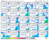
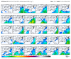
Ur standards are starting to slip my man....lolNot as good as gefs but not terrible View attachment 58579View attachment 58580View attachment 58581
-
Hello, please take a minute to check out our awesome content, contributed by the wonderful members of our community. We hope you'll add your own thoughts and opinions by making a free account!
You are using an out of date browser. It may not display this or other websites correctly.
You should upgrade or use an alternative browser.
You should upgrade or use an alternative browser.
Ostrich December
- Thread starter SETNwx
- Start date
Bannerdude
Member
The 12z GFS goes bananas with the Christmas Eve front. Wind chill near 60 degrees in Fayetteville and Raleigh around dusk on Christmas Eve but 17 in Sanford!?!

Last edited:
NBAcentel
Member
Well that’s true it has since I haven’t seen grass completely under snow in 2 years, but it is a mean, GEFS is certainly much better but at least the EPS isn’t a shutoutUr standards are starting to slip my man....lol
I know I'm just giving u hell I like ur style. I always enjoy the pbp because I'm never near my computer.Well that’s true it has since I haven’t seen grass completely under snow in 2 years, but it is a mean, GEFS is certainly much better but at least the EPS isn’t a shutout
NBAcentel
Member
Still like what I see in regards to that +EAMT, can see hints of the NPAC jet extension associated with below normal heights in the Bering sea which allows a strat attack the on SPV, and also could be the cause to a very +PNA towards late December/early January, keep the -NAO in the equation (I don’t know why it keeps coming back) and it keeps the pattern interesting 


Somebody smarter than me can find the maps but we had a system come through in early December 2000 that went from tornadoes to snow. It was before our bigger snow but it blew through at night and we woke with a good coating and temps holding in the upper teens. A few days later we got the 3.5” but that laid the groundwork. Maybe this will be similar.
NBAcentel
Member
Oh my, imagine lol 

Webberweather53
Meteorologist
Wow the 12z GFS has a high of 27F in Raleigh on Xmas day.

So seeing the 12z Euro actually take a step towards the GFS does remind me a little of how the model trend began with the 2010 Christmas storm. In that one, the GFS was actually showing in the 7-9 time frame and then lost it, but the Euro latched onto it at 6 days out and eventually the GFS trended back to it as the week progressed. Now this means absolutely nothing with this potential now, but we have definitely seen the Euro 7-8 days out not be what it used to be. Two things look very possible right now...first there looks to be a storm of some type with a lot of energy as we get close to Christmas whether it be a snowstorm or a severe weather outbreak, and secondly the pattern after that storm looks really good especially considering the climo we are going into.
NBAcentel
Member
must be a lie, it’s gonna be 70 on Christmas again right
NBAcentel
Member
Ok 

For some reason I can't attach a pic after my phone updated last night. Probably just operator error. LolAt least the MJO is weak and staying in the circle. It's doing everything it can to no emerge in the favorable phases though I see.
Woah, they following the default iPhone app too? Sheesh.
Or maybe Brad P is in denial & this might have legs. Lol
Webberweather53
Meteorologist
Here's what FFC says about the Christmas Eve system.
Rain should be ongoing at the start of the period...with some
lingering rain/snow mix at higher elevations around sunrise
Sunday. Models differ on the low pressure moving along the Gulf
coast on Monday...with the ECMWF showing a slower progression and
some pops possible across east central GA on Monday.
Otherwise...dry until the next trough deepens into the central
states mid week. A surface front should cross the state Wednesday
and Thursday. Have raised the pops a bit for that time...keeping
them in high chance category. Models show this as a progressive
system so the main precip looks like it would clear the area by
Friday. However...with such a deep trough...some wrap around or a
weak short wave could affect north GA Thursday night into early
Friday. Have confined pops to the far north at this time.
Temperatures indicate that this would be an all snow event. Will
continue to monitor this system in the coming days.
In all honesty I’m fine with the MJO staying in the circle if it’s not going to emerge into good phases. I remember a couple of years ago when all of the indexes looked good, but the MJO was so strong and in the wrong phases it was controlling everything about our pattern and kept flooding the US with Pacific airAt least the MJO is weak and staying in the circle. It's doing everything it can to no emerge in the favorable phases though I see.
NoSnowATL
Member
Yep in the circle is fine. @GaWx has talked about it in the past. Night and day difference from the past few years.In all honesty I’m fine with the MJO staying in the circle if it’s not going to emerge into good phases. I remember a couple of years ago when all of the indexes looked good, but the MJO was so strong and in the wrong phases it was controlling everything about our pattern and kept flooding the US with Pacific air
Last edited:
NBAcentel
Member
Past few years tropical forcing has been stuck in the maritime continent, but much stronger/pronounced, I don’t know what changed this year tho lol
from RAH:
A brief warming trend is then expected midweek ahead of a deep
trough forecast to develop over the central US. This potentially
full-latitude trough should bring a stout, precip laden cold front
Christmas Eve, though timing is still uncertain. With temps in this
pattern likely to crash rapidly behind the front, there will be
interest in the potential for snow on Christmas Day. However,
looking at current forecasts, there would need to be more
significant and southward deepening of the upper low to induce a
surface low at our latitude to produce more anafrontal precip.
Instead the cold air is more likely to be chasing the precip on the
tail end of the event. In any event, Christmas Eve looks to be
unusually mild, and Christmas day may be bitterly cold.
BufordWX
Member
CFS for Christmas morning. Lol
SimeonNC
Member
I love that the warmest we get during this "warmup" is the mid-50s.
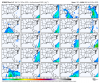
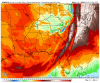
[mention]Myfrotho704_ [/mention]Do you have maps for the 23-25 time frame that show CAPE?
ATLwxfan
Member
Here's what FFC says about the Christmas Eve system.
The February 2020 even was similar to this but not nearly as cold.
Sent from my iPhone using Tapatalk
NBAcentel
Member
Euro was honestly really close to some bad stuff, wow, and EPS is more bullish on severe vs the GFS/GEFS, which is concerning give the the GFS/GEFS have a progressive bias[mention]Myfrotho704_ [/mention]Do you have maps for the 23-25 time frame that show CAPE?
Attachments
-
 5DF0F36A-4EB2-4DDD-8A60-B58D1E481424.png156.2 KB · Views: 37
 -
 48D1D3A2-8CF7-48F7-BFFF-2103C5F35BEC.png146.6 KB · Views: 38
 -
 BA740D01-D6B5-4463-B97F-54307DD7EB99.png172 KB · Views: 31
 -
 54B7FB96-A9D1-4672-A3C5-D97603D28085.png167.8 KB · Views: 31
 -
 7A623C52-0361-4C76-B981-9FB1644E06C3.png158.7 KB · Views: 33
 -
 7D71BA44-3D90-45D8-B6F8-B23CEF12BB82.png89.2 KB · Views: 32
 -
 F3872C3B-F7A1-43D6-9788-320F6A1351B9.png178.6 KB · Views: 32
 -
 54D696CB-AB3A-44CE-B1EC-2EFFCB9C40CB.png162.9 KB · Views: 32
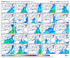
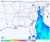
Zoom in on SC and you can see the late arriving cold that will become even more pronounced as we get closer. Snow or no snow. Rain or no rain. The cold will be late.CFS for Christmas morning. LolView attachment 58600
Say Wut? Christmas Miracle?
Saturday Night
Mostly Cloudy. A Chance Of Snow Showers After
Midnight. Lows Around 30. Light And Variable Winds. Chance Of
Snow 30 Percent.
Sunday
Mostly Cloudy In The Morning, Then Becoming Partly
Sunny. A Chance Of Snow Showers In The Morning. A Chance Of Rain
Showers. Little Or No Snow Accumulation. Highs In The Upper 40s.
Light And Variable Winds. Chance Of Precipitation 30 Percent.
Sunday Night
Mostly Cloudy With A Chance Of Rain Showers. A
Slight Chance Of Snow Showers After Midnight. Little Or No Snow
Accumulation. Lows In The Lower 30s. Light And Variable Winds.
Chance Of Precipitation 30 Percent.
A chance is all you can ask for a week out!
Thursday Night
Mostly Cloudy. Rain Showers Likely In The
Evening, Then A Chance Of Snow Showers After Midnight. Cooler
With Lows In The Mid 20s. Chance Of Precipitation 60 Percent.
Christmas Day
Mostly Sunny. A Chance Of Snow Showers In The
Morning, Then A Chance Of Rain Showers In The Afternoon. Cooler
With Highs In The Upper 30s. Chance Of Precipitation 30 Percent.
Merry Christmas!
Couple of interesting things from the Euro. Watch features 1 and 2 over the next few days, if you are looking for secondary wave development along the front or "embedded" as someone called it (sarcasm) tilting the trough axis negative with #2 can help you get there. If you want to try to slow the arctic front and fire a second low #1 can help you get there. Additionally a farther west and slightly stronger #1 would enhance the chance of widespread flurries/convective snow showers on Christmas day

Last edited:
LickWx
Member
I personally find that a bit odd , normally with these situations I always recall it being warmer ahead of the cold . We will see.I love that the warmest we get during this "warmup" is the mid-50s.
NBAcentel
Member

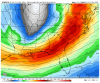
So we’ve got options. Jimmy likeCouple of interesting things from the Euro. Watch features 1 and 2 over the next few days, if you are looking for secondary wave development along the front or "embedded" as someone called it (sarcasm) tilting the trough axis negative with #2 can help you get there. If you want to try to slow the arctic front and fire a second low #1 can help you get there. Additionally a farther west and slightly stronger #1 would enhance the chance of widespread flurries/convective snow showers on Christmas day
View attachment 58609
L
Logan Is An Idiot 02
Guest
Gfs took a major set back. Cold air chasing moisture will never work out.
Sent from my Pixel 3 using Tapatalk
Sent from my Pixel 3 using Tapatalk
BufordWX
Member

NBAcentel
Member
Looks good to the eye on the sfc, but the tilt was a bit less favorable this run
BufordWX
Member
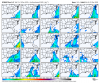
This accumulation map though... lol

Get that front to push all the way through and pop a trailing low west of Gainesville riding the Gulf Stream and us Carolina folk might have something to talk about.
L
Logan Is An Idiot 02
Guest
Looks a lot different on CODHmm. It looks about the same too me.
Sent from my Pixel 3 using Tapatalk
This should favor TN. NGA, NMS, NAL. WNC
NBAcentel
Member


NoSnowATL
Member
Looks fine to me and you.This accumulation map though... lolView attachment 58614