• Hello, please take a minute to check out our awesome content, contributed by the wonderful members of our community. We hope you'll add your own thoughts and opinions by making a free account!

Pattern November Knock-Out

This morning's 0z Euro run depicting a stout CAD dome over the Carolinas and GA to end the period. Weatherbell hasn't updated yet but the 12z run also has a CAD event near the end of the run again.
ecmwf_t2m_nc_41.png
ecmwf_slp_precip_nc_41.png
 
Not a forecast, but just an observation.
The Super Ensemble has been showing a cooler than normal mid-month in our region for four days now. Sure, it's not a temp forecast, only a departure probability and it could just be 1º, but ...
Also, there are other models that show a different solution.
However, the trend is worth noting, IMHO.
Here:
10.31.17.gif

11.1.17.gif

11.2.17.gif

11.03.17.gif
 
^This makes sense since the model consensus has clearly been cooling for the last few days fhe SE US and the E US in general for the period around 11/9-12+. Before the last few days., the EPS had been teetering between near and above normal after 11/7. The very latest run (12Z) has the last warm day Tue 11/7 followed by a transition Wed 11/8 and then bonafide colder than normal (say averaging about -5 F anomaly) Thu 11/9-Sun 11/12. This is much different from how it looked earlier, when it appeared warmer than normal could extend that far. Also, keep in mind that with this cooling model trend ongoing that further cooling adjustments could still occur.
 
The good news for those liking the much colder transition that is on the 12Z GFS for 11/9+: the 18Z GFS is very similar and is actually even colder in some places. especially in NC. For example to show the cooling progression, the low for Fri morning 11/10 at RDU:

Run/lFri low
0Z: 44
6Z: 40
12Z: 38
18Z: ~32

For the Sat AM 11/11 lows at RDU:

0Z: 50
6Z 48
12Z 33
18Z ~30

The low level cooling is enhanced by a strong wedge which is making the highs on Fri PM at RDU much colder on the last 2 runs:

0Z 62
6Z 61
12Z 50
18Z ~48

Edit: This would make RDU 14 below normal for Fri 11/10! Not too shabby after looking to be near normal to maybe still warmer than normal then on the early week model consensus!
 
Last edited:
This Bering, Kara, Barents sea ridge construct in the long range is interesting

Sent from my SM-G955U using Tapatalk
 
Similar to what the 12Z GEFS did for the 12Z GFS, the 18Z GEFS is validating the colder 18Z GFS nicely. So, it is looking more and more like this colder trend is for real. Not only is the 2nd week of Nov looking much colder than before and colder than normal, the latest trends suggest the SE may not go back to a torch the 3rd week of Nov and instead be near normal.

Using the 18Z GFS as a rough guideline, RDU would only be near +3 for Nov 1-18. That would be much cooler than how it looked (for the 1st half of Nov) on early week model consensus and would open the door to a near normal Nov. should it cool back off soon afterward..
Cool! :cool:
Now for some radiator busting ... LOL ... :p
 
Similar to what the 12Z GEFS did for the 12Z GFS, the 18Z GEFS is validating the colder 18Z GFS nicely. So, it is looking more and more like this colder trend is for real. Not only is the 2nd week of Nov looking much colder than before and colder than normal, the latest trends suggest the SE may not go back to a torch the 3rd week of Nov and instead be near normal.

Using the 18Z GFS as a rough guideline, RDU would only be near +3 for Nov 1-18. That would be much cooler than how it looked (for the 1st half of Nov) on early week model consensus and would open the door to a near normal Nov. should it cool back off soon afterward..
It's amazing what dropping an upper low off the PNW coast and cutting it off and allowing a ridge to build over top will do to the downstream pattern versus having a stringy full latitude trough

Sent from my SM-G955U using Tapatalk
 
Looks like a pretty big severe threat in the midwest this weekend. Currently an enhanced risk for areas of IL/IN/OH.
I know I'm temporarily displaced out of the South but am keeping my fingers crossed for tomorrow, might be a good chase day for me. Other than that the last 2-3 weeks have been absolutely brutal up here, 40's and rain almost every day :(
 
I know I'm temporarily displaced out of the South but am keeping my fingers crossed for tomorrow, might be a good chase day for me. Other than that the last 2-3 weeks have been absolutely brutal up here, 40's and rain almost every day :(
What part of Indiana are you in ?
 
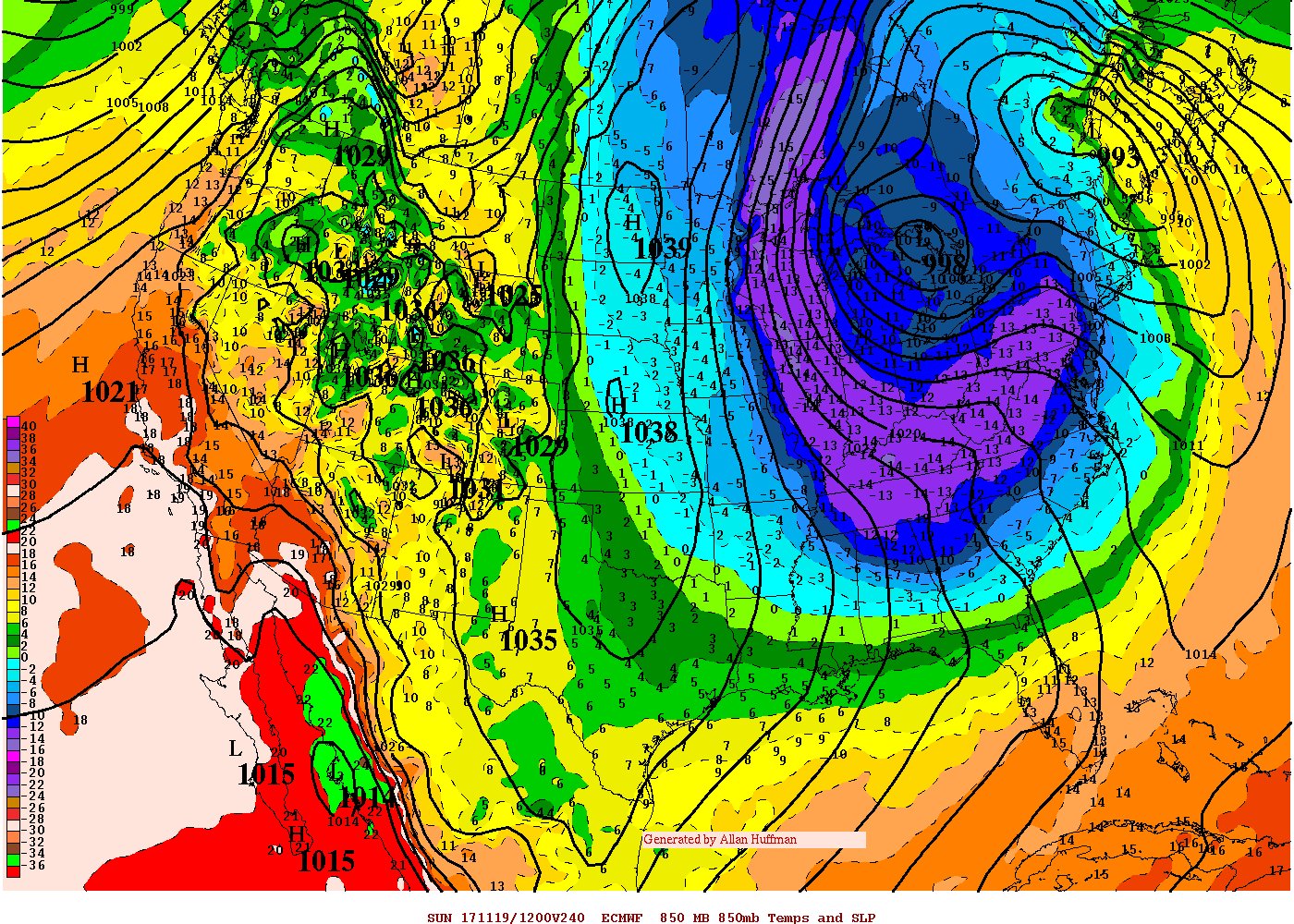
it dont... gfs looks nothing even remotely like this.... above average in this timeframe...
I understand, just wanted to post the image. GFS has been back n forth with cold, but has been trending cooler as Larry and Webb has been talking about. Yes the CMC is pretty aggressive with this cold but i wouldn't rule it out. CMC has been known of handling cold pretty well in the past.
 
I know I'm temporarily displaced out of the South but am keeping my fingers crossed for tomorrow, might be a good chase day for me. Other than that the last 2-3 weeks have been absolutely brutal up here, 40's and rain almost every day :(

Sounds like a November Bird Song ... Dry your eyes in the wind ... snow and rain ...

image.jpg


:cool:
 
Back
Top