KellynaMoon
Member
Thank you! I’ve been lurking for years and only made an account recently. Haven’t sorted it all out yet.


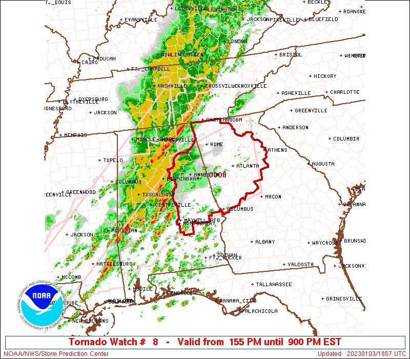
Warning issued. That may produce our first decent tornado of the day.Storm near Autaugaville about to need a warning.
Most of these warnings have been "radar indicated". Any ground reports of touch downs or funnel clouds?Warning issued. That may produce our first decent tornado of the day.
Looks like had a quick strike on the Chilton/Coosa line a few minutes ago.Most of these warnings have been "radar indicated". Any ground reports of touch downs or funnel clouds?
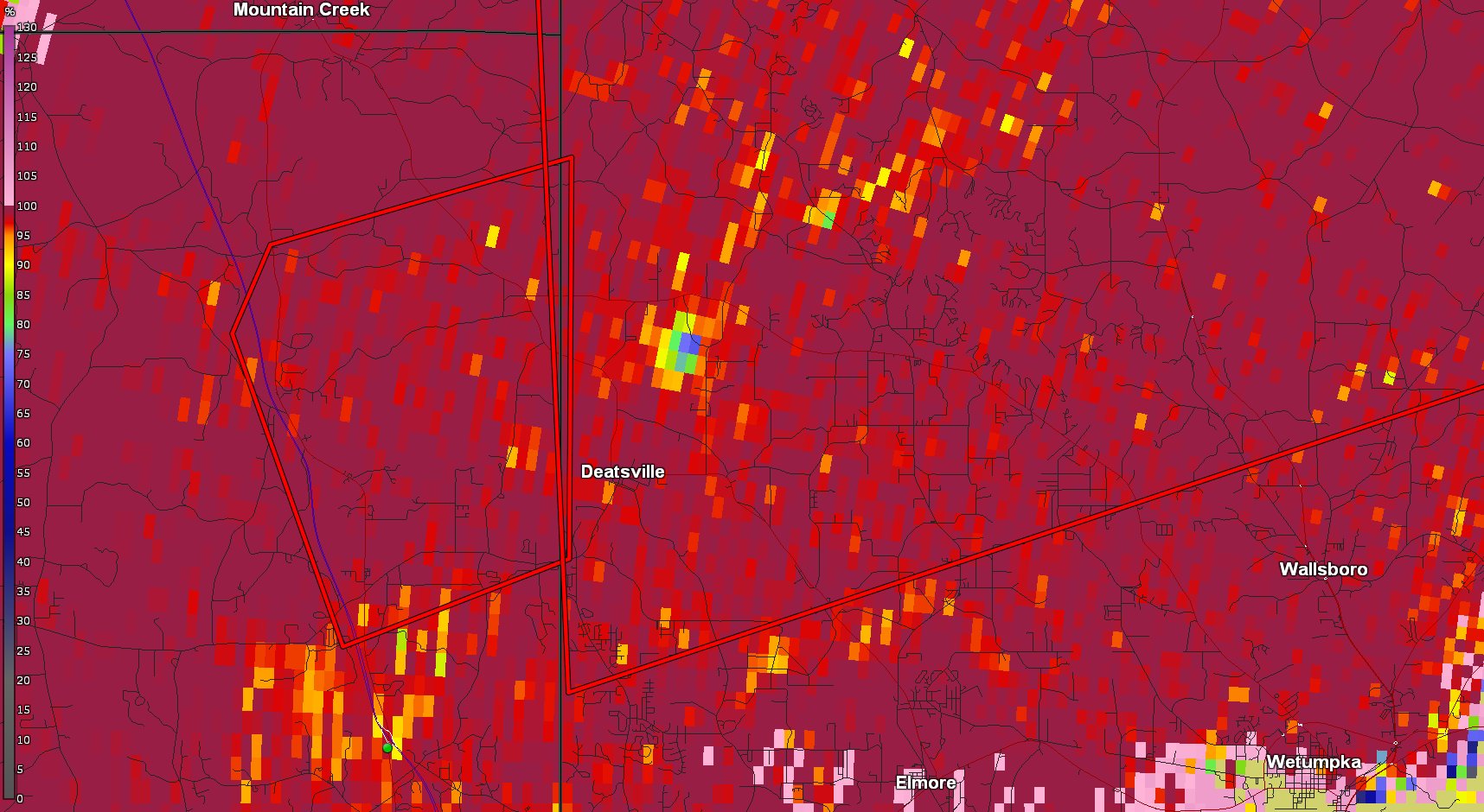
Couple of brief TDS signatures showing up every once and a while on the two warned cells. One currently NE of Deatsville, AL.Most of these warnings have been "radar indicated". Any ground reports of touch downs or funnel clouds?
While a messy storm mode; weaker low level helicity and unidirectional flow aloft saved the Montgomery area from a pretty good smack with the first wave.
Next wave is building up in southern MS. Probably arriving in central AL a little after midnight central time.What is the time frame on the second wave for central Alabama. I'm driving to work and can't look right now
Yeah, just saw this from James Spann:Next wave is building up in southern MS. Probably arriving in central AL a little after midnight central time.
Yeah, just saw this from James Spann:
@spann: The main window for “round two” of strong to severe thunderstorms will come from about 10:00 tonight through 5:00 a.m. tomorrow. Be sure you have a reliable way of hearing warnings late tonight if they are needed!
Is this second wave going to hold together around Atlanta?