B
Brick Tamland
Guest
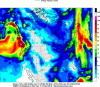
Yes, I noticed that blob of green was on top of me.Also the UK seems to follow the GFS in its depiction of the interior coastal plain (Wake Forest to Roanoke Rapids)being the biggest of the winners here for Central NC.