-
Hello, please take a minute to check out our awesome content, contributed by the wonderful members of our community. We hope you'll add your own thoughts and opinions by making a free account!
You are using an out of date browser. It may not display this or other websites correctly.
You should upgrade or use an alternative browser.
You should upgrade or use an alternative browser.
Pattern May Thread
- Thread starter Detective WX
- Start date
.02” and the afternoon looks like crap now. I’m about to go all Shetley in here.
D-Ray
Member
1.07 but .98 was from the storms last night
.02” and the afternoon looks like crap now. I’m about to go all Shetley in here.
Hate to say you could see this coming. The last three major systems have all died before getting here. I can't wait to see the look of bewilder on Glen Burns face this afternoon. This is definitely the beginning of what I hope is not a major drought.
I told my wife last night I had a feeling this would be a big fail. This is how droughts start.Hate to say you could see this coming. The last three major systems have all died before getting here. I can't wait to see the look of bewilder on Glen Burns face this afternoon. This is definitely the beginning of what I hope is not a major drought.
Z
Zander98al
Guest
Lol no kidding
Downeastnc
Member
MHX hinting at the low retrograding back inland over the SE and taking us from to little to too much rain....
"Thursday through Saturday...The low will slide southward off
the Southeast coast Thursday, then potentially retrograde back
over land by Friday and Saturday, finally allowing local winds
and swells to subside. This pattern brings the potential for a
conveyor belt of deep layer moisture advection to set up over
ENC late week into next weekend, which could be beneficial for
improving the ongoing drought, but will also have to be
monitored for potential flooding threats. Temps return near to
above normal late week."
Brent
Member
After a brief reprieve late next weekend / early the following week, 12z GFS brings the heat right back in until the end of this run, woth another "cool down."
Still not showing a ton of rain opportunities either...
Still not showing a ton of rain opportunities either...
NBAcentel
Member
Today's looking like it might be a bust temp-wise. DFW's only at 79*F as of 1pm.
We've been socked in stratus much of the morning. It tried to scatter out between 11am and 12pm, but has filled back in.
We've been socked in stratus much of the morning. It tried to scatter out between 11am and 12pm, but has filled back in.
Brent
Member
Today's looking like it might be a bust temp-wise. DFW's only at 79*F as of 1pm.
We've been socked in stratus much of the morning. It tried to scatter out between 11am and 12pm, but has filled back in.
Heh. Actually warmer than forecast here at 79
Dewpoint has creeped up to 61. It's really gonna get gross tomorrow
?

Last edited:
Heh. Actually warmer than forecast here at 79
Dewpoint has creeped up to 61. It's really gonna get gross tomorrow
?
View attachment 118246
Stratus is now finally mixing out. DFW was st 87*F as of 3pm.
The real story seems to be the dewpoints though. Widespread low/mid-70s.
Brent
Member
Stratus is now finally mixing out. DFW was st 87*F as of 3pm.
The real story seems to be the dewpoints though. Widespread low/mid-70s.
Yeah I mean the highs really aren't that insane(maybe the long stretch is but Tulsa usually has first 90 around now so that part isn't crazy) the real story is the humidity. My lows coming are 74/75 which is more like peak summer here
BHS1975
Member
Stratus is now finally mixing out. DFW was st 87*F as of 3pm.
The real story seems to be the dewpoints though. Widespread low/mid-70s.
When you have these kind of anomalies you will have higher dews.

Sent from my iPhone using Tapatalk
When you have these kind of anomalies you will have higher dews.

Sent from my iPhone using Tapatalk
Indeed.
Models are really struggling with the low clouds though, complicating the temperature forecast.
BHS1975
Member
Yeah I mean the highs really aren't that insane(maybe the long stretch is but Tulsa usually has first 90 around now so that part isn't crazy) the real story is the humidity. My lows coming are 74/75 which is more like peak summer here
I've noticed more humidity here for the summer the last few years with the extreme heat north of here.
Sent from my iPhone using Tapatalk
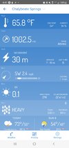
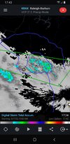
Some 2 and 2.5" pixels with 0 not 2 miles awayBeen thundering here for hours and the rain has basically been reforming in the exact same spots all afternoon. Just will not move.
View attachment 118248
Today's looking like it might be a bust temp-wise. DFW's only at 79*F as of 1pm.
We've been socked in stratus much of the morning. It tried to scatter out between 11am and 12pm, but has filled back in.
Unless we get an intra-hour high, it seems DFW gonna get 89'd.
Forecast high was 94*F yesterday, and it was lowered to 92*F this morning (still too warm).
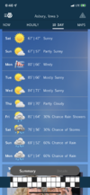
Our annual beach week is coming up the week of the 20th. I’m just here to say it better be 80 and sunny every day.
Unless we get an intra-hour high, it seems DFW gonna get 89'd.
Forecast high was 94*F yesterday, and it was lowered to 92*F this morning (still too warm).
DFW did manage to snag an intra-hour 90*F today.
Line finally moved a bit. Picked up .44. Not bad.
I ended up with .72” today… not bad at all considering my forecast today had no mention of rain.Line finally moved a bit. Picked up .44. Not bad.
BufordWX
Member
Dude! The weatherbug app? Really? I think y’all gave me crap about itBeen thundering here for hours and the rain has basically been reforming in the exact same spots all afternoon. Just will not move.
View attachment 118248
Feels like football season
Bannerdude
Member
1.00" in Moncure yesterday
Iceagewhereartthou
Member
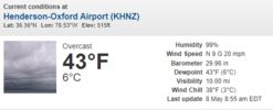
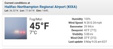
Gorgeous outside this morning! 52 and feels fantastic, looking for 40s tonight!?
We're giving them a run for it48 at my house, but the winner right now in central NC is Henerson. 43 with a windchill of 38:
View attachment 118252
NBAcentel
Member

