GeorgiaGirl
Member
68/60 with a humidity of 76% based off my most recent look. Keeping a watchful eye out here as well as it might get nasty here too. CAD isn't a factor today.
I think the central and southern midlands may be In for a ride because Sun is already peeking through clouds.63F around these parts and the WAA hasn't even started well over this way.


59 and completely covered in low clouds. Saved by the wedge!


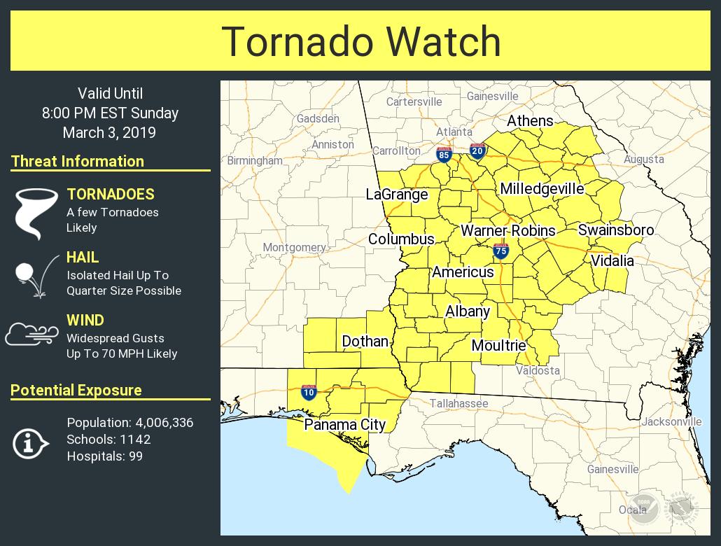
TOR Watch #8 includes Atlanta metro area until 8pm ET.

I’m actually looking forward to that later on this evening, I’m gonna sleep real good tonight47 with a driving rain here
Sent from my iPhone using Tapatalk