It's not impossible but we will see@SD and Rain Cold look to get split unless the line fills in, which is fine with me.
-
Hello, please take a minute to check out our awesome content, contributed by the wonderful members of our community. We hope you'll add your own thoughts and opinions by making a free account!
You are using an out of date browser. It may not display this or other websites correctly.
You should upgrade or use an alternative browser.
You should upgrade or use an alternative browser.
March 18-19th Possible Severe Wx Outbreak
- Thread starter NBAcentel
- Start date
It might not look like much now but I think that southern end of the line It'll continue to mature over the next hour or so ... looks nasty
B
Brick Tamland
Guest
Tornado warning for parts of Durham, Orange, and Person Counties.
Avalanche
Member
Man thats a Kansas, Oklahoma cumulonimbus!!View of the supercell to my east View attachment 79706
B
Brick Tamland
Guest

Not liking what I'm seeing on that cell. Pretty good rotation.Tornado warning for parts of Durham, Orange, and Person Counties.
NBAcentel
Member
Little TL on a cell that was rotating along the boundary dropping SE 
Shaggy
Member
It's not impossible but we will see
Models remain anemic with coverage
There's some rotation with the cell between Greensboro and Chapel Hill
Man, that's scary.Little TL on a cell that was rotating along the boundary dropping SE View attachment 79710
SouthGarnerSleet
Member
For areas north of Raleigh, the bigger story w/ this storm might legitimately end up being snow/sleet on Friday and not severe weather.
This is close enough to verification and has legitimate model support to where I don't think we can ignore the possibility esp north of the Triangle.
bad take here
LickWx
Member
In Wilson rn at the creamery . Was tempted to stop at the pizza inn.
mbway091
Member
In Wilson rn at the creamery . Was tempted to stop at the pizza inn.
You picked correctly
Downeastnc
Member
HRRR gives Pitt Co a few showers after the cells that pummel SD die to our west......
You picked correctly
From my last experience at the Creamery, he picked dead wrong. OOF
mbway091
Member
From my last experience at the Creamery, he picked dead wrong. OOF
Admittedly it has been over a decade since I’ve had it.
LickWx
Member
Yeah it’s not up to par but I’ll live lol.From my last experience at the Creamery, he picked dead wrong. OOF
Yeah it’s not up to par but I’ll live lol.
Yea sorry man. That Pizza Inn though, been great since I hit it up as a Boy Scout in the late 90's.
I haven’t checked the forum lately, but everything went NW of me. I didn’t even get any wind. I was watching FOX 8, crazy stuff there.Praying for @Ollie Williams
B
Brick Tamland
Guest
Have there been any damage reports in NC today?
Jon
Member
Have there been any damage reports in NC today?
Yes
Sent from my iPhone using Tapatalk
Have there been any damage reports in NC today?
Lot's back towards High Point. Check WRAL, they were just showing damage on TV at least.
Per Orange county scanner, deputy reported possible torando damage in northern Orange county. Trees down and structure collapse.
B
Brick Tamland
Guest
Yeah, WRAL saying damage in the Cedar Grove area of Orange County.
jay.p
Member
Will Raleigh see a severe storm pass by?
LickWx
Member
Last ive heard the storms down south by anson county and the ones just north of it are targeting us .Will Raleigh see a severe storm pass by?
I don't like either of the 2 that are kind of by themselves in that area. It wouldn't take a lot to turn those tornadicLast ive heard the storms down south by anson county and the ones just north of it are targeting us .
Bannerdude
Member
Phone just buzzed, tornado warning now for city of Durham (northern and western areas).
B
Brick Tamland
Guest
Northern Granville under a tornado warning. This is the storm that produced damage in Orange County.
B
Brick Tamland
Guest
Will Raleigh see a severe storm pass by?
Everything is going to the north of Wake for now.
The line is fixing to come through here now, though it’s kind of bowing around and seems like the worst might be to my NW.
Everything is going to the north of Wake for now.
Seems that way with the tilt of the line, but it's also the way the warm front settled I believe. If that's the case, the southern storms have not gotten into the warm juicy air yet, while the northern storms are just now getting into it a bit.
LickWx
Member
That’s weird I thought action is normally south and east of wake !Everything is going to the north of Wake for now.
B
Brick Tamland
Guest
That’s weird I thought action is normally south and east of wake !
Yeah, they must have a different gameplan this year.
Webberweather53
Meteorologist
Beautiful storm earlier near Troy this little guy is moving into Chatham county has weakened since but had a nice wall cloud apparently
Cary_Snow95
Member
I could be wrong but I think I hear the LLJ in Cary
Avalanche
Member
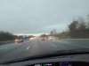
Split in Chatham co. Hardly a cloud. No wind. Tranquil.
B
Brick Tamland
Guest
Split in Chatham co. Hardly a cloud. No wind. Tranquil.
Same here.
Bannerdude
Member
Everything moving through the northern Triangle now appears to be quickly weakening