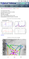
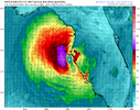
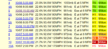
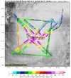
Recon about to make another eye pass. Should be in it by 1:10ish.
-
Hello, please take a minute to check out our awesome content, contributed by the wonderful members of our community. We hope you'll add your own thoughts and opinions by making a free account!
You are using an out of date browser. It may not display this or other websites correctly.
You should upgrade or use an alternative browser.
You should upgrade or use an alternative browser.
Tropical Major Hurricane Milton
- Thread starter SD
- Start date
Stormsfury
Member
I thought they were heading out it after the 925mb pass. Got fooled on it. Milton and Lenny are the only two storms I can remember that became monsters in the deep tropical region moving EasterlyRecon about to make another eye pass. Should be in it by 1:10ish.
URNT15 KNHC 071700
AF309 0814A MILTON HDOB 52 20241007
165200 2205N 09153W 6971 03078 9978 +092 +018 039044 046 057 004 00
165230 2204N 09151W 6967 03080 9959 +105 +020 040045 047 058 004 00
165300 2202N 09150W 6963 03079 9955 +104 +022 039047 049 059 005 00
165330 2201N 09149W 6967 03072 9957 +100 +022 042050 052 063 006 00
165400 2200N 09147W 6967 03066 9953 +098 +022 036050 051 064 007 00
165430 2159N 09146W 6967 03060 9947 +097 +020 036050 051 062 010 00
165500 2158N 09145W 6966 03056 9935 +102 +018 039054 056 058 007 00
165530 2156N 09143W 6963 03054 9931 +100 +019 040059 061 054 003 00
165600 2155N 09142W 6969 03037 9908 +110 +018 038062 063 057 002 00
165630 2154N 09141W 6966 03027 9895 +109 +020 034065 069 061 004 00
165700 2153N 09139W 6967 03005 9902 +086 +021 032068 071 063 008 00
165730 2151N 09138W 6978 02982 9876 +092 +022 035075 076 069 018 00
165800 2150N 09137W 6951 02982 9839 +098 +022 035075 078 072 014 00
165830 2149N 09135W 6980 02923 9817 +092 +028 036083 087 085 012 00
165900 2148N 09134W 6954 02910 9764 +094 +027 040099 106 097 015 00
165930 2147N 09133W 6972 02824 9690 +093 +024 041119 126 119 012 00
170000 2146N 09132W 6939 02763 9568 +103 +035 039135 143 144 022 00
170030 2145N 09130W 6938 02583 9385 +104 +051 037131 154 177 024 00
170100 2143N 09129W 7023 02354 9198 +171 +046 021043 102 167 003 03
170130 2142N 09127W 6958 02419 9144 +203 +031 274012 018 046 001 00
$$
;
912 mb.
Shaggy
Member
The eye has really cleared out now tooThe CDO is much more symmetrical now and really only needs slight improvement in the SSE quadrant. Excellent outflow across the board. It wouldn't surprise me for it to make it to 180 before weakening. Motion still looks ever so slightly south of due east.
I knew that hadn’t been many. It looks kinda strange watching the satellite picture and seeing a storm that strong moving eastI thought they were heading out it after the 925mb pass. Got fooled on it. Milton and Lenny are the only two storms I can remember that became monsters in the deep tropical region moving Easterly
Fascinating
Stormsfury
Member
Not to mention a nuclear 180-knot SMFR reading.914.1 MB! WTF!
View attachment 152795
I hope recon has enough fuel to stay on station until relieved. I presume this was the last center pass and would hate to see them miss this thing going sub-900Mb.
914.1 MB! WTF!
View attachment 152795
Seven more millibars to match Dean. Been a long time since we have tracked one this low.
Interestingly the recon didn't sample the SE quadrant in their latest eye pass..
One would assume the planes are dealing with quite the bumpy ride. I wouldn't want to try to get into this storm, that's for sure.
NoSnowATL
Member
175 911mb Monster
Vorticity
Member
BULLETIN
Hurricane Milton Intermediate Advisory Number 10A
NWS National Hurricane Center Miami FL AL142024
100 PM CDT Mon Oct 07 2024
...MILTON EXPLOSIVELY INTENSIFIES WITH 175-MPH WINDS...
...RESIDENTS IN FLORIDA ARE URGED TO FOLLOW THE ADVICE OF LOCAL
OFFICIALS...
SUMMARY OF 100 PM CDT...1800 UTC...INFORMATION
----------------------------------------------
LOCATION...21.7N 91.3W
ABOUT 105 MI...170 KM WNW OF PROGRESO MEXICO
ABOUT 700 MI...1130 KM SW OF TAMPA FLORIDA
MAXIMUM SUSTAINED WINDS...175 MPH...280 KM/H
PRESENT MOVEMENT...E OR 100 DEGREES AT 9 MPH...15 KM/H
MINIMUM CENTRAL PRESSURE...911 MB...26.90 INCHES
Brent
Member
I don't think I've ever seen NHC wording like that
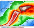
12Z main global runs:
Icon: Tampa Wed night (a bit N of 6Z/0Z’s Sarasota) vs 6Z’s Wed night/0Z’s Wed afternoon
CMC: Sarasota Thu AM (>24 hrs sooner than 0Z’s Fri AM)(N of 0Z’s Pt Charlotte)
JMA: Sarasota Thu AM (similar location and later than yesterday’s 12Z’s Wed evening
GFS: Port Richey (25 miles N of Tampa) Wed night (slightly S of 6Z’s Hudson and S of 0Z’s just N of Crystal River)
UKMET: Bradenton, MUCH further N of 0Z’s Naples and stronger; late Wed evening (later than 0Z’s Wed afternoon)
Euro: Tampa Wed night, near 6Z and just barely N of 0Z’s Bradenton; earlier than 6Z’s Thu morning but a little later than 0Z’s Wed evening
*So, 12Z has much smaller range than 0Z from 25 miles N of Tampa (Port Richey) to 50 miles S of Tampa (Sarasota)..so only 75 miles vs 0Z’s range of 200 miles
*From N to S 12Z: GFS, Icon/Euro, UKMET, CMC/JMA
*Timing of 12Z: ranges from late Wed evening to Thu morning
lexxnchloe
Member
Brent
Member
Henry2326
Member
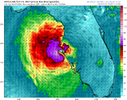
Hwrf 12z Thursday.....south of cedar key, for many times. Best case of them all from a people standpoint, but devastating.12Z main global runs:
Icon: Tampa Wed night (a bit N of 6Z/0Z’s Sarasota) vs 6Z’s Wed night/0Z’s Wed afternoon
CMC: Sarasota Thu AM (>24 hrs sooner than 0Z’s Fri AM)(N of 0Z’s Pt Charlotte)
JMA: Sarasota Thu AM (similar location and later than yesterday’s 12Z’s Wed evening
GFS: Port Richey (25 miles N of Tampa) Wed night (slightly S of 6Z’s Hudson and S of 0Z’s just N of Crystal River)
UKMET: Bradenton, MUCH further N of 0Z’s Naples and stronger; late Wed evening (later than 0Z’s Wed afternoon)
Euro: Tampa Wed night, near 6Z and just barely N of 0Z’s Bradenton; earlier than 6Z’s Thu morning but a little later than 0Z’s Wed evening
*So, 12Z has much smaller range than 0Z from 25 miles N of Tampa (Port Richey) to 50 miles S of Tampa (Sarasota)..so only 75 miles vs 0Z’s range of 200 miles
*From N to S 12Z: GFS, Icon/Euro, UKMET, CMC/JMA
*Timing of 12Z: ranges from late Wed evening to Thu morning
HMON 06z Thursday.....well you can see.
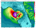
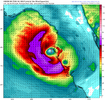
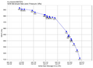
That is pretty astonishing. Still not even flattening out. It has to soon, though.
Brent
Member
That is pretty astonishing. Still not even flattening out. It has to soon, though.
Yeah at least it's doing it 2 days before Florida
I mean it'll still be really bad but no way it can keep that intensity
Henry2326
Member
Belle Lechat
Member
- Joined
- Aug 29, 2021
- Messages
- 1,529
- Reaction score
- 1,215
Shaggy
Member
Doubt he can break Wilmas record as he would need to drop another 25mb.
I'm not looking at all of the data and imagry right now, but just based on extrapolation, this thing appears dead set on breaking 900mb.
Mahomeless
Member
Doubt based on?Doubt he can break Wilmas record as he would need to drop another 25mb.
Belle Lechat
Member
- Joined
- Aug 29, 2021
- Messages
- 1,529
- Reaction score
- 1,215
Shaggy
Member
The fact wilma was 882 with a 2 mile wide eye. I think he gets down to 900-905 easily but reistically speaking sub 900 is almost unheard let alone sub 890Doubt based on?
Mahomeless
Member
Ok. Didn’t know if you were basing that off of data, storm structure, environment, etc….or just more of an “odds are it won’t because it’s unheard of”.The fact wilma was 882 with a 2 mile wide eye. I think he gets down to 900-905 easily but reistically speaking sub 900 is almost unheard let alone sub 890
Shaggy
Member
If he was more stationary over a deep pocket of hot water I'd say this would be one to test Wilma. Don't think he gets that low based on how anomalous she really was.Ok. Didn’t know if you were basing that off of data, storm structure, environment, etc….or just more of an “odds are it won’t because it’s unheard of”.
Doesn't change the fact Milton is an absolute monster in his own right
mydoortotheworld
Member
Theoretical max potential energy. Someone somewhere on Twitter has a map showing GOM supporting 900mb intensity but nothing less than that. But with the way pressure continues to drop like a rock we’ll see if that’s trueDoubt based on?
rburrel2
Member
It's probably breaching 900mb at the surface right now. We may never know though, because it might peak in a few hours and start to weaken before the next hurricane hunter gets in there.
The fact wilma was 882 with a 2 mile wide eye. I think he gets down to 900-905 easily but reistically speaking sub 900 is almost unheard let alone sub 890
I don’t think it challenges Wilma, but dang looking at the still cooling cloud tops, sub-900mb is possible.
iGRXY
Member
It 100% has a real shot of breaking sub 900mb. This thing is showing zero signs of weakening.
Brent
Member
Even if it decreases by 50 mph that’s still a significant hurricane.
Well yeah I mean I'm fully expecting a large cat 2-3 at minimum near Tampa. It's probably gonna be spreading out like a post tropical system

