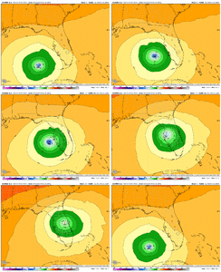
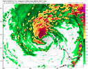
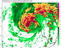
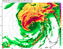
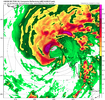
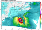
i think it is interesting that the short range models are north of the envelope. both nams model a northward lurch today before filtering back east. i don't like relying on these models but it's worth monitoring in case the hurricane models follow
-
Hello, please take a minute to check out our awesome content, contributed by the wonderful members of our community. We hope you'll add your own thoughts and opinions by making a free account!
You are using an out of date browser. It may not display this or other websites correctly.
You should upgrade or use an alternative browser.
You should upgrade or use an alternative browser.
Tropical Major Hurricane Milton
- Thread starter SD
- Start date
Triplephase93
Member
Neat tool to see how much surge affects certain areas.
 coast.noaa.gov
Sea Level Rise and Coastal Flooding Impacts
Sea Level Rise Viewer: Visualize community-level impacts from coastal flooding or sea level rise (up to 10 feet above average high tides) at U.S. coastal locations.
I noticed that most models from the 6z runs were too far left even at the 6hr forecast for 12z. Will be telling today.i think it is interesting that the short range models are north of the envelope. both nams model a northward lurch today before filtering back east. i don't like relying on these models but it's worth monitoring in case the hurricane models follow
Some deep convection firing on the northern half. Anyone have a dashboard or link to monitor surge gauges in the region later today?
Brent
Member
This is gonna be too close to call for Tampa
Henry2326
Member
If that verifies, would it pull up sooner, thus a further north landfall?I noticed that most models from the 6z runs were too far left even at the 6hr forecast for 12z. Will be telling today.
Henry2326
Member
NHC 11:00
The NHC intensity forecast lies between the statistical-dynamical models and the consensus aids at 12 hours, meaning that Milton is likely to be a category 3 or 4 strength at landfall.
On another note, Milton is expected to begin interacting with a front
later this evening, which is likely to cause the wind field to
expand on the hurricane's northwestern side. This will likely
cause very strong, gusty winds to occur even to the north of where
Milton makes landfall.
Milton is moving quickly toward the northeast (035/15 kt). The
track models insist that the hurricane will continue to move
northeastward but slow down through the rest of today, with a turn
toward the east-northeast occurring overnight. The NHC track
forecast maintains continuity with the previous predictions, lying
near the northern boundary of the guidance envelope and close to
where the raw model fields bring the center onshore.
FORECAST POSITIONS AND MAX WINDS
INIT 09/1500Z 25.8N 84.3W 125 KT 145 MPH
12H 10/0000Z 27.0N 83.0W 110 KT 125 MPH
24H 10/1200Z 28.0N 81.1W 75 KT 85 MPH...INLAND
36H 11/0000Z 28.7N 78.3W 65 KT 75 MPH...OVER WATER
48H 11/1200Z 29.1N 75.1W 55 KT 65 MPH...POST-TROP/EXTRATROP
60H 12/0000Z 29.3N 72.0W 50 KT 60 MPH...POST-TROP/EXTRATROP
72H 12/1200Z 29.9N 68.9W 45 KT 50 MPH...POST-TROP/EXTRATROP
96H 13/1200Z 31.4N 62.2W 35 KT 40 MPH...POST-TROP/EXTRATROP
120H 14/1200Z 32.8N 55.9W 30 KT 35 MPH...POST-TROP/EXTRATROP
Brent
Member
ForsythSnow
Moderator
Milton is definitely trying to push through the ERC again quickly. Looks similar to how it was a couple days ago and is really trying to push new storms out in the new eye. Eye size at 32 open NW currently.
Sure has. While the storm will likely never again have a donut eye, I wouldn't be surprised one bit to see some re-intensification over the next several hours before leveling off.Milton is definitely trying to push through the ERC again quickly. Looks similar to how it was a couple days ago and is really trying to push new storms out in the new eye. Eye size at 32 open NW currently.
As expected, the wind field is expanding rather dramatically.
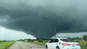
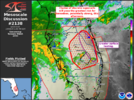
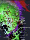
Looks like they have to worry about a tornado outbreak, too.
deluge0529
Member
Where is this? What is this?
South AL Wx
Member
Brent
Member
Where is this? What is this?
Somewhere in South Florida. Like something from the Plains in May
Honestly, unless something changes, my 120mph call may be generous.
Downeastnc
Member
Yeah shear is definitely giving it a beating. Most of the 12z hurricane models have it rising to 945-955mb before landfall. Wonder how winds will respondMilton looks ummmm less than optimal....
Brent
Member
Yeah shear is definitely giving it a beating. Most of the 12z hurricane models have it rising to 945-955mb before landfall. Wonder how winds will respond
I don't think the NHC will go below major before landfall no matter how bad it looks but we'll see
Honestly, unless something changes, my 120mph call may be generous.
I haven’t seen anyone say this but I hope you’re right. On what are you basing this? My guess was 125 and I’d love to miss it too high. However, even if so, would it change the overall effects all that much? It still looks to be a monster.
Great to see but then again this has been expected/forecasted and it is still a beast.
Triplephase93
Member
A couple of these cams have IR technology.
I haven’t seen anyone say this but I hope you’re right. On what are you basing this? My guess was 125 and I’d love to miss it too high. However, even if so, would it change the overall effects all that much? It still looks to be a monster.
Great to see but then again this has been expected/forecasted and it is still a beast.
Satellite trends mostly. The trump card is eventually extratropical transition will slow the bleeding, but how much weakening happens before then. That said, if dry air will hollow out the rest of the core, I think it would really help the landfall regions. Still gonna be a nasty storm regardless, but if those really high winds aloft can’t make it to the surface, it will definitely help.
I see the HWRF gave up on north of Tampa landfall. Just got finished putting up the hurricane shutters just in case.
Mahomeless
Member
Falling apart rather rapidly at the moment.
JMB
Member
Which is a good thingFalling apart rather rapidly at the moment.
South AL Wx
Member
2 pm advisory: Down to 130 mph, pressure up to 944 mb. But the wind field is expanding.
Listening to the Statewide Amateur Radio Net in Florida, and they just said they have 12 tornado warnings now.

 www.broadcastify.com

SARNET - Florida's State Wide Connected Repeater System Live Audio Feed
SARNET - Florida's State Wide Connected Repeater System Live Audio Feed on Broadcastify.com
2 pm advisory: Down to 130 mph, pressure up to 944 mb. But the wind field is expanding.
Which is a good thing
It would be a great thing if it were really “falling apart rather rapidly”. I hope it is but that sounds like a bit of an exaggeration especially the “falling apart” portion, which makes it sound like it will no longer be that big of a deal. Imho
Henry2326
Member
Falling apart rather rapidly at the moment.
Regardless, the storm surge based on everything I’ve read still is going to be very high a la Katrina after she weakened from a 5 to a 3. Also, the very heavy rainfall and tornadoes are still expected to be bad.
Henry2326
Member
Henry2326
Member
Shaggy
Member
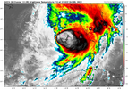
If you looked at the IR loops of both Milton and Leslie and then asked which one was 130mph storm versus an 85mph storm and I'd bet you guess wrong.
The tornado outbreak might be the big story with this when it's all over.
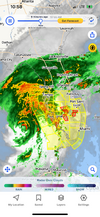
The outer eyewall is closing off on the south side in the past few radar frames. If this persists, some modest reintensification would occur.

