NBAcentel
Member
Interesting, uni flow and skinny cape tho, that’s a low topped sup/QLCS type sounding there from Laura’s remnants, kinda depends on timing to 


Honestly think that’s the most realistic scenario12z ICON slightly east of last forecast and slightly weaker at 972. It running slightly faster than GFS....
View attachment 47104
He may be right, but i think there's a decent shot at northern NC feeling a few impacts.Brad still going with no impacts even with the remnants here in NC
Honestly think that’s the most realistic scenario
Small scale atmospheric differences that could prevent Laura from RI. She is going over a cold spot of water. I don't expect her to be significantly affected by this but it goes to show GOM is not as primed as it is made out to be. While the sea surface temperatures are great the oceanic heat content is not fantastic everywhere.


ICON is and has been running faster than GFS and HWRF by about 12 hours. This version shortened tO 6 hours. The rapid intensification in the GFS happens in the last 12 hours before landfall.....
So if it the storm runs quicker, we get an Icon result.
If it runs slower we get a GFS/HWRF result.
All three are ending up in the same general area.
GSP discussion.....The remnantsBrad still going with no impacts even with the remnants here in NC

A couple things here. #1) The cone says nothing about flooding or tornado impacts. #2) The event is still several days away. It is way too early to be getting into specifics regarding impacts that far inland. It is much easier to slowly walk the impacts upward than it is to flip flop all over the place.I'm not bashing anyone but for those living in flood prone areas you should monitor the national hurricane center and follow Laura closely. Screaming zero percent impacts on the top of your lungs on social media six days out is crazy whether they right or wrong. This was said 30 mins ago even after the latest NHC cone warns the majority of North Carolinian's could be impacted with flooding and tornadoes.

I think you’re correct on this one and I don’t view this as bashing someone as much as questioning what they said. GSP mentions in its discussion this morning that the remnants will likely increase moisture and rain chances late in the week, and as has been discussed, a remnant low moving through Tennessee and the Carolinas could bring severe weather.I'm not bashing anyone but for those living in flood prone areas you should monitor the national hurricane center and follow Laura closely. Screaming zero percent impacts on the top of your lungs on social media six days out is crazy whether they right or wrong. This was said 30 mins ago even after the latest NHC cone warns the majority of North Carolinian's could be impacted with flooding and tornadoes.
12z HWRF identical to 06z other than 934 pressure compared to 931. It tracked on the south side of the islands and crosses over land coming off the island at 994, identical to GFS......Icon comes off at 1001 which is part of the variance in the pressure diiference.
View attachment 47114
Yea, I'm expecting NHC to upgrade to a major later today or tomorrow. I said yesterday they need to wait and see how it comes off the island.We all know intensity forecast are the hardest for NHC and the models to get right especially a storm thats interacting with land some what. It could very easily blow up or struggle to get an inner core.
This move to the south of Cuba ups its chances of cat 3 or better IMO.
.png")
Come on man!!! What about other places that's not NC that are fixing to get hit the hardest?? I understand your concern about your town but theres more than yoursI'm not bashing anyone but for those living in flood prone areas you should monitor the national hurricane center and follow Laura closely. Screaming zero percent impacts on the top of your lungs on social media six days out is crazy whether they right or wrong. This was said 30 mins ago even after the latest NHC cone warns the majority of North Carolinian's could be impacted with flooding and tornadoes.

Euro in line with the other models finally lol but will it last? I'm still not 100 percent sold on anything there is a good consensus at the moment on around the border or SW LA thoughView attachment 47115
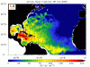
Hmmm, maybe some weak shear close to landfall all though it’s not much View attachment 47118
This timing is running with ICON.....GFS and HWRF stay over water longer.Euro in line with the other models finally lol but will it last? I'm still not 100 percent sold on anything there is a good consensus at the moment on around the border or SW LA thoughView attachment 47115
With center south of Cuba... makes you wonder if their could be a more expansive wind field as it strengthens than what models are indicatingThe keys are already seeing a couple of noticeable wind gusts from the outer bands. I saw a report of a 70 mph wind gust in Key west.