• Hello, please take a minute to check out our awesome content, contributed by the wonderful members of our community. We hope you'll add your own thoughts and opinions by making a free account!

Tropical Major Hurricane Helene

Almost 2.5 inches in northeast Gwinnett county from Day 1 of this whole system. Rain to south trying hard to drive north especially east of Atlanta so I wouldn’t be surprised if we get another inch by morning here. It will probably dry out for a bit in Atlanta and west until the southeasterly flow strengthens and drives the rain bands back to the northwest.

Tonight is the night to get some sleep. Tomorrow night looks to be a long and active one for many of us.
 
Currently sitting at 3.67 inches back home. In St. Thomas right now and wondering if we will be able to get back to Atlanta tomorrow evening. It has been calm seas the whole time we have been here since last Friday. Today was the first day of choppy rough seas and windy conditions. The ocean water is definitely like bathtub water. Praying for the best for everyone.
My mom is on a cruise to St.Thomas/Martin, carnival, she gets back Sunday. She lives in PCB (across from Pier Park) so I have been on double duty watching this hurricane track and intensity, good friends are shuddering her house and thankfully we already have her pups!
 
This was posted on FB by Steven Nelson, forecaster at NWS Ptree City office. Pretty sobering stuff:

For PTC and north Georgia friends, here's the latest update on Helene.

tldr; Helene will produce Opal-like (1995) rainfall and flooding and Hugo-like (1989) inland wind impacts. Google those storms and prepare accordingly. Sleep downstairs/away from windows Thursday night. Prepare for extended power outages.

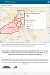
The heavy rain that was forecast began today and will continue in waves tonight, tomorrow, tomorrow night, Friday morning ✋. By that point we should have around 6 inches of rain with a 10% chance of seeing ~9 inches. See the map below for even more ridonkulous worst-case/90th percentile amounts in the NE GA/W NC mountains. and box and whisker rainfall plot for Peachtree City. Yea, we need the rain but not so much over so fast please. 🙏 River forecasts from US National Weather Service Southeast River Forecast Center are taking many points from drought levels to major flood stage (10-50 year flood event) in just 12-24 hours.

The inland wind impacts Thursday night and Friday morning will be unprecedented. In response to a deep upper low to the west, Helene is using that "Fujiwara-slingshot" itself north at 30 mph (Michael's NE motion was only 15 mph at landfall), maintaining hurricane strength perhaps as far north as I-20. This swath of high winds will extend well east all the way to Augusta and into SC. See the wind gust box and whisker plots for Tallahassee, Albany and Peachtree City below. It will be bad here but Tallahassee is really in the crosshairs.

I can't find data on Hugo's forward speed but it's intensity was 140 mph at landfall. It carried hurricane force winds so far inland it destroyed 1/3rd of the harvestable timber in South Carolina (over $1B in 1989 dollars), enough to build 600,000 homes. Michael also produce $1B of forestry loss and $2.5B of agricultural losses and 400K without power. Irma peaked at 1M without power. Helene will likely exceed the wind impacts of Frances, Opal, Irma and Michael and may even surpass Hugo in the amount of inland treefall, agricultural loss, damaged homes and number of customers without power.

There's still time to stock up on water and other necessities tomorrow before the strong winds arrive. Once winds exceed 35 mph, power companies will not respond, at ~50 mph first responders won't either. Prepare for being without power for an extended period. Irma (2017) knocked out power in DeKalb county for 3 days. Forecasts and storm response by first responders, state and local government, Georgia Forestry Commission, power companies and others are much better these days. Most areas won't see outages that long, but some will.

The east winds will hit hard Thursday night. If you have large trees and tree limbs near and especially to the east of rooms where you and your family sleep, I strongly recommend sleeping downstairs and away from any windows. Keep your cell phones charged and near your bed to alert you to any tornadoes or level 2 or 3 flash flood warnings. The flashlight also comes in handy.

If you read this far, please help spread the word to family and friends in the path of this storm, especially those in their later years or that may not use social media or watch the news. A phone call might give you a chance to catch up and let them know you're thinking about them. Stay safe everyone!

Link

Hugo brought hurricane force wind gusts all the way to Charlotte. It was 90 mph when it went through there. Hugo was going at 25 mph when it made landfall.
 
I am sorry, but this is definitely enough for me. With this recent GGEM Eastward tug, too much agreement with globals that handle 500mb better than the hurricane models with the track. I'll gladly be wrong for mby's sake though. My Athens area for Eastern extent track stands.
 
My pws reporting 3.44 inches on the day here in Duluth. Lost power twice, the longest period was for about 2 hours earlier this evening.
 
0Z UKMET: a bit E of 12Z and a little stronger once again as expected with landfall Big Bend and goes over Athens or 65 miles E of ATL/75 miles E of NHC:

HURRICANE HELENE ANALYSED POSITION : 22.8N 86.8W

ATCF IDENTIFIER : AL092024

LEAD CENTRAL MAXIMUM WIND
VERIFYING TIME TIME POSITION PRESSURE (MB) SPEED (KNOTS)
-------------- ---- -------- ------------- -------------
0000UTC 26.09.2024 0 22.8N 86.8W 976 52
1200UTC 26.09.2024 12 24.6N 85.7W 972 50
0000UTC 27.09.2024 24 28.6N 84.0W 967 62
1200UTC 27.09.2024 36 34.5N 83.3W 979 37
0000UTC 28.09.2024 48 38.3N 86.9W 985 33
1200UTC 28.09.2024 60 36.7N 87.7W 995 16
0000UTC 29.09.2024 72 37.6N 87.2W 1002 24
1200UTC 29.09.2024 84 37.0N 87.0W 1006 21
0000UTC 30.09.2024 96 37.2N 86.8W 1009 20
1200UTC 30.09.2024 108 CEASED TRACKING
 
The hurricane is sitting directly over the loop current right now with towers building. Dry air is basically non existent. The only question is if the storm can develop an inner eye instead of fighting with out outer ring all night long (due to her size).

My guess is Cat 4 by 11AM if she gets a dominant eye-wall in the next couple of hours.

goes16-ir-09-L-optimize.gif
 
Looking at water vapor there is dry air issues still...it does appear she has almost closed off her inner core but it's not the look of a storm about to go bonkers IMO...that warming cloud tops just NE of the center typically is not something you see that close to the core of a system trying to go RI. That said she does look better and recon is almost there.
 
The hurricane is sitting directly over the loop current right now with towers building. Dry air is basically non existent. The only question is if the storm can develop an inner eye instead of fighting with out outer ring all night long (due to her size).

My guess is Cat 4 by 11AM if she gets a dominant eye-wall in the next couple of hours.

goes16-ir-09-L-optimize.gif
She looks poised to go bombs away!
 
Back
Top