Drizzle Snizzle
Member
Damn...
Hopefully nobody was in this building.
Damn...
Glad you are safe! That is exactly why I didn't want this thing to my west. Crazy stuff!Hey guys. I’m on my wife’s hotspot. Been off grid a while. We’ve got cell towers down and power out accross the grid. It looks like a war zone here. Power lines down in the roads everywhere. 100 year oak trees snapped at the base. Pine trees splintered and snapped. Debris everywhere. National guard out doing clean up. It’s a mess. This is the new benchmark around here. Thankfully I was able to find a path to get back home earlier. I’ll keep y’all updated. My house is still standing.


Is this real???View attachment 152206

 www.wbir.com
Probably doesn’t, it’s all in the Watauga river valley. Hope those people left, however not many permanent residents there anyways mostly vacation homes so may but be too badHopefully this isn't banter... Anyone heard of anything out of Valle Crucis and places like that? I'm thinking that the entire area may not exist anymore.
Here's a post from the Watauga Traffic alerts group. This is near the Mast General StoreHopefully this isn't banter... Anyone heard of anything out of Valle Crucis and places like that? I'm thinking that the entire area may not exist anymore.

Looks like both Mast General Stores were flooded.Here's a post from the Watauga Traffic alerts group. This is near the Mast General Store View attachment 152211


At 330 PM EDT, dam operators reported the failure of Walters DamDam upstream of Newport TN has failed: mayor ordering evac of downtown

And WRAL reporting 14 buildings damaged.15 injured in Rocky Mount tornado


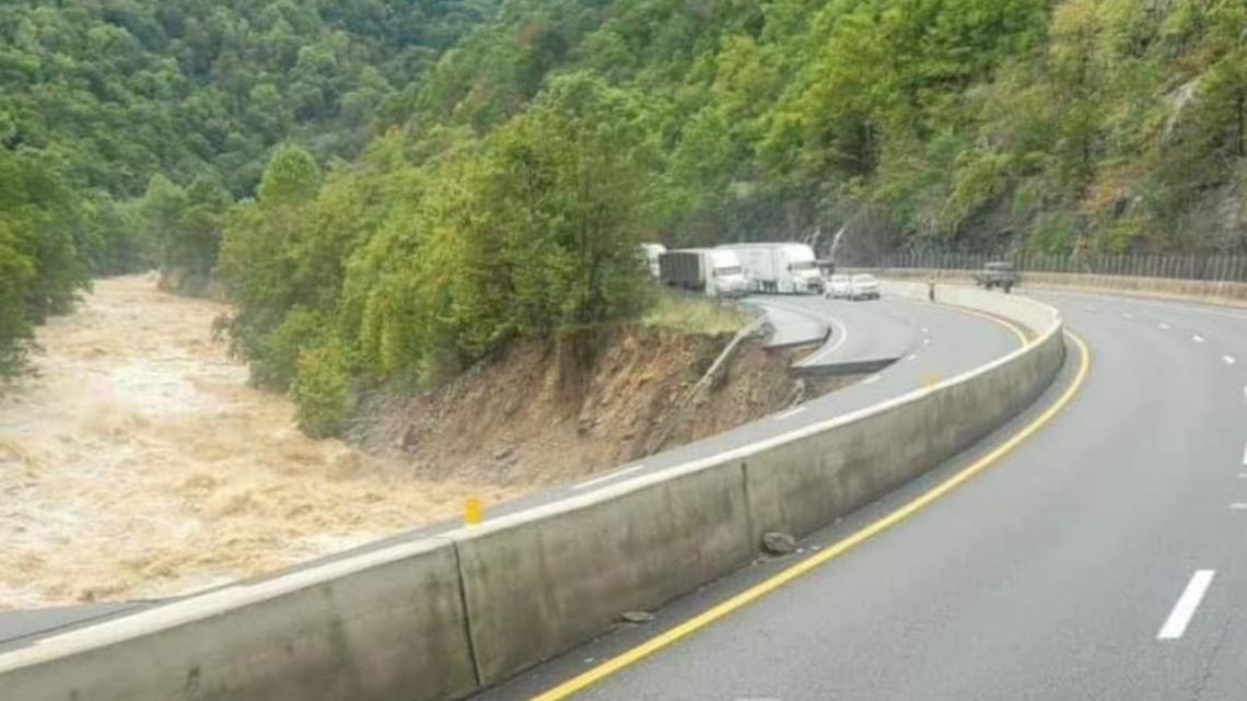
It was a rock slide last time that had it closed forever if I recall.

That's bad, but honestly not as bad as I thought it would be.Here's a post from the Watauga Traffic alerts group. This is near the Mast General Store View attachment 152211
