I would call the local police department directly and ask.My in-laws live on a mountain near Spruce Pine/Banner Elk in NC. We are unable to reach them - phone calls going straight to voicemail. Does anyone know of somewhere I can see a map of police reports or anything like that?
-
Hello, please take a minute to check out our awesome content, contributed by the wonderful members of our community. We hope you'll add your own thoughts and opinions by making a free account!
You are using an out of date browser. It may not display this or other websites correctly.
You should upgrade or use an alternative browser.
You should upgrade or use an alternative browser.
Tropical Major Hurricane Helene
- Thread starter SD
- Start date
- Status
- Not open for further replies.
All said and done good experience. Lost a car and have to fly home, but good experience overall
Belle Lechat
Member
- Joined
- Aug 29, 2021
- Messages
- 1,529
- Reaction score
- 1,215
My in-laws live on a mountain near Spruce Pine/Banner Elk in NC. We are unable to reach them - phone calls going straight to voicemail. Does anyone know of somewhere I can see a map of police reports or anything like that?
If you know a Ham radio operator, they may be able to help.
Belle Lechat
Member
- Joined
- Aug 29, 2021
- Messages
- 1,529
- Reaction score
- 1,215
All said and done good experience. Lost a car and have to fly home, but good experience overall
That sounds terribly unpleasant. Car flooded?
Trees. Damaged it and then engine seized up. A storm chaser from Memphis got me out of there. Good guyThat sounds terribly unpleasant. Car flooded?
Drizzle Snizzle
Member
I’m just glad you’re ok. You can always replace a car.Trees. Damaged it and then engine seized up. A storm chaser from Memphis got me out of there. Good guy
Not worried about it in the least. Part of the hobby
SuperNET
Member
Belle Lechat
Member
- Joined
- Aug 29, 2021
- Messages
- 1,529
- Reaction score
- 1,215
116 PM EDT FRI SEP 27 2024
THE NATIONAL WEATHER SERVICE IN RALEIGH HAS ISSUED A
* TORNADO WARNING FOR...
NORTHEASTERN NASH COUNTY IN CENTRAL NORTH CAROLINA...
NORTHWESTERN EDGECOMBE COUNTY IN CENTRAL NORTH CAROLINA...
NORTHEASTERN WILSON COUNTY IN CENTRAL NORTH CAROLINA...
* UNTIL 145 PM EDT.
* AT 116 PM EDT, A SEVERE THUNDERSTORM CAPABLE OF PRODUCING A TORNADO
WAS LOCATED NEAR ROCKY MOUNT, MOVING NORTH AT 45 MPH.
Sctvman
Member
Sent from my SM-G998U using Tapatalk
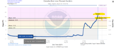
The French Broad and Swananoa Rivers join and Flow Northeast, dumping out over in TN. Big River flooding heading those folks way
Triplephase93
Member
My mom’s condo in Englewood Florida took on 1-2 feet of water inside. She just got done replacing floors, sheet rock and furniture from Ian
Downeastnc
Member
This can kill you....there will be fatalities found as they get into the harder hit areas....
SuperNET
Member
My in-laws live on a mountain near Spruce Pine/Banner Elk in NC. We are unable to reach them - phone calls going straight to voicemail. Does anyone know of somewhere I can see a map of police reports or anything like that?
Mitchell County EM - below is there website - there is a contact section.

Emergency Management - Mitchell County, North Carolina
Mitchell County Emergency Management is responsible for disaster planning and response to hazardous materials & natural and manmade disasters.
 www.mitchellcountync.gov
Mitchell County Sherriff -

Sheriff - Mitchell County, North Carolina
The Mitchell County Sheriff’s Department protects citizens through crime investigation and prevention.
 www.mitchellcountync.gov
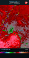
Confirmed tornado on the ground north of Rocky Mount!
Downeastnc
Member
Looks like the tornado near Rocky Mount has lifted.
Belle Lechat
Member
- Joined
- Aug 29, 2021
- Messages
- 1,529
- Reaction score
- 1,215
144 PM EDT FRI SEP 27 2024
THE NATIONAL WEATHER SERVICE IN RALEIGH HAS ISSUED A
* TORNADO WARNING FOR...
NORTHWESTERN EDGECOMBE COUNTY IN CENTRAL NORTH CAROLINA...
CENTRAL HALIFAX COUNTY IN CENTRAL NORTH CAROLINA...
* UNTIL 230 PM EDT.
* AT 144 PM EDT, A SEVERE THUNDERSTORM CAPABLE OF PRODUCING A TORNADO
WAS LOCATED 12 MILES NORTHEAST OF ROCKY MOUNT, MOVING NORTHEAST AT
35 MPH.
* THIS DANGEROUS STORM WILL BE NEAR...
HALIFAX AROUND 200 PM EDT.
OTHER LOCATIONS IMPACTED BY THIS TORNADIC THUNDERSTORM INCLUDE
ENFIELD, WELDON, LEGGETT, TILLERY, AND WHITAKERS.
Downeastnc
Member
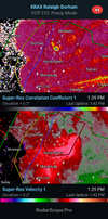
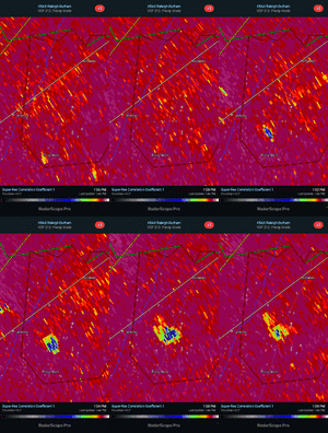
Decent CC drop so it definitely tore stuff up, hopefully its all tree debris....
Belle Lechat
Member
- Joined
- Aug 29, 2021
- Messages
- 1,529
- Reaction score
- 1,215
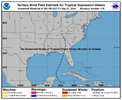
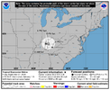
| ...HELENE STILL PRODUCING HISTORIC AND CATASTROPHIC FLOODING OVER PORTIONS OF THE SOUTHEAST AND SOUTHERN APPALACHIANS... |
| 2:00 PM EDT Fri Sep 27 Location: 36.6°N 84.6°W Moving: NNW at 28 mph Min pressure: 982 mb Max sustained: 35 mph |
Just heard a call on the scanner for a structure collapse in Rocky Mount.
Anybody seen anything from the SW mtns? Brevard/Highlands/Waynesville etc?
Sctvman
Member
Tennessee
Sent from my SM-G998U using Tapatalk
Sent from my SM-G998U using Tapatalk
Belle Lechat
Member
- Joined
- Aug 29, 2021
- Messages
- 1,529
- Reaction score
- 1,215
Shaggy
Member
Not if you're in your car chasing it !!!
Belle Lechat
Member
- Joined
- Aug 29, 2021
- Messages
- 1,529
- Reaction score
- 1,215
I'm good haha. Not interested in chasing a rain wrapped tor through the back, wooded roads of Halifax CoNot if you're in your car chasing it !!!
Hey guys. I’m on my wife’s hotspot. Been off grid a while. We’ve got cell towers down and power out accross the grid. It looks like a war zone here. Power lines down in the roads everywhere. 100 year oak trees snapped at the base. Pine trees splintered and snapped. Debris everywhere. National guard out doing clean up. It’s a mess. This is the new benchmark around here. Thankfully I was able to find a path to get back home earlier. I’ll keep y’all updated. My house is still standing.
WRAL reporting 4 people were injured in Rocky Mount from the tornado.
Belle Lechat
Member
- Joined
- Aug 29, 2021
- Messages
- 1,529
- Reaction score
- 1,215
I'm good haha. Not interested in chasing a rain wrapped tor through the back, wooded roads of Halifax Co
I don't know how far you'd get if you tried (trees and water in road).
Drizzle Snizzle
Member
Cincinnati is getting stronger winds from Helene than Atlanta. That’s insane !
Man.
LickWx
Member
Man, when I read that at first my mind went somewhere else… jimmy you animal! Stay safeHey guys. I’m on my wife’s hotspot. Been off grid a while. We’ve got cell towers down and power out accross the grid. It looks like a war zone here. Power lines down in the roads everywhere. 100 year oak trees snapped at the base. Pine trees splintered and snapped. Debris everywhere. National guard out doing clean up. It’s a mess. This is the new benchmark around here. Thankfully I was able to find a path to get back home earlier. I’ll keep y’all updated. My house is still standing.
Downeastnc
Member
Downeastnc
Member
Damn...
- Status
- Not open for further replies.

