Brent
Member
Special NWS soundings coming
This is getting real now
This is getting real now
It’s gonna be a lot less than 98212Z Euro 982 Thu evening in vicinity of Apalachicola; ATL Fri AM 992
While correct, a lot are getting happy or sad and there is no Center of Circulation yet! Let it form before getting excited, depressed, whatever! Not directed at you but it’s getting ridiculous!Forward speed, size of the wind field are important. The thing to look at here though is the potential of the storm merging into the jet stream, which would help to enhance it well inland
What’s that mean exactly?Special NWS soundings coming
This is getting real now
It’s gonna be a lot less than 982
What’s that mean exactly?
Likely has everything to do with the jet stream influence. Another model suite with agreement of such widespread impacts, and a major hurricane likely, getting the path and inland interactions down better is key. The way it's coming in at the speed it is too is concerning. This is under 5 days from landfall and is basically nothing yet in terms of designation.They only do them for big US threats. It's just for the models
I wonder if there's any chance that nothing develops at all ? Or is it pretty much a lock at this point ?Likely has everything to do with the jet stream influence. Another model suite with agreement of such widespread impacts, and a major hurricane likely, getting the path and inland interactions down better is key. The way it's coming in at the speed it is too is concerning. This is under 5 days from landfall and is basically nothing yet in terms of designation.
I wonder if there's any chance that nothing develops at all ? Or is it pretty much a lock at this point ?
06Z GEFS with more members toward the Big Bend area and 12Z with more members in the Panhandle. Is the ULL having an influence or pull on this in the 12Z run?
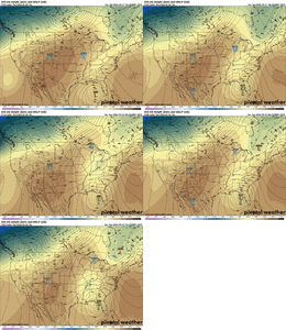
View attachment 151451View attachment 151452
Was this detail published somewhere? Interested in checking it out if so.Special NWS soundings coming
This is getting real now
Was this detail published somewhere? Interested in checking it out if so.
Lot of big hitsView attachment 151453
I'm good with that as long as I'm off that nightSo almost a cat 1 to near Bham. That will be fun.
Fortunately Birmingham wouldn't be on the east side.So almost a cat 1 to near Bham. That will be fun.
Fortunately Birmingham wouldn't be on the east side.
Almost like it purposely sneaks around so it’s over water the whole timeLot of big hitsView attachment 151453
That is a huge tornado threat for all of GALot of big hitsView attachment 151453
September seems a little early for fall break considering school started back last month !Lots of people from Atlanta area on fall break from school this coming week. Be racing home from the beach
I don’t believe that it’s going to turn that far NW but we will see.That is a huge tornado threat for all of GA
September seems a little early for fall break considering school started back last month !
Lol I know. Our district goes back Aug 1st every year and get fall break last week of SeptemberSeptember seems a little early for fall break considering school started back last month !
I don’t believe that it’s going to turn that far NW but we will see.
12z AI Euro View attachment 151454

She will be east again, Cedar Key my guess.Let’s see what the happy hour GFS has in store for us
