HugeSnowStick
Member
Oh, now they move the track back to the Euro, I see. Fly the planes, let us call the shots, NHC. We don't need you guys now that we have the Euro AI!

One thing I noticed is the nhc weakened intensity guidance but there’s a lot of water between their max intensity point and the coast.
Just saying
Gon be good for 50 mph gusts there! Windy dayEven if these gusts are, let’s say 25% off, those are still significant for a good portion of CLT and the metro.
View attachment 151925
With this look and all the lopsided convection and dry air wrapping in, I don’t see this becoming a Cat 3, imo
It’s almost never as bad as it’s made out to be.There’s always potential for it to be but usually never pans out.Dryslot gonna keep this from being a lot worse! Latest GFSView attachment 151928
View attachment 151929View attachment 151930
Cat 3 FL winds now on the east side. It's bomb time most likely the moment hot towers go up on the west side unless the dropping pressure/increasing winds spread the rest around faster.Pressure keeps dropping. Dry air is gone and recon shows a closed eyewall.
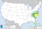
Hrrr Says central.and eastern NC have tornado problemsWith the shifts overnight to the east, it’s pushing the tornado threat overnight today and early Friday that way.
View attachment 151924

It seems like dry air always finds its way in, no matter what. Very interesting.It’s almost never as bad as it’s made out to be.There’s always potential for it to be but usually never pans out.
Yep, with the slight shift east the severe threat here tomorrow is getting a little attentionHrrr Says central.and eastern NC have tornado problems View attachment 151933

Winds will still be huge issue for Fl, inland Ga and upstate SC, even mountains of NC due to forward speed and energy from the interaction from the ULL. Whether its hits as a 4, 3 or 2 I believe those factors don't really change the possible impacts well inlandMaybe it won't be a cat 3, but I think the big problem is going to be rain and the tornado threat.
I don’t have a map but I can give you some ground reports from around here. McDowell county 7-11 inches of rain so far with multiple swift water rescues done overnight. All before the main event.Anyone got the past 24 hrs rainfall qpf map. The apps from north GA, especially NC have been getting trained over for about 12 straight hours now. Thanks in advance
