Blue_Ridge_Escarpment
Member
Tornado in blowing rock this evening
Obviously they are the experts on this and they do a great job. That said it is suprising to see all of the globals in such agreement within 36 hours and it seeming like the NHC is pretty much dismissing them. I always say it’s hard to bet against the EURO, so we will see if that holds true here.This seems like some major bust potential one way or another
Board voted it all in one threadIs there an obs thread, or we keepin it in here? I’m at 1.89 inches today, and it’s just the wee little beginning…..
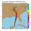
At 00Z, the NHC track lies on the western edge. Regardless, this suite is still through western Ga.
View attachment 151879

I guess It's big enough to do that.
I believe you have been on the west side all along.And it inches closer… Not gonna change much for here, but seeing that low pressure would be pretty cool.
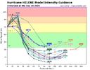
Obviously the NHC is leaning on the models above and the Canadian Ensembles.
View attachment 151885
We’re kind of in that range where @Rain Cold tells us to cut modeled wind gusts and rain totals in half but I don’t see him doing that yet. Paging @Rain Cold we need you like we haven’t needed you in a long time

I believe you have been on the west side all along.
Probably one of the reasons is the size. I wondered earlier if the dry air entrainment into the core would form a large eye and looking at IR, that is probably what is happening. Wont make it impossible to go nuts, but definitely harder. While it may spare the coast, the wind field is gonna grow even more.
Edit: Would also make it harder for dry air to penetrate in the future as well.
Slash 'em.We’re kind of in that range where @Rain Cold tells us to cut modeled wind gusts and rain totals in half but I don’t see him doing that yet. Paging @Rain Cold we need you like we haven’t needed you in a long time
Almost same track HRRR takes, fwiw
Let's not forget PTC 8. We're still recovering.You don't need a cat 3 to cause a lot of problems like flooding, power outages, trees down, and other damage. Fran was a cat 3 when it made landfall, but barely a hurricane when it went through the Triangle and still caused extensive damage here.
And the tornadoes from Debby.Let's not forget PTC 8. We're still recovering.
Will the bigger ring become the eye wall and contract? Isn't this something similar to a replacement cycle?
What makes you say or think that man?Models playing catch up it appears….wouldnt it be something to have a Cat 1 run the east coast….lol
Carry on, the thread is low-fill right now because the wise are preparing. Don’t get distracted.What makes you say or think that man?
Gotcha...thank you. Was really interested in there logic but I guess it's not oneCarry on, the thread is low-fill right now because the wise are preparing. Don’t get distracted.
From my years on these forums there is an eerie quiet that develops before actual threats, when the members are not posting every few minutes because it’s real enough to need to do something about it in real life. I do feel that is one of these times. (Not saying scope or dangerousness of impact, just that this isn’t just a non-event, clearly).
