NoSnowJoe
Member
Sorry I didn’t clarify the east side of Georgia, he saying very little impact on AlabamaThat ain’t good for Alabama…
Sorry I didn’t clarify the east side of Georgia, he saying very little impact on AlabamaThat ain’t good for Alabama…
Hang on!I am located in the red circle. Should be fun
Sorry I didn’t clarify the east side of Georgia, he saying very little impact on Alabama
Where is that underlying map from? The cone looks to be shifted west quite a bit from the current NHC cone.....and not sure it's ever been that far west for Helene.I am located in the red circle. Should be fun


The word “west” has been used a lot lately on this board. Why do you guys from Atlanta to western Bama want this thing? A little morbid. I know this is banter but most of these post now are with wishcasting.
I absolutely do not want it at all but I need to be on top of the changes to keep my family and home protected as much as possible.The word “west” has been used a lot lately on this board. Why do you guys from Atlanta to western Bama want this thing? A little morbid. I know this is banter but most of these post now are with wishcasting.
The word “west” has been used a lot lately on this board. Why do you guys from Atlanta to western Bama want this thing? A little morbid. I know this is banter but most of these post now are with wishcasting.

I promise you most of us don’t want the hassle of flooded roads and no power for days. The reality is it’s likely ATL is likely going to get the worst of the wind and rain and boy it’s going to suckThe word “west” has been used a lot lately on this board. Why do you guys from Atlanta to western Bama want this thing? A little morbid. I know this is banter but most of these post now are with wishcasting.
You realize that the ICON is the ONLY model showing this doing anything other than west GA/east AL right? Its not wishcasting when you want nothing to do with the storm, but everything is pointing at the same solution.The word “west” has been used a lot lately on this board. Why do you guys from Atlanta to western Bama want this thing? A little morbid. I know this is banter but most of these post now are with wishcasting.
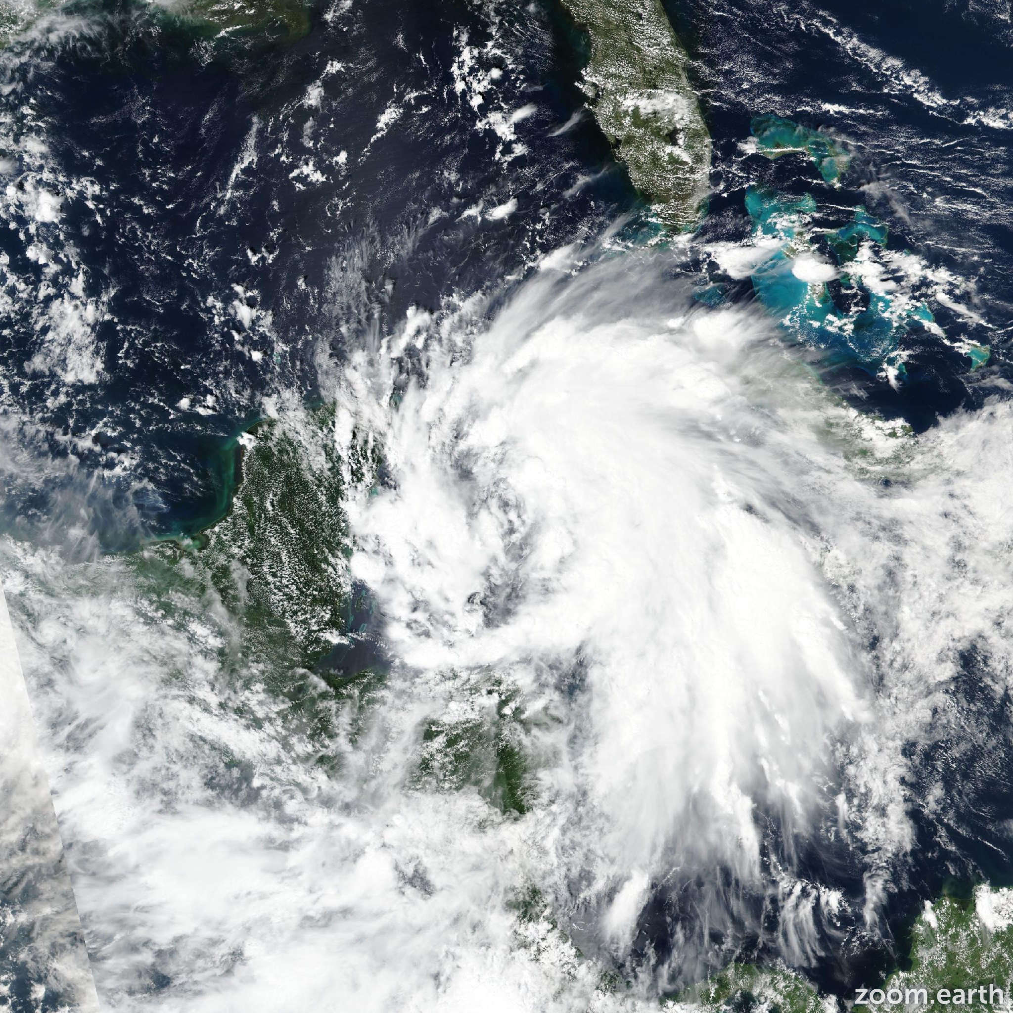
i think the hot towers/convection is so vigorous that it may take a little longer than usual. maybe a dimple or two but i don't think we'll get a clear eye until tomorrowJust looking at the Satellite it already looks like a 80-90mph Hurricane. It's really getting that look of a storm that will have a clearing eye within in the next 12 hours
Huh? I wouldn’t call it wish casting when the latest ensemble modeling has Helene tracking on the west end of previous guidance. I don’t think anyone necessarily wants this storm over their backyard. We’re just looking at the reality of the situation.The word “west” has been used a lot lately on this board. Why do you guys from Atlanta to western Bama want this thing? A little morbid. I know this is banter but most of these post now are with wishcasting.

Can someone re-post the full screen satellite imagery page?
Dude! I’m in the bullseye!! Troup County GA. Right on GA/AL line!That ain’t good for Alabama…
We are boiling tops now with beautiful outflow on the western side.....classic look for rapid intensification!


On right on the blue line on the west side of the track on that map.Where is that underlying map from? The cone looks to be shifted west quite a bit from the current NHC cone.....and not sure it's ever been that far west for Helene.View attachment 151764
06z HMON taking the west track now.
947 at landfall
952 south GA
959 middle GA
969 north GA
View attachment 151741


The wind gusts look much more realistic. I see the Atlanta metro isn't above 50 eitherView attachment 151767
View attachment 151768
View attachment 151769
WPC and the National Blend for the Upstate, NE Georgia, and Western NC. Along and west of US221 and north to Highway 11 looks good for 6-10". Peak gusts are around 40mph on average with the blend. Power Outages seems very very likely.
Based on ?The wind gusts look much more realistic. I see the Atlanta metro isn't above 50 either
You know exactly what I meantActually very cold. -90 C
Sent from my iPhone using Tapatalk

I definitely would question the intensity but we are dealing with a unique situation and I'd rather take the precedence of Irma and how that interacted with the upper level features than with previous storms that were isolated inland racers. The pressure being so low too will enhance the winds.The wind gusts look much more realistic. I see the Atlanta metro isn't above 50 either